Baldwin County, Alabama
| Baldwin County, Alabama | ||
|---|---|---|

The Baldwin County Courthouse in Bay Minette
|
||
|
||
 Location in the U.S. state of Alabama |
||
 Alabama's location in the U.S. |
||
| Founded | December 21[1], 1809[1] | |
| Seat | Bay Minette | |
| Largest city | Daphne | |
| Area | ||
| • Total | 2,027 sq mi (5,250 km2) | |
| • Land | 1,590 sq mi (4,118 km2) | |
| • Water | 438 sq mi (1,134 km2), 21.6% | |
| Population (est.) | ||
| • (2014) | 200,111 | |
| • Density | 126/sq mi (49/km²) | |
| Congressional district | 1st | |
| Time zone | Central: UTC-6/-5 | |
| Website | www |
|
Footnotes:
|
||

Baldwin County is a county of the U.S. state of Alabama. As of the 2010 census, the population was 182,265.[2] The county seat is Bay Minette. The county is named in honor of Senator Abraham Baldwin, though he never lived in what is now Alabama.
The U.S. federal government designates Baldwin County as the Daphne-Fairhope-Foley, AL Metropolitan Statistical Area.
It is the largest county in Alabama by area and is located on the eastern side of Mobile Bay.
Contents
History
Baldwin County was established on December 21, 1809,[1] ten years before Alabama became a state. Previously, the county had been a part of the Mississippi Territory until 1817, when the area was included in the separate Alabama Territory. Statehood was gained by Alabama in 1819.[3]
There have been numerous border changes to the county as population grew and other counties were formed. Numerous armies have invaded during the Revolutionary War, War of 1812, and Civil War.[4]
In the first days of Baldwin County, the town of McIntosh Bluff on the Tombigbee River was the county seat. (It is now included in Washington County, west of Baldwin County.) The county seat was transferred to the town of Blakeley in 1810, and then to the city of Daphne in 1868. In 1900, by an act of the legislature of Alabama, the county seat was authorized for relocation to the city of Bay Minette; however, the city of Daphne resisted this relocation.
To achieve the relocation, the men of Bay Minette devised a scheme. They fabricated a murder to lure the Sheriff and his deputy out of the Daphne. While the law was chasing down the fictitious killer during the late hours, the group of Bay Minette men stealthily traveled the seventeen miles (27 km) to Daphne, stole the Baldwin County Courthouse records, and delivered them to the city of Bay Minette, where Baldwin County's county seat remains. A New Deal mural, completed by WPA artists during the Great Depression, depicts the events. It hangs in the Bay Minette United States post office .[5]
Due to its proximity to the Gulf of Mexico, Baldwin County frequently endures tropical weather systems, including hurricanes. Since the late 20th century, the county was declared a disaster area in September 1979 due to damage from Hurricane Frederic,[6] in July 1997 due to Hurricane Danny,[7] in September 1998 from Hurricane Georges,[8] in September 2004 due to damage from Hurricane Ivan,[9] and again in August 2005 due to damage from Hurricane Katrina.[10]
Geography
According to the U.S. Census Bureau, the county has a total area of 2,027 square miles (5,250 km2), of which 1,590 square miles (4,100 km2) is land and 438 square miles (1,130 km2) (21.6%) is water.[11] It is the largest county by area in Alabama and the 12th-largest county east of the Mississippi River. It is larger than the US state of Rhode Island.

Adjacent counties
- Monroe County - northeast
- Escambia County, Florida - east
- Escambia County - east
- Mobile County - west
- Washington County - northwest
- Clarke County - northwest
Environmental recognition
Two separate areas in Baldwin County have been designated as "Outstanding Alabama Water" by the Alabama Environmental Management Commission, which oversees the Alabama Department of Environmental Management. As of April 2007, only two other areas in Alabama have received what is the "highest environmental status" in the state. A portion of Wolf Bay and 42 miles (68 km) of the Tensaw River in northern Baldwin County have received the designation. Officials believe the "pristine water" will become an important eco-tourism destination.[12]
National protected area
Transportation
Major highways
 Interstate 10
 Interstate 65
 U.S. Highway 31
 U.S. Highway 90
 U.S. Highway 98
 State Route 59
 State Route 104
 State Route 180
 State Route 181
 State Route 182
 State Route 225
 State Route 287
Airports
- Bay Minette, 1R8, has a single runway 08/26 that is 5,497'
- Fairhope, 4R4, has a single runway 01/19 that is 6,604'
- Foley, 5R4, has a single runway 18/36 that is 3,700'
- Gulf Shores, Jack Edwards Airport JKA has two runways, 09/27 at 6,962' and 17/35 at 3,596'
There are numerous private airports and heliports in Baldwin County. Considerable military airspace overlies much of the county and adjacent bay and coastal waters.
Commercial, scheduled service is from Mobile Regional Airport or Pensacola International Airport.
Demographics
| Historical population | |||
|---|---|---|---|
| Census | Pop. | %± | |
| 1810 | 1,427 | — | |
| 1820 | 1,713 | 20.0% | |
| 1830 | 2,324 | 35.7% | |
| 1840 | 2,951 | 27.0% | |
| 1850 | 4,414 | 49.6% | |
| 1860 | 7,530 | 70.6% | |
| 1870 | 6,004 | −20.3% | |
| 1880 | 8,603 | 43.3% | |
| 1890 | 8,941 | 3.9% | |
| 1900 | 13,194 | 47.6% | |
| 1910 | 18,178 | 37.8% | |
| 1920 | 20,730 | 14.0% | |
| 1930 | 28,289 | 36.5% | |
| 1940 | 32,324 | 14.3% | |
| 1950 | 40,997 | 26.8% | |
| 1960 | 49,088 | 19.7% | |
| 1970 | 59,382 | 21.0% | |
| 1980 | 78,556 | 32.3% | |
| 1990 | 98,280 | 25.1% | |
| 2000 | 140,415 | 42.9% | |
| 2010 | 182,265 | 29.8% | |
| Est. 2014 | 200,111 | [13] | 9.8% |
| U.S. Decennial Census[14] 1790–1960[15] 1900–1990[16] 1990–2000[17] 2010–2014[2] |
|||
2010
Whereas according to the 2010 United States Census Bureau:
- 85.7% White
- 9.4% Black
- 0.7% Native American
- 0.7% Asian
- 0.0% Native Hawaiian or Pacific Islander
- 1.5% Two or more races
- 4.4% Hispanic or Latino (of any race)
As of the census of 2010, there were 182,265 people, 73,180 households, and 51,151 families residing in the county. The population density was 110 people per square mile (40/km2). There were 104,061 housing units at an average density of 54 per square mile (23/km2). The racial makeup of the county was 85.7% White, 9.4% Black or African American, 0.7% Native American, 0.7% Asian, 0.04% Pacific Islander, 2.0% from other races, and 1.5% from two or more races. 4.4% of the population were Hispanic or Latino of any race.
There were 73,180 households out of which 28.0% had children under the age of 18 living with them, 54.5% were married couples living together, 11.1% had a female householder with no husband present, and 30.1% were non-families. 25.1% of all households were made up of individuals and 10.2% had someone living alone who was 65 years of age or older. The average household size was 2.46 and the average family size was 2.93.
In the county the population was spread out with 23% under the age of 18, 10.6% from 18 to 24, 24.4% from 25 to 44, 28.3% from 45 to 64, and 16.9% who were 65 years of age or older. The median age was 41.1 years. For every 100 females there were 95.7 males. For every 100 females age 18 and over, there were 95.46 males.
The median income for a household in the county was $40,250, and the median income for a family was $47,028. Males had a median income of $34,507 versus $23,069 for females. The per capita income for the county was $20,826. 10.10% of the population and 7.60% of families were below the poverty line. 13.10% of those under the age of 18 and 8.90% of those 65 and older were living below the poverty line.
According to the 2000 census, 21.4% were of American, 12.5% English, 11.4% German and 9.9% Irish ancestry.
In 2000, the largest denominational groups were Evangelical Protestants (with 38,670 adherents) and Mainline Protestants (with 16,399 adherents).[18] The largest religious bodies were the Southern Baptist Convention (with 27,789 members) and the Catholic Church (with 10,482 members).[18]
Education
The Baldwin County Board of Education oversees most public education in the county. Numerous private and parochial schools also serve the area.
Government
The county is governed by a four-member county commission, elected from single-member districts. A sheriff, coroner, and revenue commissioner are elected in at-large positions countywide. The sheriff of Baldwin County is Hoss Mack (R)[19]
Regions
Communities

Cities
<templatestyles src="Div col/styles.css"/>
- Bay Minette (county seat)
- Daphne
- Fairhope
- Foley
- Gulf Shores
- Orange Beach
- Robertsdale
- Spanish Fort
Towns
Unincorporated areas
<templatestyles src="Div col/styles.css"/>
Ghost town
See also
- National Register of Historic Places listings in Baldwin County, Alabama
- Properties on the Alabama Register of Landmarks and Heritage in Baldwin County, Alabama
References
- ↑ 1.0 1.1 1.2 A Digest of the Laws of the State of Alabama: Containing the Statutes and Resolutions in Force at the end of the General Assembly in January, 1823. Published by Ginn & Curtis, J. & J. Harper, Printers, New-York, 1828. Title 10. Chapter III. Pages 81-82. An Act to divide Washington County, and for other purposes therein mentioned.--Passed December 21, 1809.
- ↑ 2.0 2.1 Lua error in package.lua at line 80: module 'strict' not found.
- ↑ Lua error in package.lua at line 80: module 'strict' not found.
- ↑ Lua error in package.lua at line 80: module 'strict' not found.[dead link]
- ↑ Lua error in package.lua at line 80: module 'strict' not found.
- ↑ Lua error in package.lua at line 80: module 'strict' not found.
- ↑ Lua error in package.lua at line 80: module 'strict' not found.
- ↑ Lua error in package.lua at line 80: module 'strict' not found.
- ↑ Lua error in package.lua at line 80: module 'strict' not found.
- ↑ Lua error in package.lua at line 80: module 'strict' not found.
- ↑ Lua error in package.lua at line 80: module 'strict' not found.
- ↑ Gary Busby, "Wolf Bay Listed as Outstanding Alabama Water", The Mobile Register, Baldwin Register, April 24, 2007, page 1
- ↑ Lua error in package.lua at line 80: module 'strict' not found.
- ↑ Lua error in package.lua at line 80: module 'strict' not found.
- ↑ Lua error in package.lua at line 80: module 'strict' not found.
- ↑ Lua error in package.lua at line 80: module 'strict' not found.
- ↑ Lua error in package.lua at line 80: module 'strict' not found.
- ↑ 18.0 18.1 Lua error in package.lua at line 80: module 'strict' not found. Cite error: Invalid
<ref>tag; name "thearda" defined multiple times with different content - ↑ Lua error in package.lua at line 80: module 'strict' not found.
External links
| Wikivoyage has a travel guide for [[Wikivoyage:Baldwin County (Alabama)#Lua error in Module:Wikidata at line 863: attempt to index field 'wikibase' (a nil value).|Baldwin County (Alabama)]]. |
- Baldwin County
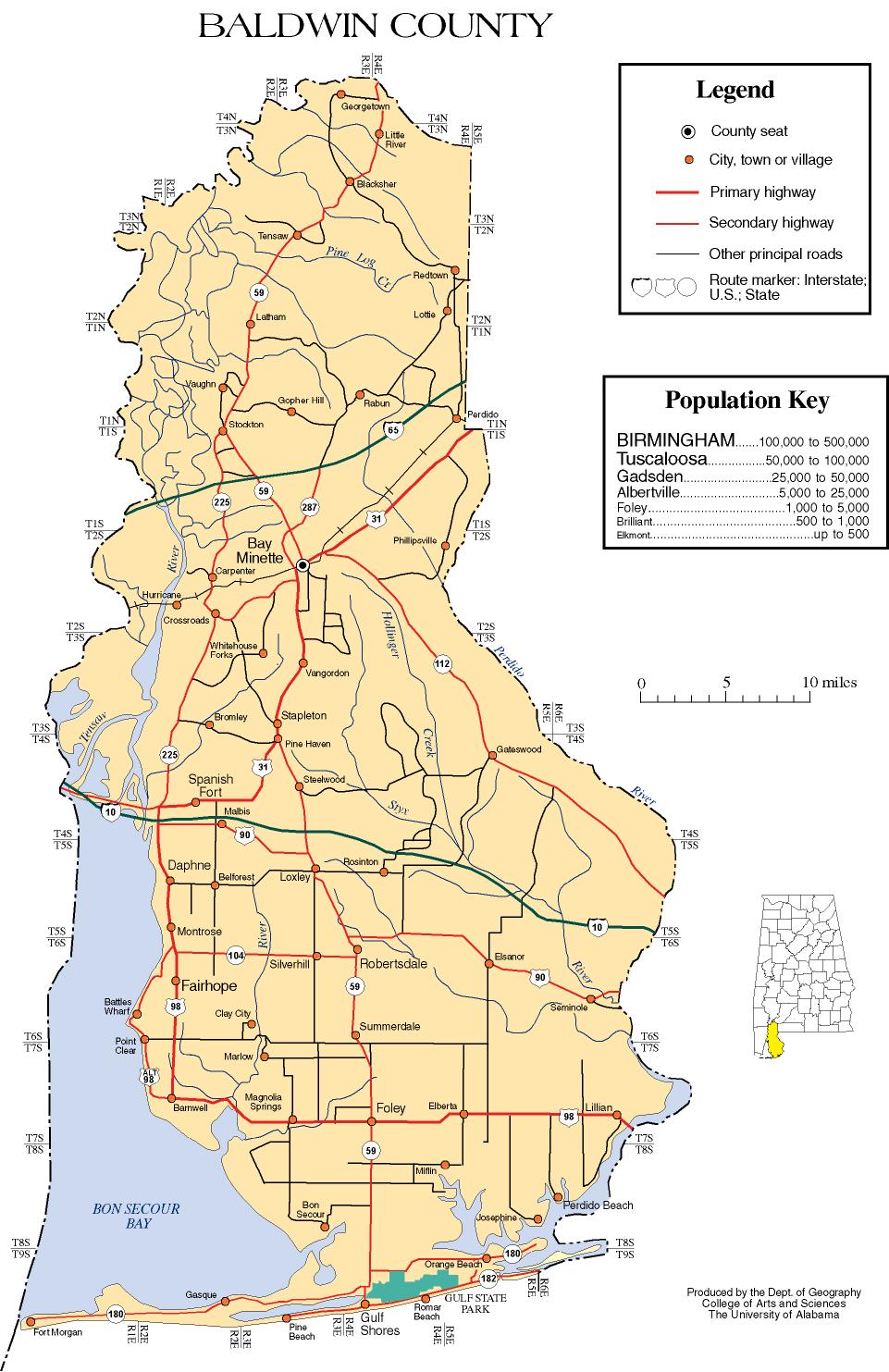
- Baldwin County map of roads/towns (map © 2007 Univ. of Alabama).
- Baldwin County Economic Development
- Baldwin County Alabama Genealogy
- Baldwin County Alabama Free Census Records
- Baldwin County Alabama Archives and Libraries
- Baldwin County Alabama Cemeteries
- South Alabama Community Website
 |
Washington County and Clarke County | Monroe County | |
|
| Mobile County | Escambia County and Escambia County, Florida | |||
|
||||
| Gulf of Mexico |
|
Municipalities and communities of Baldwin County, Alabama, United States
|
||
|---|---|---|
| Cities |
 |
|
| Towns | ||
| CDP | ||
| Unincorporated communities |
||
| Ghost town | ||
Lua error in package.lua at line 80: module 'strict' not found.