File:Location of Subei within Gansu (China).png
From Infogalactic: the planetary knowledge core

Size of this preview: 800 × 591 pixels. Other resolutions: 320 × 236 pixels | 880 × 650 pixels.
Original file (880 × 650 pixels, file size: 82 KB, MIME type: image/png)
Summary
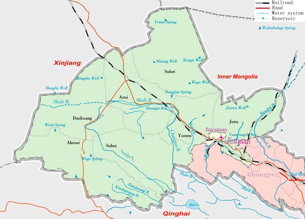
Location of Subei County (pink) within Jiuquan Prefecture (yellow) and Gansu province of China
Map drawn in september 2007 using various sources, mainly :
- <a rel="nofollow" class="external text" href="http://sedac.ciesin.org/china/admin/bnd90/t6290.html">Gansu province administrative regions GIS data: 1:1M, County level, 1990</a>
- <a rel="nofollow" class="external text" href="http://www.hua2.com/MAPWORLD/chinamap/xingzheng/yulan/gansu.jpg">Gansu Counties map from www.hua2.com</a>
- <a rel="nofollow" class="external text" href="http://pic.gansudaily.com.cn/0/10/11/30/10113090_084303.jpg">Jiuquan Prefecture map from gansudaily.com.cn</a>
Licensing
Lua error in package.lua at line 80: module 'strict' not found.
File history
Click on a date/time to view the file as it appeared at that time.
| Date/Time | Thumbnail | Dimensions | User | Comment | |
|---|---|---|---|---|---|
| current | 21:14, 7 January 2017 | | 880 × 650 (82 KB) | 127.0.0.1 (talk) | <p>Location of Subei County (pink) within Jiuquan Prefecture (yellow) and Gansu province of China </p> <p>Map drawn in september 2007 using various sources, mainly : </p> <ul> <li> <a rel="nofollow" class="external text" href="http://sedac.ciesin.org/china/admin/bnd90/t6290.html">Gansu province administrative regions GIS data: 1:1M, County level, 1990</a> </li> <li> <a rel="nofollow" class="external text" href="http://www.hua2.com/MAPWORLD/chinamap/xingzheng/yulan/gansu.jpg">Gansu Counties map from www.hua2.com</a> </li> <li> <a rel="nofollow" class="external text" href="http://pic.gansudaily.com.cn/0/10/11/30/10113090_084303.jpg">Jiuquan Prefecture map from gansudaily.com.cn</a> </li> </ul> |
- You cannot overwrite this file.
File usage
The following page links to this file:
.png&oldid=723757601)
.png)
.png&action=edit&redlink=1)
.png&action=edit)
.png&action=history)
.png)
.png)
.png&printable=yes)
.png&oldid=723757601)
.png&action=info)
.png&mobileaction=toggle_view_mobile)