Fortunian
Lua error in package.lua at line 80: module 'strict' not found.

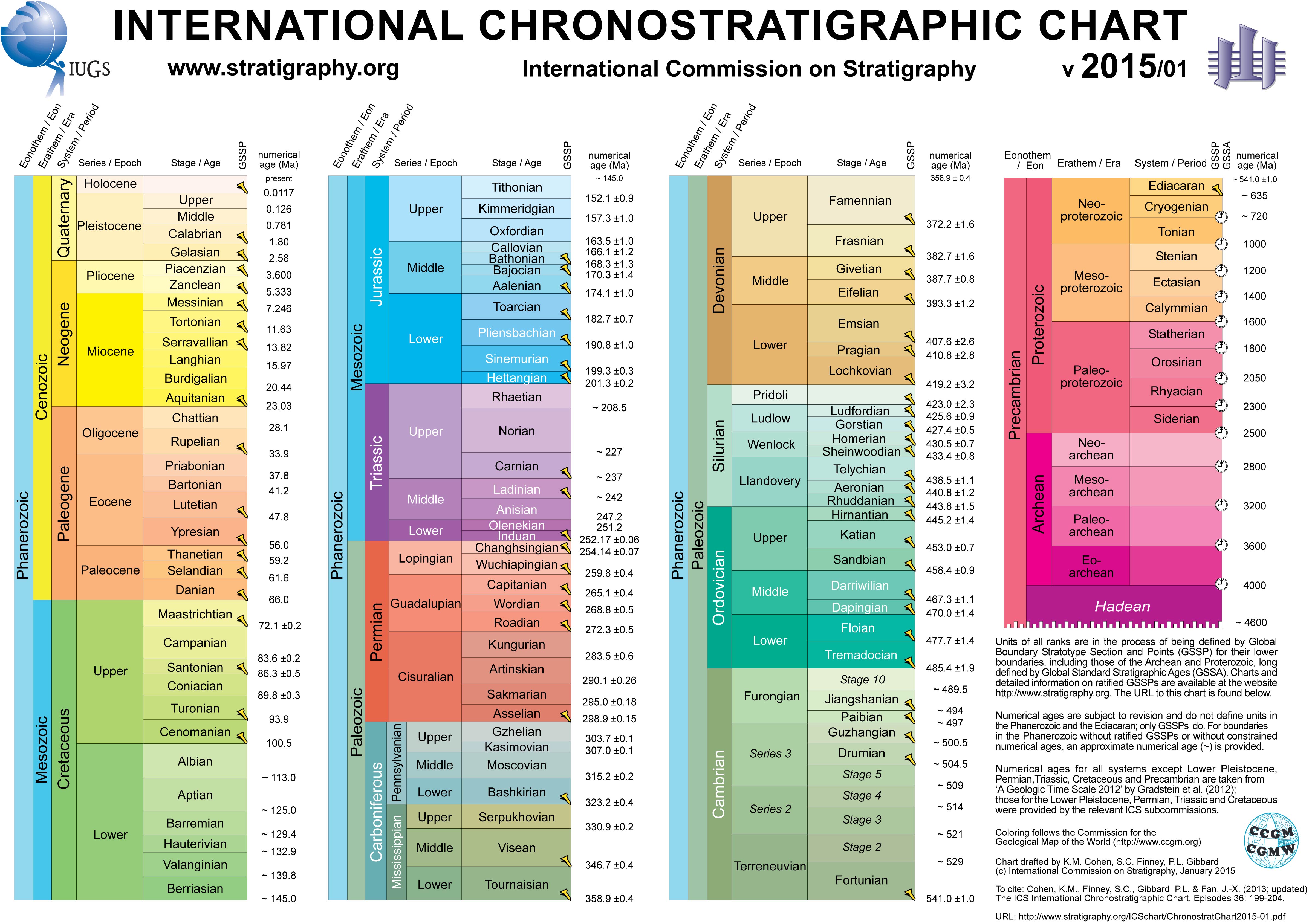
The Fortunian stage marks the beginning of the Phanerozoic eon, the Paleozoic era, and the Cambrian period. It is the first of the two stages of the Terreneuvian series. Its base is defined as the first appearance of the trace fossil Treptichnus pedum 541.0 ± 1.0 million years ago. The top of the Fortunian which is the base of the Stage 2 of the Cambrian has not been formally defined yet, but will correspond to the appearance of an Archeocyatha species or "Small shelly fossils" approximately ~529 million years ago.[1]
The name Fortunian is derived from a part of the Burin Peninsula, the village Fortune near the GSSP and Fortune Bay.[2]
Contents
GSSP
The type locality (GSSP) of the Fortunian stage is in Fortune Head, at the northern edge of the Burin Peninsula, Newfoundland, Canada (Lua error in package.lua at line 80: module 'strict' not found.). This GSSP coincides with the beginning of the Terreneuvian series, the Precambrian-Cambrian boundary and the beginning of the Phanerozoic. The outcrops show a carbonate-siliciclastic succession which is mapped as the Chapel Island Formation. The formation is divided into the following members that are composed of peritidal sandstones and shales (Member 1), muddy deltaic and shelf sandstones and mudstones (Member 2A), laminated siltstones (Member 2B and 3) and mudstones and limestones of the inner shelf (Member 4). The Precambrian-Cambrian boundary lies 2.4 m above the base of the 2nd member which is the lowest occurrence of Treptichnus pedum. The traces can be seen on the lower surface of the sandstone layers. The first calcareous shelled skeletal fossils (Ladatheca cylindrica) is 400 m above the boundary. The first trilobites appear 1400 m above the boundary which corresponds to the beginning of the Branchian Series.[3]
See also
References
External links
- Lua error in package.lua at line 80: module 'strict' not found.
- Lua error in package.lua at line 80: module 'strict' not found.
- Album of the Ichnia 2012 conference at Fortune Head
| Preceded by Proterozoic Eon | Phanerozoic Eon | |||||||||||
|---|---|---|---|---|---|---|---|---|---|---|---|---|
| Paleozoic Era | Mesozoic Era | Cenozoic Era | ||||||||||
| Cambrian | Ordovician | Silurian | Devonian | Carboniferous | Permian | Triassic | Jurassic | Cretaceous | Paleogene | Neogene | 4ry | |
<templatestyles src="Asbox/styles.css"></templatestyles>
|
This geology article is a stub. You can help Wikipedia by expanding it. |