Pere Marquette State Forest
| Pere Marquette State Forest | |
|---|---|
|
IUCN category VI (protected area with sustainable use of natural resources)
|
|
| Map showing State Forests in Michigan.
Map showing State Forests in Michigan.
|
|
| Location | Lower Peninsula, Michigan |
| Coordinates | Lua error in package.lua at line 80: module 'strict' not found. |
| Governing body | Michigan Department of Natural Resources |
The Pere Marquette State Forest encompasses lands in Michigan’s northern Lower Peninsula, on the western side of the state. Counties within the Pere Marquette are: Leelanau, Benzie, Grand Traverse, Kalkaska, Manistee, Wexford, Missaukee, Mason, Lake, Osceola, Oceana, Newaygo and Mecosta.
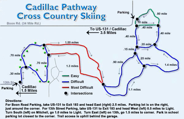
There are several trail-ways in the Pere Marquette, the longest of which are the Muncie Lake Pathway, at 11.5 miles (18.5 km) in length; the VASA Pathway, at 16.7 miles (26.9 km); and the Cadillac Pathway, at 11.3 miles (18.2 km). The trails are well suited to biking, hiking and cross country skiing.
The North Country Trail includes 65 miles (105 km) within the Pere Marquette, and over 1,500 miles (2,400 km) in Michigan as a whole.
It is named after French explorer Jacques Marquette, who founded the first European settlement of Michigan, in 1668.
External links
<templatestyles src="Asbox/styles.css"></templatestyles>
|
This Michigan state location article is a stub. You can help Wikipedia by expanding it. |
- IUCN Category VI
- Pages using infobox map without location map
- Pages with broken file links
- Michigan state forests
- Protected areas of Leelanau County, Michigan
- Protected areas of Benzie County, Michigan
- Protected areas of Grand Traverse County, Michigan
- Protected areas of Kalkaska County, Michigan
- Protected areas of Manistee County, Michigan
- Protected areas of Wexford County, Michigan
- Protected areas of Missaukee County, Michigan
- Protected areas of Mason County, Michigan
- Protected areas of Lake County, Michigan
- Protected areas of Osceola County, Michigan
- Protected areas of Oceana County, Michigan
- Protected areas of Newaygo County, Michigan
- Protected areas of Mecosta County, Michigan
- Michigan geography stubs