Ras Karkar
| Ras Karkar | |
|---|---|
| Other transcription(s) | |
| • Arabic | رأس كركر |

Ras Karkar
|
|

Ras Karkar
|
|
| Coordinates: Lua error in package.lua at line 80: module 'strict' not found. | |
| Palestine grid | 159/150 |
| Governorate | Ramallah & al-Bireh |
| Government | |
| • Type | Municipality |
| Population (2007) | |
| • Jurisdiction | 1,663 |
| Name meaning | The Hill-top[1] |
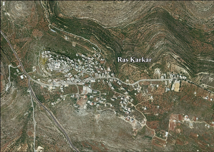
Ras Karkar (Arabic: رأس كركر) is a Palestinian village in the Ramallah and al-Bireh Governorate, located 11 kilometers (6.8 mi) northwest of Ramallah in the northern West Bank. According to the Palestinian Central Bureau of Statistics (PCBS), the town had a population of 1,663 inhabitants in 2007.[2]
Contents
History
Potsherds from the Hellenistic, Mamluk and early Ottoman era have been found.[3]
Ottoman era
The village, also known as Ras Ibn Samhan, is topped with a castle on a high, rocky and sharply sloping mountain surrounded by cactus trees. One of the many throne villages (a central village dominated by a semi-feudal family which controlled tens of villages around it) in Palestine, the castle of the Samhan family, erected in 18th or 19th century, is the subject of a preservation effort, and provides proof of the great power and wealth held by its owners at the time.[4][5]
The chief Sheikh of the Simhan family was Isma'il, who was killed by Ibrahim Pasha in the 1834 uprising. After Isma'il, Hasan es-Sa'id and Mohammah ibn Isma'il became the rulers.[6]
Ras Karkar was ruled by Sheikh Ismail Ibn Samhan who was respected and appreciated by his clan for the many contributions and support that he provided. Sheikh Ismail was killed by the Abu Ghosh family which controlled another throne village near Ras Karkar, and the castle was handed over to his nephew Hussein.[citation needed]
In 1882 the Palestine Exploration Fund's Survey of Western Palestine (SWP) described Ras Kerker as "A small village in a lofty position, with a spring below it on the north. In the middle of the village is a fortress built about 50 year since. The place was the seat of the great native family of Beni Simhan."[7]
British Mandate era
In a census conducted in 1922 by the British Mandate authorities, Ras Kerker had a population of 209, all Muslims,[8] increasing in the 1931 census to 291, still all Muslims, in a total of 75 houses.[9]
In 1945 the population was 340, all Arabs, while the total land area was 5,883 dunams, according to an official land and population survey.[10] Of this, 3,366 were allocated for plantations and irrigable land, 1,237 for cereals,[11] while 12 dunams were classified as built-up areas.[12]
1948-1967
In the wake of the 1948 Arab–Israeli War, and after the 1949 Armistice Agreements, Ras Karkar came under Jordanian rule.
post-1967
After Six-Day War in 1967, Ras Karkar has been under Israeli occupation.
The majestic castle is surrounded with historic buildings, overlooking to the west the mountains leading to the Mediterranean Sea and to the south, the city of Jerusalem. The village fields below are planted with olive trees.[citation needed]
Entering the now abandoned castle from the northern gate leads to a large courtyard surrounded by a row of rooms. Al-Iliyeh, which is the highest room in the three-floor castle, was used for administrative purposes and as the Sheikh's private refuge. Narrow hallways and oil storage containers, as well as decorations and poems carved in the castle's walls and stones are among the things one can see there.[citation needed]
Footnotes
- ↑ Palmer, 1881, p. 240
- ↑ 2007 PCBS Census. Palestinian Central Bureau of Statistics. p.114.
- ↑ Finkelstein et al, 1997, p. 221
- ↑ Lua error in package.lua at line 80: module 'strict' not found.
- ↑ Grossmann 1986:358, cited in Finkelstein et al, 1997, p. 222
- ↑ Macalister and Masterman, 1905, p. 354
- ↑ Conder and Kitchener, 1882, SWP II, pp. 294-295
- ↑ Barron, 1923, Table VII, Sub-district of Ramallah, p. 17
- ↑ Mills, 1932, p. 50.
- ↑ Government of Palestine, Department of Statistics. Village Statistics, April, 1945. Quoted in Hadawi, 1970, p. 65
- ↑ Government of Palestine, Department of Statistics. Village Statistics, April, 1945. Quoted in Hadawi, 1970, p. 112
- ↑ Government of Palestine, Department of Statistics. Village Statistics, April, 1945. Quoted in Hadawi, 1970, p. 162
Bibliography
| Wikimedia Commons has media related to [[commons:Lua error in Module:WikidataIB at line 506: attempt to index field 'wikibase' (a nil value).|Lua error in Module:WikidataIB at line 506: attempt to index field 'wikibase' (a nil value).]]. |
- Lua error in package.lua at line 80: module 'strict' not found.
- Lua error in package.lua at line 80: module 'strict' not found.
- Lua error in package.lua at line 80: module 'strict' not found.
- Lua error in package.lua at line 80: module 'strict' not found.
- Lua error in package.lua at line 80: module 'strict' not found.
- Lua error in package.lua at line 80: module 'strict' not found.
- Lua error in package.lua at line 80: module 'strict' not found.
External links
- Welcome To Ras Karkar
- Survey of Western Palestine, Map 14: IAA, Wikimedia commons
- Ras Karkar Village (Fact Sheet), ARIJ
- Ras Karkar Village Profile, ARIJ
- Ras Karkar Areal photo, ARIJ
- Throne villages, with Ibn Sahman Castle, Ras Karkar, RIWAQ
