Sembawang
| Sembawang | |
|---|---|
| Name transcription(s) | |
| • Chinese | 三巴旺 |
| • Tamil | செம்பவாங் |

The Sungei Sembawang winds through the Sembawang new town
|
|
| Country | |
| Government | |
| • Ruling parties | People's Action Party[1] |
| Area | |
| • Total | 7.08 km2 (2.73 sq mi) |
| Population | |
| • Total | 58,700 |
| • Density | 8,300/km2 (21,000/sq mi) |
| Dwelling Units | 17,874 |


Sembawang (Chinese: 三巴旺) (officially Sembawang New Town) is an area in the northernmost portion of Singapore, encompassing the largest land mass within the Sembawang Group Representation Constituency. The incumbent Member of Parliament for the Sembawang Constituency is Khaw Boon Wan. The constituency jurisdiction extends into the Woodlands New Town, bordering the Woodlands, Marsiling and Admiralty constituency. It is the closest point to Malaysia.
The Sembawang Road End region contains some of the historically important colonial architecture which remains standing on the main land till this day. Towards the north-west lies the new residential town of Sembawang, replacing the previous satellite town of Sembawang Road End, of which the latter was phrased out in early 2004 under the Selective En bloc Redevelopment Scheme.
Despite the relatively large development in the new residential area, Sembawang remain a largely suburban residential area with military, industrial and recreational facilities at its periphery. It hosted a major naval base and port facilities since the early 20th century, and continues to handle regular shipping traffic today.
Contents
Etymology
The earliest reference to Sembawang is found in Franklin and Jackson's 1830 Map of Singapore, which refers to the River Tambuwang. The place is said to have got its name from the Sembawang tree (Kayae ferruginea), which has been renamed Mesua ferruginea from 1980. This tree can be seen at Carpark C1, Sembawang Park.
History
The Sembawang area in the early twentieth century was the site of the Nee Soon Rubber estate. During the colonial times, Sembawang was home to a major British naval base, its construction of which began in 1928 and was completed in 1938.[2] The base included dockyards, wharves and workshops, as well as supporting administrative, residential and commercial areas. The Naval Base has since been handed over to the Singapore government, which in 1968 converted it into a commercial dockyard (as Sembawang Shipyard, now part of Singapore Exchange-listed SembCorp Marine) that went on to become SembCorp, a major state-owned industrial conglomerate.
Military
<templatestyles src="Module:Hatnote/styles.css"></templatestyles>
<templatestyles src="Module:Hatnote/styles.css"></templatestyles>

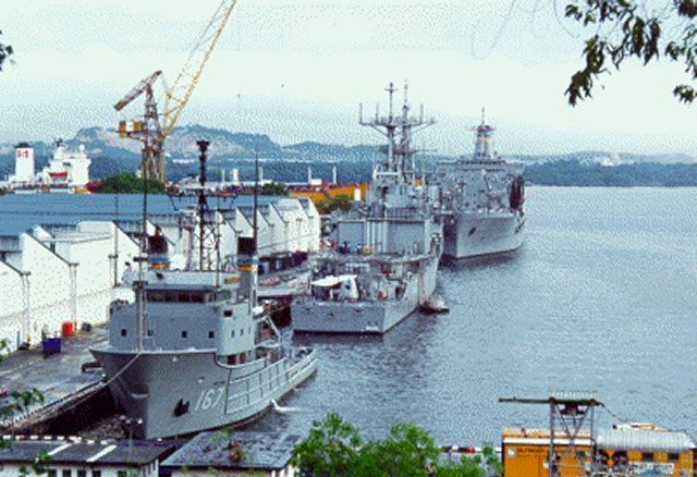
| External image | |
|---|---|
| Sembawang Naval Pier | |
The completion of Royal Navy's Singapore Naval Base (also known as HMS Sembawang) in 1938 and RAF Sembawang (also known as HMS Simbang) in March 1940 marked the start of military presence in Sembawang. In February 1942, both bases were partially torched and wrecked by the retreating British forces during the Battle of Singapore to deny their use by units of the advancing Imperial Japanese Army. After the end of World War II in 1945, both bases were reverted to British control and would eventually go on to play an important part in Britain's continued military presence in the Far East (along with the three other RAF bases in Singapore: RAF Changi, RAF Seletar and RAF Tengah) during the critical period of Malayan Emergency (1948–1960), the Brunei Revolt in 1962 and during the Indonesia–Malaysia confrontation (1962–1966).
Despite the withdrawal of British forces from Singapore in 1971 and the handover of the Singapore Naval Base to the Singapore Government in 1968, the British Ministry of Defence (MoD) continues to maintain a small logistics base at Sembawang wharf to control most of the foreign military activities there, which includes repair, refuel and resupply for ships of the Australian, British and New Zealand navies as well as those from other Commonwealth countries under the auspices of Five Power Defence Arrangements (FPDA).[3] This special arrangement was also extended to the United States Navy since early 1960s to support the American involvement in the Vietnam War.[3][dead link]
As part of a 1990 agreement between Singapore and the United States, American military forces (primarily naval and air force) have been making use of Sembawang's base facilities. The Task Force 73/Commander, Logistics Group Western Pacific (COMLOG WESTPAC) command has been headquartered in Sembawang since 1992, providing logistic support for the US 7th Fleet in its operations in the Pacific and Southeast Asia.[4]
Sembawang Camp
The Sembawang Camp is a Singapore Armed Forces military base on Admiralty Road, open only to military personnel on official business. The camp houses the 1st and 3rd Transport Battalion of the Singapore Army, as well as the Republic of Singapore Navy's Naval Diving Unit (NDU). Also, the compound housing the Naval Diving Unit was previously known as Terror Camp in deference to the old admin and Officers club section of the Royal Naval facility which was called HMS Terror.
Land reclamation
Extensive land reclamation throughout Singapore has left Sembawang with one of the country's last natural beaches,[5][6] the Wak Hassan Beach located at Sembawang Park. Today, the vegetable farms, rubber plantations and Chinese graveyards surrounding the former naval base have given way to modern housing, especially in the 1990s during the development of a New town by the Singapore Housing and Development Board. The town remains a major port, with Sembawang Wharves handling a high volume of bulk commodities cargo, such as timber and rubber.[7]
Roads and waterways
Sembawang Road is one of the key roads built to connect the naval base to the city centre in the South. This road began as a track in the 1920s and was officially named Sembawang Road in 1938. Buses operated by various private companies were then the main mode of transport. The thoroughfare was also dotted with many villages along its length: Chye Kay Village, Sungei Simpang Village, Chong Pang Village, Sembawang Village. Most of these villages were cleared during the 1970s–1990s to make way for Yishun and Sembawang New Towns. The last of the villages, Kampong Wak Hassan, was cleared in 1998. Present day Sembawang Road is a major arterial road linking the Northern and Central portion of Singapore.
Many other roads in Sembawang are named after various Royal Navy dockyards, warships, admirals, countries and cities. Examples include Wellington, Canberra, Canada, Gibraltar, Kenya and Falkland. These names were given during the previous British administration, and reflect the town's history as a British naval base.
The main river running through Sembawang, the 4-kilometre (2.5 mi) long Sungei Sembawang, flowed along a winding route and ended to the west of Sembawang Shipyard. Its middle section was diverted in the 1920s to provide the land needed for the British Naval Base. During the 1970s, the Northern portions of the river was straightened and canalised. The Southern portions of the river, which consisted of mangroves, ponds and grassland, was filled in during the 1990s in preparation for the development of Sembawang New Town.
Infrastructure
Planning and construction
The planning of Sembawang New Town was first mentioned in the Urban Redevelopment Authority's Planning Report in 1996. This Development Guide Plan, with the aid of zoning maps, highlights the various land zoning proposals, which eventually led to the creation of Sembawang New Town. This provides an interesting perspective to the development of the town. The Sembawang Mass Rapid Transit (MRT) Station serves as the central hub, around which residential, commercial as well as industrial zones mushroomed.
Public housing
The Housing and Development Board (HDB) flats in the Sembawang Planning Area have been split among three divisions, each of which is represented by a member of parliament. The North West Community Development Council (CDC) is the local administration, initiating, planning and managing community programmes to promote community bonding and social cohesion.
HDB Executive Condo (EC)
Main facilities


The new town contains some of the most common communal facilities found in Singapore, such as:
- Sembawang MRT Station. To preserve the kampong atmosphere of Sembawang, this station has a uniquely shaped kampong-styled roof. Acceding to a request by workers from the Sembawang Shipyard, the Land Transport Authority constructed a bay for 350 bicycles as most of the workers cycle to and from work. This is in line with the environmentally friendly mentality prevalent in the kampongs.
- Shopping centres, including the Sun Plaza shopping centre next to the Sembawang MRT Station, and Sembawang Shopping Centre.
- The Sembawang Public Library managed by the National Library Board is situated within the Sun Plaza shopping centre.
- Four primary schools (Canberra Primary School, Endeavour Primary School, Wellington Primary School and Sembawang Primary School located to a holding campus due to PRIME), and two secondary schools (Canberra Secondary School and Sembawang Secondary School).
- Sembawang Bus Interchange, strategically located next to Sun Plaza, was completed in December 2005. This replaced the old bus interchange located at the Northern tip of Sembawang Road, just next to Sembawang Park. Some photos of the old interchange can be found here
Attractions
Bottle Tree Village
The Bottle Tree Village is located at the end of Jalan Mempurong and is known for its Bottle Trees (Brachychiton rupestris) flown in from Queensland, Australia. Apart from these, other Australian flora can be spotted in the surroundings.
Sembawang Park
Sembawang Park, a 15 hectare tranquil park developed in the 1970s and maintained by the National Parks Board, is situated at the Northern tip of Sembawang Road. One of the few parks in Singapore with a natural beach, the Wak Hassan Beach, this park is a heaven for city dwellers who are tired of the never-ending concrete buildings and sky-scrapers. It's a popular spot for campers as well as families who wish to spend an idyllic day by the beach. One can dine at the Beaulieu House, built in 1910, which was the residence of Admiral Sir Geoffrey Layton (Commander-in-Chief British Eastern Fleet, 1940–1942). A wide range of fauna and flora awaits visitors, ranging from the spectacular Cannon Ball tree (Couroupita guianensis) to the many species of birds which have made the park their nesting grounds.[8]
-
Sun rise semb park.jpg
Sunrise
-

Wak Hassan Beach
-

Cannon Ball Tree


Sembawang Park Connector
The Sembwang Park Connector is part of the Park Connector Network managed by the National Parks Board. As their name imply, these connectors aim to form a continuous loop which would hopefully connect all the major parks within Singapore. The Sembawang Park Connector runs parallel to Sungei Sembawang, a canal which serves as the demarcation between Woodlands and Sembawang New Towns.
Simpang Kiri Park Connector
The Simpang Kiri Park Connector demarcates the Southern border of Sembawang New Town, starting from the southernmost tip of Canberra Link and terminating at Jalan Mempurong, where the Bottle Tree Village and Masjid Penempatan Melayu Sembawang can be found. It follows the river Sungei Simpang Kiri which is 5-kilometres long.
Sembawang Hot Spring
The Sembawang Hot Spring, discovered in 1909, is located near the junction of Sembawang Road and Gambas Avenue, on Jalan Ulu Sembawang. It is Singapore mainland's only natural hot spring and was once bottled for sale under the label Seletaris by Fraser and Neave, a food and beverage company. Located on land used by the Ministry of Defence, improvement works were carried out in the area surrounding the spring and it was re-opened to the public on 1 May 2002.
See also
References
- Notes
- ↑ Lua error in package.lua at line 80: module 'strict' not found.
- ↑ Singapore. The Columbia Encyclopedia, Sixth Edition. 2001–07
- ↑ 3.0 3.1 [1]
- ↑ Global Security article on the US military in Singapore
- ↑ Singapore finds it hard to expand without sand
- ↑ Ruminations: A trip to Sembawang
- ↑ Singapore – Sea
- ↑ Birds of Sembawang
- Bibliography
- Victor R Savage, Brenda S A Yeoh (2003), Toponymics – A Study of Singapore Street Names, Eastern Universities Press, ISBN 981-210-205-1
- N Edwards, Peter Keys (1985), Singapore, A Guide to Buildings, Streets, Places, Times Books International, ISBN 9971-65-231-5
- Yim Chee Peng (2001), Sembawang Town : Aesthetically Yours, Roseapple Books
External links
- Sembawang Town Council official website
- USN Commander, Logistics Group Western Pacific official website
- Infopedia, Sembawang Hot Spring (National Library Board)
- Infopedia, Sembawang Road (National Library Board)
 |
Stulang | Permas Jaya | Taman Bukit Rinting | |
| Woodlands | Kampung Wak Hassan | |||
|
||||
| Sembawang Airbase | Chong Pang | Nee Soon East |