User:Rectified/Objections to plate tectonics


Plate tectonics is one of the geological theories developed to explain and describe the development and motion of the continents and ocean basins of Earth's lithosphere, past and present. This theoretical model builds on the concept of continental drift, which was first proposed in 1596 AD by Abraham Ortelius, and further developed during the first few decades of the 20th century. Other theories propose gradual shrinking (contraction) or gradual expansion of the globe to account for the motion of the continents.[1] The theory of continental drift did not gain traction for its first 300 years because scientists objected to the idea of entire continents being able to sail across the oceans like so many ships. They expected a difference between solid rock and liquid water. After an additional century and more, this objection remains current.
Of the several theories, its detractors note that Plate Tectonics is the only one that has been allowed to be funded and promoted since about the 1970's. Members of the geoscientific community who wished to complete their degrees and continue receiving government grants had to accept plate-tectonic theory after seafloor spreading was discovered in the late 1950s and early 1960s, "and every aspiring author must jump the bandwaggon to gild another anther of this fashionable lily" [Carey, TEE, page 14]. For this reason, other theories are denied funding, though not in China[2]. [Maxlow, Carey, Adams, deHilster]
Like many other heavily-promoted contemporary scientific theories, Plate Tectonics is in a state of crisis. It has many internal contradictions and there are many observations that call it into question. The prime mover cannot be described in a consistent manner, as its proponents admit in various ways. The number of tectonic plates and their boundaries is continuous altered. The necessary loss of surface area in subduction zones, needed to offset the seafloor spreading, cannot be located. The imagined, ancient super-continent of Pangaea has numerous construction difficulties. The geodetic data (VLBI, SLR, GPS, LLR) is said to be manipulated. [Maxlow, Carey] For these reasons and many others, Plate Tectonics is a disputed theory.
In Plate Tectonics, the lithosphere, which is the rigid outermost shell of Earth (the crust and upper mantle), is broken up into tectonic plates. The Earth's lithosphere is composed of seven or eight major plates, depending on how they are defined, and many minor plates, also dependent on subjective definitions. Where the plates meet, their relative motion determines the type of boundary: convergent, divergent, or transform. Earthquakes, volcanic activity, mountain-building, and oceanic trench formation occur along these plate boundaries. The lateral relative movement of the plates typically ranges from zero to 100 mm annually.[3]

Tectonic plates are composed of oceanic lithosphere and thicker continental lithosphere, each topped by its own kind of crust. Along convergent boundaries, subduction carries plates into the mantle; the material lost is roughly balanced by the formation of new (oceanic) crust along divergent margins by seafloor spreading. In this way, the total surface of the globe remains the same. This prediction of plate tectonics is also referred to as the conveyor belt principle.
Tectonic plates are said to be able to move because the Earth's lithosphere has greater strength than the underlying asthenosphere. Lateral density variations in the mantle result in convection. Plate movement is thought to be driven by a combination of the motion of the seafloor away from the spreading ridge (due to variations in topography and density of the crust, which result in differences in gravitational forces) and drag, with downward suction, at the subduction zones. Another explanation lies in the different forces generated by tidal forces of the Sun and Moon. The relative importance of each of these factors and their relationship to each other is unclear, and still the subject of much debate.
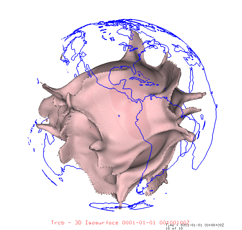
Major inconsistencies in Plate Tectonics mappings can be seen by comparing the reconstruction of Pangaea with the map of the ocean floor. The floor has been mapped with enough detail to show the relative ages of its different parts. If Pangaea had collected together on one side of the Earth, then the other side, where the Pacific Ocean is now, should be of a much older age. The map shows it to be of the same range of ages, mostly about 0-175 Million years. It also shows a tremendous expansion of the area of the Pacific emanating from the East Pacific Rise, not a contraction.
For one objection, there are many different attempts at a Pangaea reconstruction. Almost all of them require the excision of Central America and the Caribbean Sea in addition to other, smaller adjustments. The Carribean is one of the oldest seas on Earth. It cannot have been erased. Central America also does not have geological evidence of an origin less than 200 million radioisotope-years ago, or a creation of its southern portions since then. Without these excisions, Pangaea cannot be assembled.
Contents
Key principles

In Plate Tectonics, the outer layers of the Earth are divided into the thin lithosphere and the asthenosphere, the thick rock layer beneath the lithosphere. This is based on differences in mechanical properties and in the proposed methods for the transfer of heat. Mechanically, the lithosphere is sometimes less dense, other times more dense, cooler, and more rigid, while the asthenosphere is hotter and flows more easily, in a manner akin to viscoplastic deformation. Asthenosphere, a word made up from the Greek ἀσθενής asthenḗs 'weak' + "sphere", is the highly viscous, mechanically weak and ductilely deforming region of the upper mantle of the Earth. It lies below the lithosphere, at depths between approximately 80 and 200 km (50 and 120 miles) below the surface.
Tectonic plates may include continental crust or oceanic crust, and most plates are said to contain both. The distinction between oceanic crust and continental crust is based on their modes of formation. Oceanic crust is formed at sea-floor spreading centers, and continental crust is formed through arc volcanism and accretion of terranes through tectonic processes.
The asthenosphere is generally solid, yet simultaneously has to flow like a liquid, following the rules of pipe flow and fluid dynamics. Energy in pipe flow is expressed as head and is defined by the Bernoulli equation. Pipe flow is subject to frictional losses along the flow as defined by the Darcy-Weisbach formula. In this case, the walls of the pipe are the undersides of the lithosphere and the more stationary parts of the asthenosphere around the convection currents.
The picture is of a thin rigid "plate", or "shell", riding atop a "sea" of liquid yet solid rock, driven around by currents in the underlying rock and by other debated means. This is claimed to be the result of gigantic "convection cells", spanning the continents and operating for millions of years within the asthenosphere. These convection cells have never been observed, nor does the greater part of the asthenosphere appear to be molten enough to support currents that are said to run through it. In terms of heat transfer, the more rigid lithosphere loses heat by conduction, whereas the asthenosphere also transfers heat by convection.
Oceanic crust is also denser than continental crust owing to their different compositions. Oceanic crust is denser than continental crust because it has less silicon and more heavier elements.[4] Plate tectonic theorists claim that as a result of this density difference, oceanic crust generally lies below sea level, while continental crust buoyantly projects above sea level (see the page isostasy for an explanation of this principle). But water is many times less dense than either ocean or continental rock, so that explanation is unsatisfactory. Also, the prime mover of plate tectonics does not need the presence of the oceans. It would either work or not regardless of whether water were present, although water is invoked as an auxiliary to lubricate the subduction process.
Arguments against plate tectonics
Over the decades, numerous scientists, proponents or otherwise, have raised objections to the theory of Plate Tectonics, either in toto or in part. Many of the most comprehensive and informed objections come from proponents of the Expanding Earth theory, Carey, and his student James Maxlow in particular. Carey coined the term "Plate Tectonics", made original contributions to it, then later disavowed the theory, similar to the story of the founder of magnetohydrodynamics, Hannes Alfven.
Add to objections
A theorem [of Euler’s] "that provides the linchpin of plate tectonics", requires rigid-body motion...
Objections to Pangaea
The original impetus for continental drift was the observation that the continents seemed to have been joined together in the distant past. This post-prediction remains a major component of Plate Tectonics. "Pangaea" is the proposed super-continent, made up of all the current continents joined as one, millions of years ago. There are other, older super-continents proposed as well, but the analysis can stop with the first one, which has the best evidence.


- The continents do not actually fit together as Pangaea without severe 'cutting' and 'pasting'. This has been noticed by many in the field.
- The reconstruction of super-continent Pangaea requires cutting away major land masses such as Central America, which show no signs of being recent. [Carey]
- It is topologically impossible to transfer "an oceanic area, equal to the combined area of the post-Jurassic Atlantic and Indian Oceans", from the proto-Pacific to Pangaea, "during a time interval within which the intercontinental sides of the Pacific-bounding polygon... increase very greatly in length." [Carey, TEE p34 after Meservey, 1965]
- Pangaea explains trans-Atlantic similarities between various species but can't explain the trans-Pacific similarities. [Carey]
- Pangaea explains trans-Atlantic similarities between certain geological strata but can't explain the trans-Pacific similarities. [Carey]
- Pangaea purports to explain the similar coastlines on either side of the Atlantic but doesn't attempt to explain the similar coastlines on either side of the Pacific. [Carey}
- The North and South paleomagnetic poles of Pangaea would have to both be on the same side of the Earth, not diametrically opposed. [Maxlow]
- The transform faults off the East Pacific Rise have the continents going the wrong direction. Their Euler pole is near the axis of the Aleutian_Islands arc.
- Antarctica has no place to move to or from. It is surrounded by expansion joints, seafloor spreading rifts. So are all the other continents, less obviously. This is partially admitted by the proponents. [Carey, S. Warren (1985) Theories of the Earth and Universe, page 175.]
- If the continents had all gathered together on one side of the Earth to form the super-continent Pangaea, the planet's center of gravity would have shifted towards the single continent. The waters of the world-ocean would have followed, flooding almost the entire continental mass to many hundreds of meters depth, and leaving evidence of that behind. This was pointed out by Neal Adams.
- The continents would have had to have destroyed by subduction nearly all of the ocean floor of the Earth over the past 175 million years, since most of it is younger than that. This has been pointed out by numerous authors.
- The floor of the Pacific Ocean is as young as the Atlantic. This was pointed out by NOAA and numerous others. The old continents would have had to have swept the older floor away, then quickly come around to join each other as Pangaea before the new Pacific floor could age. [Carey]
Lack of a viable mechanism for movement
These arguments are the weaker objections. It is not necessary to explain a process in order to observe it.
- There is no viable mechanism, proposed or observed, that can explain the motion of the continents (this is mostly admitted by the proponents). [E. N. Lyustikh (1967) Criticism of Hypotheses of Convection and Continental Drift Geophysical Journal International 14 (1-4), 347–352 doi:10.1111/j.1365-246X.1967.tb06250.x ]
- The mechanical ideas of 'conveyor belt' transport do not work out, from considerations of friction, compression, boundary layer shear, power, etc.
- The solid roots of the continents extend hundreds of kilometers downward, as evidenced by deep earthquakes. They are not like thin rafts floating on an ocean of molten rock. A solid cannot also be a circulating liquid. Carey.
- The original proposals invoked upwelling, convection cells, and the Coriolis force. These have been removed (Coriolis) or supplanted (slab suction, ridge push, tidal, etc.) as the convection cell idea has been shown to be inadequate. The result is a fragmenting into various schools and flavors of Plate Tectonics, similar to what happened to relativity.
- “To date however, there is no direct unambiguous evidence that mantle convection and/or mantle circulation actually takes place; in fact, there is some evidence to the contrary. Moreover, there is no evidence that oceanic basalt can be repeatedly recycled through the mantle without being substantially and irreversibly changed. Yet, mantle convection/circulation and basalt recycling are fundamental necessities for the validity of plate tectonics. Furthermore, plate tectonics theory does not provide an energy source for geodynamic activity.” — J. Marvin Herndon, geophysicist, 2005
Objections to subduction
In order for Plate Tectonics to work, subduction has to be true. The material generated at the seafloor spreading ridges has to be removed at the subduction zones, in order to balance the areas and volumes across the Earth. There are a number of people who have expressed doubts as to the existence of subduction on a large enough scale to counter the seafloor expansion. BrianR of https://clasticdetritus.com/ calls these people "Subduction Denialists".
- "Subduction exists only in the minds of its creators". [Carey, TEE p16]
- “Subduction is not only illogical, it is not supported by geological or physical evidence, and violates fundamental laws of physics.” — Lawrence S. Myers, cryptologist/geoscientist, 1999
- “Now that the subduction concept has been developed for almost 30 years, it can be said that it has not been fruitful geologically.” — Yury V. Chudinov, geologist, 1998
- “There is no doubt that the subduction model constitutes the weakest link in the construction of plate tectonics, as has been repeatedly pointed out.” — Yury V. Chudinov, geologist, 1998
- “About twenty years ago, when I expressed my reservations about the plate tectonics theory to one of its supporters, I got the answer, ‘You either believe in it or not.’ Unfortunately the religious mentality of the supporters of plate tectonics did not change in the years to come.” — Stavros T. Tassos, seismologist/geoscientist, 1997
- “The many geophysical and geological paradoxes that have accumulated during the past two or three decades are apparently the consequences of forcing observational data into an inadequate tectonic model.”– Karsten M. Storetvedt, geophysicist, 1992
- “No evidence whatsoever of subduction has been found on any other planet or moon of the solar system.” — David Ford, geologist, 2000
- “Around the lovely Ring of Fire we have what are commonly called ‘subduction zones’. Cue Disney “Rites of Spring” music and animation. … Are we in some kind of hell where facts are thrown out, en masse, no matter how they accumulate? You know, when this blows up, there’s gonna be an awfully big splatter.” — Neal Adams, artist/computer animator, February 2007
- “In the oral session, except for one presentation that was clearly pro plate tectonics, and another one that did not address the issue of global and large scale geology specifically, there was general consensus that subduction, and therefore plate tectonics, is mechanically impossible.” — Stavros T. Tassos (seismologist/geoscientist) and Karsten M. Storetvedt (geophysicist), November 2007
- “There is now a lack of reference or any factual basis in plate tectonic discussions.” — Stefan Cwojdzinski, geologist, 2005
- There is no geological evidence that India was ever separate from Asia. There is no seam between the two. This was extensively researched in situ by Carey, who published on it in numerous papers, books, symposia, conferences, proceedings, etc. over several decades.
- There are no discontinuous seams in the basement geology at most of the proposed convergent zones. This was studied extensively by Carey and James Maxlow
- With a few possible exceptions (Juan De Fuca Plate?), no subduction has been observed at the putative subduction zones. There is no observed subduction in subduction zones, unlike the observed and celebrated spreading at mid-ocean rifts.
- There are few observed accretionary prisms at proposed subduction boundaries. [Carey].
- The oceanic lithosphere has to be simultaneously light enough to float on top of the asthenosphere and dense enough to forcefully sink into it (to subduct).
- The oceanic lithosphere has to have the tensile strength to pull sizable portions of floating rock down with it (slab pull).
- The asthenosphere has to somehow create a negative-pressure regime in the subduction zone in order to permit "slab suction".
- The oceanic trenches, where subduction is said to occur, show the signs of extension where they should show heavy compression. (Carey, TEE p 30 quoting Fairbridge (1965) "...interpreted the deep-see gashes as the contemporary prototypical orthogeosynclines, as tension gashes in a crust extending continuously at an increasing rate.")
- When a thin oceanic plate collides with a thick, continental plate, the thin plate should do most of the buckling and consequent mountain-building on the ocean side, for the same reason that a car colliding with a brick wall does most of the crumpling. This has been pointed out by Carey and others. [Carey, S. Warren (1985) Theories of the Earth and Universe, page 174]
- There are about 3.5 km2 of new ocean floor calculated to be added each year at the seafloor spreading rifts. An equal amount of area would have to be subtracted in the subduction zones to keep the total surface area of the Earth the same. Reliable measurements and accounting of subduction velocities cannot be located.
Dumping area for now

Lack of experiments or data on subduction
Can't locate velocity experiments for subduction. There are many papers on ocean sedimentation and borehole data, on seismic data, and on velocities between stations across the ocean and on the land, but nothing on velocities across the line of subduction itself. Example-
- http://www.sciencedirect.com/science/article/pii/S0031920113001465#b0595 "Global correlations between maximum magnitudes of subduction zone interface thrust earthquakes and physical parameters of subduction zones" studies 24 parameters, and charts them all against earthquake strength (Mw, similar to a Richter-scale number). Of the 24 parameters, six are velocities along and across the line of subduction. The other 18 parameters all have references, the velocities do not. This is typical.
- BrianR at https://clasticdetritus.com/2008/11/14/subduction-denialism-part-3-sedimentation-in-the-cascadia-subduction-zone goes over many of the arguments for subduction- earthequake, seismic data in aprticular. But he never mentions any obsrvations of actual velocities across the line of subduction.
- The USGS has many pages of searchable, published data available on its website. Measured velocities of subduction are not found there.
Unsorted refs
“The nebular hypothesis is completely false and one day will be recognized as one of the greatest errors in the history of science, possibly surpassing the centuries-old dogma of geocentrism overturned in the 16th and 17th centuries by Copernicus, Galileo and Kepler. However, the prevailing dominance of religion in that era makes that error less egregious than the adoption of subduction in the 20th Century.” — Lawrence S. Myers, cryptologist/geoscientist, 1999
HOW SUBDUCTION WAS INVENTED
The story of the scientific research that led to the invention of subduction is very interesting, but it also reveals some very troubling aspects of modern scientific research. Rather than try to recapitulate the story here, we recommend viewers read "The Ocean of Truth" by H. W. Menard [1986, Princeton University Press].
Menards book is highly recommended reading for anyone interested in scientific research and the intellectual pursuit of answers to complex and controversial geophysical questions, but it is also a warning to the entire scientific community to re-evaluate even the most fundamental beliefs when new ideas are under investigationan entirely different (and totally unexpected) factor may be involved. The participants and their highly competitive search for answers to the riddles of the oceans, as well as professional honors and glory, is ably recounted by Menard, one of the marine geologists closely involved with the research and who was personally acquainted with most of the participating scientists. This highly readable book shows how interpretation of scientific evidence (Benioff zones, spreading ridges, convection cells, deep-focus earthquakes, earthquake clusters, etc.) was influenced by a preconceived notion of Earths creation and a fixed diameter held by the senior scientists who controlled the research effort.
Subduction was a new idea conjured up by intelligent people trying to explain newly-discovered phenomena observed in nature that they did not, and still do not, fully understand. Using the same known facts, albeit incomplete and largely hypothetical, other intelligent persons came to completely different conclusions. The Earth's processes certainly had not changed, so the debate developed into philosophical differences devised by the minds of men pending some additional discovery or revelation from Nature that might resolve the issue in favor of either viewpoint.
PT has been promoted on Wiki to the exclusion of other theories. Mr X. earthexpansion.blogspot.com.au calls PT a "loony tune"-
I just made a donation to the Wikipedia and am including this promo for it despite its editors waging war against the symphonic grandeur of Earth expansion and trying to substitute for it the loony tune of Plate Tectonics.
Carey, unknown to most, had earlier become convinced that Wegener’s drifting continents were attributable to, and caused by, secular expansion of the Earth. Such heretical thoughts were originally included in his doctoral dissertation at the University of Sydney in 1938, but he withdrew them at the last moment, realizing such revolutionary ideas would cost him his degree.[10] Lawrence S. Myers, "An Unheralded Giant of Geology: Warren Carey" Pages 118-122, APEIRON Vol.4, Nr. 4, October 1997, http://redshift.vif.com/JournalFiles/Pre2001/V04NO4PDF/v04n4eph.pdf
L. S. Myers, “The Accreation of the Earth” (Myers, 1972) 30pp (This paper was returned by the AGU referee with the comment “Mr. Myers does not understand plate tectonics.”)
L. S. Myers, (Abs.) “Accreation of the Earth,” EOS, Vol. 63, No. 45, Nov. 9, 1982, p. 1114
L. S. Myers, (Abs.) “Geodetic Test to Prove/Disprove Subduction Hypothesis”, EOS, Vol. 67, No. 44, Nov. 4, 1986, p. 912
L. S. Myers, (Abs.)“Evidence Showing N. and S. American Continents Adjoined Asia and New Zealand prior to Formation of Pacific Ocean", EOS, Vol. 71, No. 43, Oct. 23, 1990, p. 1642
L. S. Myers, (Abs.) “Plate Tectonics: Still Unproven After 25 years of Ignoring Carey’s Earth Expansion Hypothesis”, EOS Supplement, Vol. 73, No. 14, Apr. 7, 1992, p. 284
L. S. Myers, (Abs.) “Empirical Evidence Earth Expanding Exponentially”, p. 149 in M. S. Strauss (ed): Unity in Diversity, Atlanta,GA, 16-21 Feb. 1995 (AAAS, Wash., D.C.)
L. S. Myers, “Subduction: A Scientific Hoax (And how to prove it),” 1966 (St. Clair Enterprises, Knoxville,TN)
Which Theory of the Earth is correct? Some hints and clues: What's the geological history of the Arctic? What's the geological history of the Pacific? What's the geological history of India and the Himalaya? What kind of rocks have been found in the Atlantic, Pacific, and Indian Oceans, and how old are they? Are Subduction and Seafloor Spreading "settled science"... or merely myths? http://www.frontier-knowledge.com/earth/
the oldest known sediment found in the Pacific basin is only ~175 Ma in age, which would have been prior to opening of the Atlantic Ocean basin somewhere between ~100-150 Ma. This Late Jurassic sediment further implies that all oceans have been created within the last ~200-250 Ma [Cheryl Silver (ed), “A Record of Our Changing Planet”, (Joint Oceanog. Inst., Inc.. Wash., D.C.)]
Types of plate boundaries
<templatestyles src="Module:Hatnote/styles.css"></templatestyles>


Three main types of plate-tectonics boundaries are proposed,[5] with a fourth, mixed type, characterized by the way the plates move relative to each other. The different types of plate boundaries are:[6][7]
1. Transform boundaries (Conservative) occur where two lithospheric plates slide, or grind, past each other along transform faults, where plates are neither created nor destroyed. Transform faults occur across a spreading center. Strong earthquakes can occur along a fault. The San Andreas Fault in California is an example. These types of faults are not generally disputed.
2. Divergent boundaries (Constructive) occur where two plates slide apart from each other. At zones of ocean-to-ocean rifting, divergent boundaries form by seafloor spreading, allowing for the formation of new ocean basin. As the continent splits, the ridge forms at the spreading center, the ocean basin expands, and finally, the plate area increases causing many small volcanoes and/or shallow earthquakes. At zones of continent-to-continent rifting, divergent boundaries may cause new ocean basin to form as the continent splits, spreads, the central rift collapses, and ocean fills the basin. Active zones of Mid-ocean ridges (e.g., Mid-Atlantic Ridge and East Pacific Rise), and continent-to-continent rifting (such as Africa's East African Rift and Valley, Red Sea) are examples of divergent boundaries. The observations are not generally disputed.
3. Convergent boundaries (Destructive) (or active margins) occur where two plates slide toward each other to form either a subduction zone (one plate moving underneath the other) or a continental collision. At zones of ocean-to-continent subduction (e.g. the Andes mountain range in South America, and the Cascade Mountains in Western United States), Plate Tectonincs claims that the dense oceanic lithosphere plunges beneath the less dense continent. Earthquakes then trace the path of the downward-moving plate as it descends into asthenosphere, a trench forms, and as the subducted plate partially melts, magma rises to form continental volcanoes. At zones of ocean-to-ocean subduction (e.g. Aleutian islands, Mariana islands, and the Japanese island arc), older, cooler, denser crust slips beneath less dense crust. This causes earthquakes and a deep trench to form in an arc shape. The upper mantle of the subducted plate then heats and magma rises to form curving chains of volcanic islands. Deep marine trenches are typically associated with subduction zones, and the basins that develop along the active boundary are often called "foreland basins". The subducting slab contains many hydrous minerals which release their water on heating. This water then causes the mantle to melt, producing volcanism. [SAY WHAT?] Closure of ocean basins can occur at continent-to-continent boundaries (e.g., Himalayas and Alps): collision between masses of granitic continental lithosphere; neither mass is subducted; plate edges are compressed, folded, uplifted. All of the above is disputed.
4. Plate boundary zones occur where the effects of the interactions are unclear, and the boundaries, usually occurring along a broad belt, are not well defined and may show various types of movements in different episodes. These are regions where the Plate Tectonic people cannot decide what is going on.
Driving forces of plate motion


Key points
- The necessary driving forces of Plate Tectonics are debated by the advocates of Plate Tectonics; they are not settled.
- Convection cells and conveyor belts have become generally acknowledged as inadequate.
- Convection cells have not been detected.
- Other proposed mechanisms are also considered inadequate or debatable.
- The other driving mechanisms include "slab pull", "slab suction", "ridge push", tidal forces, the Coriolis force, "pole flight", "mantle domes", "plume tectonics", and "surge tectonics".
- These objections create divisions within the Plate Tectonics community.
Summary
It is claimed that tectonic plates are able to move horizontally because of the relative density of oceanic lithosphere and the relative weakness of the asthenosphere. Deep earthquake data refutes that.
Dissipation of heat from the mantle is acknowledged to be the original source of the energy required to drive plate tectonics through convection or large scale upwelling and doming. The current view, though still a matter of some debate, asserts that as a consequence, a powerful source of plate motion is generated due to the excess density of the oceanic lithosphere sinking in subduction zones. When the new crust forms at mid-ocean ridges, this oceanic lithosphere is initially less dense than the underlying asthenosphere, but it becomes denser with age as it conductively cools and thickens. The greater density of old lithosphere relative to the underlying asthenosphere allows it to sink into the deep mantle at subduction zones, providing most of the driving force for plate movement THIS IS THE SLAB-PULL THEORY, WHICH RELIES ON THE TENSILE STRENGTH OF ROCK AND ON LESS-DENSE MATERIAL SINKING UNDERNEATH MORE-DENSE MATERIAL. The weakness of the asthenosphere (BELIED BY EARTHQUAKE DATA) allows the tectonic plates to move easily towards a subduction zone.[8] Although subduction is thought to be the strongest force driving plate motions, it cannot be the only force since there are plates such as the North American Plate which are moving, yet are nowhere being subducted. The same is true for the enormous Eurasian Plate. The sources of plate motion are a matter of intensive research and discussion among scientists. One of the main points is that the kinematic pattern of the movement itself should be separated clearly from the possible geodynamic mechanism that is invoked as the driving force of the observed movement, as some patterns may be explained by more than one mechanism.[9] In short, the driving forces advocated at the moment can be divided into three categories based on the relationship to the movement: mantle dynamics related, gravity related (mostly secondary forces) WHAT IS THE THIRD CATEGORY?.
<templatestyles src="Module:Hatnote/styles.css"></templatestyles>

Previously, the leading theory of the driving force behind tectonic plate motions envisaged large scale convection currents in the upper mantle which are transmitted through the asthenosphere. This theory was launched in the 1930s[10] and was immediately seized upon as the solution for the acceptance of the theory as originally discussed in the papers of Alfred Wegener in the early years of the century. However, despite its seeming acceptance, it is still debated in the scientific community. There are many problems with the idea, not the least of which is the lack of any observed convection currents.
Slab suction or convection cell?
The PT proponents are divided on this as they admit. Example from 2009 http://www.geosociety.org/gsatoday/archive/20/9/article/i1052-5173-20-9-4.htm -
Spreading ridge subduction is an apparent contradiction—an impossibility if we assume ridges mark the upwelling limbs of mantle convection cells, or a geodynamic oddity if we believe that ridges spread passively, pulled apart by distant sinking slabs.
From seafloor spreading page, an illustration of the state of Plate Tectonics-
The driver for seafloor spreading in plates with active margins is the weight of the cool, dense, subducting slabs that pull them along. The magmatism at the ridge is considered to be "passive upswelling", which is caused by the plates being pulled apart under the weight of their own slabs.[4] This can be thought of as analogous to a rug on a table with little friction: when part of the rug is off of the table, its weight pulls the rest of the rug down with it.
[4] = 404. But http://www.nature.com/nature/journal/v311/n5987/abs/311615a0.html "The motion of the Indian plate is determined in an absolute frame of reference and compared with the position of the southern margin of Eurasia deduced from palaeomagnetic data in Tibet. The 2,600±900 km of continental crust shortening observed is shown to have occurred in three different episodes: subduction of continental crust, intracontinental thrusting and internal deformation, and lateral extrusion. The detailed chronology of the collision and plate reorganizations in the Indian and Pacific oceans supports the hypothesis that slab-pull is a dominant driving mechanism of plate tectonics." then paywall.
Online 3D convection cell generators are 404'd. Searching mantle convection cell image is almost all 2D cartoons. Animation generators do fanciful upwelling- https://images.duckduckgo.com/iu/?u=http%3A%2F%2Fannarborearthscience.weebly.com%2Fuploads%2F1%2F3%2F9%2F7%2F13972856%2Fmv57.gif&f=1 but they don't show the full flow around the cell circuit (because they can't without showing the contradictions in the model).
Two- and three-dimensional imaging of Earth's interior (seismic tomography) shows a varying lateral density distribution throughout the mantle. Such density variations can be material (from rock chemistry), mineral (from variations in mineral structures), or thermal (through thermal expansion and contraction from heat energy). The manifestation of this varying lateral density is claimed to somehow cause mantle convection from buoyancy forces.[11]
How mantle convection directly and indirectly relates to plate motion is unresolved. Somehow, this force would have to be transferred to the lithosphere for tectonic plates to move. The rising current would have to transition to a horizontal current sheet moving underneath the entire continent, acting in concert over thousands of kilometers. If only part of the continent had a current sheet, it would be torn apart as part of it moved and another part stood still.
THE CONVECTION CURRENT WOULD NOT ONLY HAVE TO MOVE LATERALLY, IT WOULD HAVE TO MOVE "IN CONCERT WITH ITSELF" OVER MILLIONS OS SQUARE KM, OVER MILLIONS OF YEARS, AND DO SO WITHOUT CRUMPLING UP THE CONTINENT. A DELICATE OPERATION. The convection cell would additionally have to grow larger in length as the continent it is propelling moves away from the mid-ocean ridge.
The case of North and South America illustrate this problem. Both continents appear to be moving westward, together, relative to Europe and Africa. The convection-cell conveyor belt that they are imagined to ride on would have to span the entire distance from northern Canada to the southern tip of South America, while also stretching along the entire underside of both continents, along with the half of the Atlantic ocean basin on their side of the mid-Atlantic ridge. This giant convection cell, spanning a large part of the entire surface of the Earth, would have had to maintain this concerted action over tens of millions of years.
There are essentially two types of forces that are thought to [THE ARTICLE IS RIFE WITH THESE SPECULATIONS] influence plate motion: friction and gravity.
- Basal drag (friction): Plate motion driven by friction between the convection currents in the asthenosphere and the more rigid overlying lithosphere. [BOUNDARY-LAYER STRUCTURE AND THEORY NEGATES THIS IDEA.]
- Slab suction (gravity): Plate motion driven by local convection currents that exert a downward pull on plates in subduction zones at ocean trenches. Slab suction may occur in a geodynamic setting where basal tractions continue to act on the plate as it dives into the mantle (although perhaps to a greater extent acting on both the under and upper side of the slab).
Lately, the convection theory has been much debated as modern techniques based on 3D seismic tomography still fail to recognize these predicted large scale convection cells. [BA DA BING]. Therefore, alternative views have been proposed:
In the theory of plume tectonics developed during the 1990s, a modified concept of mantle convection currents is used. It asserts that super plumes rise from the deeper mantle and are the drivers or substitutes of the major convection cells. These ideas, which find their roots in the early 1930s with the so-called "fixistic" ideas of the European and Russian Earth Science Schools, find resonance in the modern theories which envisage hot spots/mantle plumes which remain fixed and are overridden by oceanic and continental lithosphere plates over time and leave their traces in the geological record (though these phenomena are not invoked as real driving mechanisms, but rather as modulators) [TRANSLATION: HOT SPOTS CAN'T CAUSE CONTINENTS TO MOVE]. Modern theories that continue building on the older mantle doming concepts and see plate movements as a secondary phenomena are beyond the scope of this page and are discussed elsewhere (for example on the plume tectonics page).
Another theory is that the mantle flows neither in cells nor large plumes but rather as a series of channels just below the Earth's crust, which then provide basal friction to the lithosphere. This theory, called "surge tectonics", became quite popular in geophysics and geodynamics during the 1980s and 1990s.[12]
http://www.tectonic-forces.org/simplified.htm An actual engineer. Talks about "some of the major anomalies associated with the convection current theory", adds yet another theory for the mechanism of PT. Example of dissension in the ranks.
Forces related to gravity, other than mantle convection itself, are usually invoked as secondary phenomena within the framework of a more general driving mechanism such as the various forms of mantle dynamics described above.
Gravitational sliding away from a spreading ridge: According to many authors, plate motion is driven by the higher elevation of plates at ocean ridges.[13] As oceanic lithosphere is formed at spreading ridges from hot mantle material, it gradually cools and thickens with age (and thus adds distance from the ridge). Cool oceanic lithosphere is significantly denser than the hot mantle material from which it is derived and so with increasing thickness it gradually subsides into the mantle to compensate the greater load. The result is a slight lateral incline with increased distance from the ridge axis.
This force is regarded as a secondary force and is often referred to as "ridge push". This is a misnomer as nothing is "pushing" horizontally and tensional features are dominant along ridges. It is more accurate to refer to this mechanism as gravitational sliding as variable topography across the totality of the plate can vary considerably and the topography of spreading ridges is only the most prominent feature. Other mechanisms generating this gravitational secondary force include flexural bulging of the lithosphere before it dives underneath an adjacent plate which produces a clear topographical feature that can offset, or at least affect, the influence of topographical ocean ridges, and mantle plumes and hot spots, which are postulated to impinge on the underside of tectonic plates.
Slab-pull: Current scientific opinion is that the asthenosphere is insufficiently competent or rigid to directly cause motion by friction along the base of the lithosphere. Slab pull is therefore most widely thought to be the greatest force acting on the plates. In this current understanding, plate motion is mostly driven by the weight of cold, dense plates sinking into the mantle at trenches [NO SUCH PROCESS HAS EVER BEEN OBSERVED].[14] Recent models indicate that trench suction plays an important role as well. However, as the North American Plate is nowhere being subducted, yet it is in motion presents a problem. The same holds for the African, Eurasian, and Antarctic plates.
Gravitational sliding away from mantle doming: According to older theories, one of the driving mechanisms of the plates is the existence of large scale asthenosphere/mantle domes which cause the gravitational sliding of lithosphere plates away from them. This gravitational sliding represents a secondary phenomenon of this basically vertically oriented mechanism. This can act on various scales, from the small scale of one island arc up to the larger scale of an entire ocean basin.[15]
Alfred Wegener had proposed tidal forces and pole flight force as the main driving mechanisms behind continental drift; however, these forces were considered far too small to cause continental motion as the concept then was of continents plowing through oceanic crust.[16] Later the Coriolis force was invoked, only to be withdrawn.
In early 21st C. literature, the debated driving forces are:
- Tidal drag due to the gravitational force the Moon (and the Sun) exerts on the crust of the Earth[17] This hypothesis relies on Tidal theory, which is also in a state of disarray and dispute.
- Global deformation of the geoid due to small displacements of rotational pole with respect to the Earth's crust.
- Other smaller deformation effects of the crust due to wobbles and spin movements of the Earth rotation on a smaller time scale.
For these mechanisms to be overall valid, systematic relationships should exist all over the globe between the orientation and kinematics of deformation and the geographical latitudinal and longitudinal grid of the Earth itself. Ironically, these systematic relations studies in the second half of the nineteenth century and the first half of the twentieth century underline exactly the opposite: that the plates had not moved in time, that the deformation grid was fixed with respect to the Earth equator and axis, and that gravitational driving forces were generally acting vertically and caused only local horizontal movements (the so-called pre-plate tectonic, "fixist theories"). Later studies invoked many of the relationships recognized during this pre-plate tectonics period to support their theories.[18]
Of the several forces discussed in this paragraph, tidal force is still highly debated and defended as a possible principle driving force of plate tectonics. The other forces are only proposed as minor modulations within the overall plate tectonics model, and so cannot actually be responsible for the gross motion.
In 1973, George W. Moore[19] of the USGS and R. C. Bostrom[20] presented evidence for a general westward drift of the Earth's lithosphere with respect to the mantle. He concluded that tidal forces (the tidal lag or "friction") caused by the Earth's rotation and the forces acting upon it by the Moon are a driving force for plate tectonics. As the Earth spins eastward beneath the moon, the moon's gravity ever so slightly pulls the Earth's surface layer back westward, just as proposed by Alfred Wegener. In a 2006 study[21] a few scientists reviewed and advocated these earlier proposed ideas. The debate is still open.
Relative significance of each driving force mechanism
The vector of a plate's motion is claimed to be a function of all the forces acting on the plate; however, therein lies both the problem regarding the degree to which each process contributes to the overall motion of each tectonic plate, as well as the validity of assigning a force-summation vector to an extensive, deformable body.
[SAME OBJECTION ABOUT SUMMATION OF CONVECTION CURRENTS NOTED ABOVE]
The diversity of geodynamic settings and the properties of each plate result from the impact of the various processes actively driving each individual plate. One method of dealing with this problem is to consider the relative rate at which each plate is moving as well as the evidence related to the significance of each process to the overall driving force on the plate.
The Pacific Plate is relatively much thinner and more fragile than an eggshell. The material properties of basalt and eggshell are similar within an order of magnitude (eggshell may be the stronger of the two, particularly in toughness and tensile strength). A thin plate, both plastically-deformable and at the same time brittle (depending on length and time scales) cannot be forced to move against external resistance without causing it to fail in some fashion. A force-summation vector implies a single-point of net force, which would immediately destroy that region of the plate. To prevent that, the translating force has to be distributed across the entire plate, to within a few plate thicknesses. The convection cell, or whatever other motive cause, has to therefore also be distributed across most of the area of the plate. For this case of a "fast-moving" Pacific Plate, its underlying convection cell would be even larger than the one needed to propel the Americas. None of these giant cell motions have been reproduced in a physical demonstration system.
One of the most significant correlations discovered to date is that lithospheric plates attached to downgoing (subducting) plates move much faster than plates not attached to subducting plates.
The Pacific plate is claimed to be essentially surrounded by zones of subduction (the so-called Ring of Fire), but most of the eastern side of it is an expansion zone, as can be seen on the Age of the Ocean Floors map.
and moves much faster than the plates of the Atlantic basin, which are attached to adjacent continents instead of subducting plates. It is thus thought that forces associated with the downgoing plate (slab pull and slab suction) are the driving forces which determine the motion of plates, except for those plates which are not being subducted.[14]
The driving forces of plate motion continue to be active subjects of on-going research within geophysics and tectonophysics because the original proposals of convection have been shown to be unworkable. This is why ideas like "slab suction" are entertained.
Development of the theory
<templatestyles src="Module:Hatnote/styles.css"></templatestyles>


Key points
- The fit between the Old World and the New World was noticed by cartographers early on. This led to the idea of continental drift.
- The continental-drift hypothesis was decried by the "Fixists", who advocated an unchanging Earth, for centuries.
- Accumulating geological evidence led to more proposals for continental drift in the late 19th C., which were also dismissed by leading scholars.
- Other competing hypotheses were also advanced in that time, prominently the "Cooling Earth" and the "Expanding Earth".
- With the discovery of the mid-Atlantic Ridge, the theory of continental drift was elaborated upon to include parts of the ocean floor attached to and moving with the continents.
- The various models were debated at conferences in the mid-20th C., the 1956 conference [22] is specifically referenced. The main line of division was between Expanding Earth and Continental Drift.
- In the decade following the 1956 conference, the theory of continental drift, now called Plate Tectonics, was accepted by leading scholars.
- By the 1970's, Plate Tectonics displaced all other theories in public education and research funding.
Summary
In line with other previous and contemporaneous proposals, in 1912 Alfred Wegener described what he called continental drift, [23] and the scientific debate started that would end up fifty years later in the theory of plate tectonics.[24] Starting from the idea, expressed by his forerunners, that the present continents once formed a single land mass (called Pangea later on) that drifted apart, releasing the continents from the Earth's mantle and likening them to "icebergs" of lesser density granite floating on a sea of slightly denser basalt.[25] Supporting evidence for the idea came from the dove-tailing outlines of South America's east coast and Africa's west coast, and from the matching of the rock formations along these edges. Confirmation of their previous contiguous nature also came from the fossil plants Glossopteris and Gangamopteris, and the therapsid or mammal-like reptile Lystrosaurus, all widely distributed over South America, Africa, Antarctica, India and Australia.
The evidence for joining of these continents was patent to field geologists working in the southern hemisphere. Alex du Toit put together a mass of such information in his 1937 publication Our Wandering Continents, and went further than Wegener in recognising the strong links between the Gondwana fragments.
But without detailed evidence and a force sufficient to drive the movement, the theory was not generally accepted: the Earth might have a solid crust and mantle and a liquid core, but there seemed to be no way that portions of the crust could move around. Harold Jeffreys and Charles Schuchert, were outspoken critics of continental drift.
Despite much opposition, the view of continental drift gained support and a lively three-way debate started between "Drifters" or "Mobilists" (proponents of the theory), proponents of the Expanding Earth, and "Fixists" (supporters of fixed continents). During the 1920s, 1930s and 1940s, the former proposed that convection currents might have driven the plate movements, and that spreading may have occurred below the sea within the oceanic crust.
One of the first pieces of geophysical evidence that was used to support the movement of lithospheric plates came from paleomagnetism. Rocks of different ages show a variable magnetic field direction. The magnetic north and south poles reverse through time and the relative position of the magnetic north pole varies through time. the latter phenomenon was explained by introducing what was called "polar wander" (see apparent polar wander), i.e., it was assumed that the north pole location had been shifting through time, an observation later confirmed. An alternative explanation, though, was that the continents had moved (shifted and rotated) relative to the north pole, and each continent, in fact, shows its own "polar wander path". it was proposed on two occasions that these data might validitate continental drift: by Keith Runcorn in a paper in 1956,[26] and by S. Warren Carey in a symposium held in March 1956.[22]
The second piece of evidence came during the late 1950s and early 60s from data on the bathymetry of the deep ocean floors and the nature of the oceanic crust such as magnetic properties and, more generally, with the development of marine geology[27] which gave evidence for the association of seafloor spreading along the mid-oceanic ridges and magnetic field reversals, published between 1959 and 1963 by Heezen, Dietz, Hess, Mason, Vine & Matthews, and Morley.[28]
Simultaneous advances in early seismic imaging techniques in and around the trenches bounding many continental margins, together with many other geophysical (e.g. gravimetric) and geological observations, were used to suggest how the oceanic crust might disappear into the mantle, providing the mechanism to balance the extension of the ocean basins along the spreading ridges with shortening along their margins.
All this evidence, both from the ocean floor and from the continental margins, made it clear around 1965 that continental drift was feasible and the theory of plate tectonics became accepted. The theory has affected the Earth sciences by attempting to explain a diverse range of geological phenomena and their implications in other studies such as paleogeography and paleobiology.
Continental drift
Lua error in Module:Details at line 30: attempt to call field '_formatLink' (a nil value).
In the late 19th and early 20th centuries, geologists assumed that the Earth's major features were fixed, and that most geologic features such as basin development and mountain ranges could be explained by vertical crustal movement, described in what is called the geosynclinal theory. Generally, this was placed in the context of a contracting planet Earth due to heat loss in the course of a relatively short geological time.
It was observed as early as 1596 that the opposite coasts of the Atlantic Ocean—or, more precisely, the edges of the continental shelves—have similar shapes and seem to have once fitted together.[29]
Since that time many theories were proposed to explain this apparent complementarity, but the assumption of a solid Earth made these various proposals difficult to accept.[30]
The discovery of radioactivity and its associated heating properties in 1895 prompted a re-examination of the apparent age of the Earth.[31] This had previously been estimated by its cooling rate and assumption the Earth's surface radiated like a black body.[32] Those calculations had implied that, even if it started at red heat, the Earth would have dropped to its present temperature in a few tens of millions of years.
Armed with the knowledge of a new heat source, scientists realized that the Earth would be much older, and that its core was still sufficiently hot to be liquid.
[33] Alfred Wegener noted how the east coast of South America and the west coast of Africa looked as if they were once attached. Wegener was not the first to note this (Abraham Ortelius, Antonio Snider-Pellegrini, Eduard Suess, Roberto Mantovani and Frank Bursley Taylor preceded him just to mention a few), but he was the first to marshal significant fossil and paleo-topographical and climatological evidence to support this simple observation Furthermore, when the rock strata of the margins of separate continents are very similar it suggests that these rocks were formed in the same way, implying that they were joined initially. For instance, parts of Scotland and Ireland contain rocks very similar to those found in Newfoundland and New Brunswick. Furthermore, the Caledonian Mountains of Europe and parts of the Appalachian Mountains of North America are very similar in structure and lithology.
However, his ideas were not taken seriously by many geologists, who pointed out that there was no apparent mechanism for continental drift. Specifically, they did not see how continental rock could plow through the much denser rock that makes up oceanic crust. Wegener could not explain the force that drove continental drift, and his vindication did not come until after his death in 1930.
Floating continents, paleomagnetism, and seismicity zones

As it was observed early that although granite existed on continents, seafloor seemed to be composed of slightly denser basalt, the prevailing concept during the first half of the twentieth century was that there were two types of crust, named "sial" (continental type crust) and "sima" (oceanic type crust). Furthermore, it was supposed that a static shell of strata was present under the continents. It therefore looked apparent that a layer of basalt (sial) underlies the continental rocks.
However, based on abnormalities in plumb line deflection by the Andes in Peru, Pierre Bouguer had deduced that less-dense mountains must have a downward projection into the denser layer underneath. The concept that mountains had "roots" was confirmed by George B. Airy a hundred years later, during study of Himalayan gravitation, and seismic studies detected corresponding density variations. Therefore, by the mid-1950s, the question remained unresolved as to whether mountain roots were clenched in surrounding basalt or were floating on it like an iceberg.
During the 20th century, improvements in and greater use of seismic instruments such as seismographs enabled scientists to learn that earthquakes tend to be concentrated in specific areas, most notably along the oceanic trenches and spreading ridges. By the late 1920s, seismologists were beginning to identify several prominent earthquake zones parallel to the trenches that typically were inclined 40–60° from the horizontal and extended several hundred kilometers into the Earth. These zones later became known as Wadati-Benioff zones, or simply Benioff zones, in honor of the seismologists who first recognized them, Kiyoo Wadati of Japan and Hugo Benioff of the United States. The study of global seismicity greatly advanced in the 1960s allowed seismologists to map precisely the zones of earthquake concentration worldwide.
[3D RECONSTRUCTIONS OF CLAIMED W-B ZONES DO NOT SHOW A CORRELATION WITH PROPOSED LINES OF SUBDUCTION. INSTEAD, THE EARTHQUKES LOCI RESEMBLE SCATTER PLOTS.] [1999] http://www.readcube.com/articles/10.1038/16909
Since the advent of plate-tectonic theory over 30 years ago 1,2, the geometries of subduction zones have been constrained mainly by the spatial distribution of earthquake hypocentres, known as Wadati-Benioff zones. This is due to the fact that, despite the existence of a wealth of shallow seismic reflection and refraction data, very few high-resolution images of deep subduction-zone structure have been obtained. The few attempts to image these structures (see, for example, refs 3-5) were restricted to marine surveys, with the exception of one experiment 6,7, and none of these studies was successful at mapping structure to more than 30±40 km depth. The association of intermediate-depth earthquakes with a given layer of subducting oceanic lithosphere has therefore remained largely unresolved 8. Here we report seismic reflection and refraction data across the central Andean subduction zone, which image the subduction boundary to a depth of 80 km. We show, by comparing the location of this boundary with earth-quake hypocentres precisely located by a temporary seismic array in the region, that most of the intermediate-depth seismicity is offset into the subducting oceanic mantle, rather than lying within the crust or on the subduction-zone boundary itself, as has often been assumed.
Meanwhile, debates developed around the phenomena of polar wander. Since the early debates of continental drift, scientists had discussed and used evidence that polar drift had occurred because continents seemed to have moved through different climatic zones during the past. Furthermore, paleomagnetic data had shown that the magnetic pole had also shifted during time. Reasoning in an opposite way, the continents might have shifted and rotated, while the pole remained relatively fixed. The first time the evidence of magnetic polar wander was used to support the movements of continents was in a paper by Keith Runcorn in 1956,[26] and successive papers by him and his students Ted Irving (who was actually the first to be convinced of the fact that paleomagnetism supported continental drift) and Ken Creer.
This was immediately followed by a symposium in Tasmania in March 1956.[34] In this symposium, the evidence was used in the theory of an expansion of the global crust. In this hypothesis the shifting of the continents can be simply explained by a large increase in size of the Earth since its formation. However, this was unsatisfactory because its supporters could offer no convincing mechanism to produce a significant expansion of the Earth. Certainly there is no evidence that the moon has expanded in the past 3 billion years; other work would soon show that the evidence was equally in support of continental drift on a globe with a stable radius. [NEITHER EXPANDING EARTH NOR PT HAVE A CREDIBLE, OBSERVED MECHANISM. THEY ARE ON EQUAL FOOTING HERE.]
English geologist Arthur Holmes proposed in 1920 that plate junctions might lie beneath the sea, and in 1928 that convection currents within the mantle might be the driving force.[35] Often, these contributions are forgotten because:
- At the time, continental drift was not accepted.
- Some of these ideas were discussed in the context of abandoned fixistic ideas of a deforming globe without continental drift or an expanding Earth.
- They were published during an episode of extreme political and economic instability that hampered scientific communication.
- Many were published by European scientists and at first not mentioned or given little credit in the papers on sea floor spreading published by the American researchers in the 1960s.
Mid-oceanic ridge spreading and convection
Lua error in Module:Details at line 30: attempt to call field '_formatLink' (a nil value).
the floor of the seabed beneath the layer of sediments consist of basalt, not the granite which is the main constituent of continents. The oceanic crust is much thinner than continental crust.
All along the globe, a system of mid-oceanic ridges was detected where new ocean floor was being created, which led to the concept of the "Great Global Rift" described in the crucial paper of Bruce Heezen (1960),[36]. A profound consequence of seafloor spreading is that new crust was, and still is, being continually created along the oceanic ridges. Therefore, Heezen advocated the so-called "expanding Earth" hypothesis of S. Warren Carey (see above). So, still the question remained: how can new crust be continuously added along the oceanic ridges without increasing the size of the Earth? In reality, this question had been solved already by numerous scientists during the forties and the fifties, like Arthur Holmes, Vening-Meinesz, Coates and many others: The crust in excess disappeared along what were called the oceanic trenches, where so-called "subduction" occurred.
Harry Hammond Hess ... understood the broad implications of sea floor spreading and how it would eventually agree with the ideas of continental drift
It agrees with one-half of some of the ideas of continental drift.
If the Earth's crust was expanding along the oceanic ridges, it must be shrinking elsewhere
in order to preserve the idea that the Earth has been about the same size it is now, for millions of years.
Hess suggested that new oceanic crust continuously spreads away from the ridges in a conveyor belt–like motion. many millions of years later, the oceanic crust eventually descends along the continental margins where oceanic trenches – very deep, narrow canyons – are formed, e.g. along the rim of the Pacific Ocean basin.
Not all continental margins which are said to be subduction zones are "trenches". Trenches, in at least the most famous case of the Mariana Trench, are wide valleys with gently sloping sides and flat bottoms.
The important step Hess made was that convection currents would be the driving force in this process,
convection currents appear to be going out of fashion.
... the thinning of the ocean crust was performed using Heezen's mechanism of spreading along the ridges.
Doesn't make sense. The new crust is thinnest at the ridge and thickens as it cools and moves away from the ridge.
Hess concluded that the Atlantic Ocean was expanding while the Pacific Ocean was shrinking.
Hess didn't have the Age of the Ocean Floor map, which wasn't made until 2-3 decades later. It shows that the Pacific expanded far more than the Atlantic in the same time frame. This could happen if the subduction rate were higher than the expansion rate.
As old oceanic crust is "consumed" in the trenches new magma rises and erupts along the spreading ridges to form new crust. In effect, the ocean basins are perpetually being "recycled," with the creation of new crust and the destruction of old oceanic lithosphere occurring simultaneously. The... Earth does not get bigger with sea floor spreading, why there is so little sediment accumulation on the ocean floor, and why oceanic rocks are much younger than continental rocks.
Definition and refining of the theory
After some consideration, Plate Tectonics (initially called "New Global Tectonics") became quickly accepted by scientists who wished to retain their positions and income streams. Numerous taxpayer-funded papers followed that defined the concepts:
- In 1965, Tuzo Wilson who had been a promotor of the sea floor spreading hypothesis and continental drift[37] added the concept of transform faults to the model.[38]
- A symposium on continental drift was held at the Royal Society of London in 1965 which is promoted as the official start of the acceptance of plate tectonics by funded scientists.
- In 1966 Wilson published the paper that referred to previous plate tectonic reconstructions, introducing the concept of what is now known as the "Wilson Cycle".[39]
- In 1967, at the American Geophysical Union's meeting, W. Jason Morgan proposed that the Earth's surface consists of 12 rigid plates that move relative to each other.[40]
- Two months later, Xavier Le Pichon published a complete model based on 6 major plates with their relative motions, which marked the final acceptance by tenured and funded scientists of plate tectonics, in a kind of bandwagon effect.[41]
- In the same year, McKenzie and Parker independently presented a model similar to Morgan's using translations and rotations on a sphere to define the plate motions.[42]
Since that time, no alternative models are allowed to be funded within academia and government.
Implications for biogeography


Continental drift theory helps biogeographers explain the disjunct biogeographic distribution of past and present-day life found on particular, different continents but having similar characteristics.[44] For one example of many, it is used to explain the ancient distribution of ratites and the Antarctic flora. This is one of the major, though non-exclusive, pieces of supporting evidence for Plate Tectonics. The objection is raised that it fails to explain other distribution patterns of similiar fossils and living creatures found between Asia and the Americas.
Regardless of long-standing feuds over dispersal, it would seem difficult to dispute that the hundreds of trans-Pacific taxa cited are more apt to annex regions that are proximal rather than regions on the other side of the world. No matter how committed some may be to using oceanic jump-dispersal to explain every biotic disjunction across the Pacific, biogeographers should at least be able to agree that terrestrial vertebrates find it easier to cross a river than a superocean.[45]

See also
<templatestyles src="Div col/styles.css"/>
- Conservation of angular momentum
- Geological history of Earth
- Geosyncline theory
- GPlates, desktop software for the interactive visualization of plate-tectonics.
- List of plate tectonics topics
- List of submarine topographical features
- Supercontinent cycle
- Tectonics
References
Notes
- ↑ Scalera & Lavecchia 2006.
- ↑ Lua error in package.lua at line 80: module 'strict' not found.
- ↑ Read & Watson 1975.
- ↑ Schmidt & Harbert 1998.
- ↑ Meissner 2002, p. 100.
- ↑ Lua error in package.lua at line 80: module 'strict' not found.
- ↑ Lua error in package.lua at line 80: module 'strict' not found.
- ↑ Lua error in package.lua at line 80: module 'strict' not found.
- ↑ van Dijk 1992, van Dijk & Okkes 1991.
- ↑ Lua error in package.lua at line 80: module 'strict' not found.
- ↑ Tanimoto & Lay 2000.
- ↑ Meyerhoff et al. 1996.
- ↑ Spence 1987, White & McKenzie 1989.
- ↑ 14.0 14.1 Conrad & Lithgow-Bertelloni 2002.
- ↑ Spence 1987, White & Mckenzie 1989, Segev 2002.
- ↑ Lua error in package.lua at line 80: module 'strict' not found.
- ↑ Lua error in package.lua at line 80: module 'strict' not found.
- ↑ van Dijk 1992, van Dijk & Okkes 1990.
- ↑ Moore 1973.
- ↑ Bostrom 1971.
- ↑ Scoppola et al. 2006.
- ↑ 22.0 22.1 Carey 1956.
- ↑ Wegener 1929.
- ↑ Hughes 2001a.
- ↑ Wegener 1966, Hughes 2001b.
- ↑ 26.0 26.1 Runcorn 1956.
- ↑ see for example the milestone paper of Lyman & Fleming 1940.
- ↑ Korgen 1995, Spiess & Kuperman 2003.
- ↑ Kious & Tilling 1996.
- ↑ Frankel 1987.
- ↑ Joly 1909.
- ↑ Thomson 1863.
- ↑ Wegener 1912.
- ↑ Carey 1956; see also Quilty 2003.
- ↑ Holmes 1928; see also Holmes 1978, Frankel 1978.
- ↑ Heezen 1960.
- ↑ Wilson 1963.
- ↑ Wilson 1965.
- ↑ Wilson 1966.
- ↑ Morgan 1968.
- ↑ Le Pichon 1967.
- ↑ McKenzie & Parker 1967.
- ↑ Lua error in package.lua at line 80: module 'strict' not found.
- ↑ Moss & Wilson 1998.
- ↑ Lua error in package.lua at line 80: module 'strict' not found.
Cited books
- Lua error in package.lua at line 80: module 'strict' not found.
- Lua error in package.lua at line 80: module 'strict' not found. Expanding Earth from p. 311 to p. 349.
- Lua error in package.lua at line 80: module 'strict' not found.
- Lua error in package.lua at line 80: module 'strict' not found.
- Lua error in package.lua at line 80: module 'strict' not found.
- Lua error in package.lua at line 80: module 'strict' not found.
- Lua error in package.lua at line 80: module 'strict' not found.
- Lua error in package.lua at line 80: module 'strict' not found.
- Lua error in package.lua at line 80: module 'strict' not found.
- Lua error in package.lua at line 80: module 'strict' not found.
- Lua error in package.lua at line 80: module 'strict' not found.
- Lua error in package.lua at line 80: module 'strict' not found.
- Lua error in package.lua at line 80: module 'strict' not found.
- Lua error in package.lua at line 80: module 'strict' not found.* Lua error in package.lua at line 80: module 'strict' not found.
- Lua error in package.lua at line 80: module 'strict' not found.
- Lua error in package.lua at line 80: module 'strict' not found.
- Lua error in package.lua at line 80: module 'strict' not found.
- Lua error in package.lua at line 80: module 'strict' not found.
- Lua error in package.lua at line 80: module 'strict' not found.
- Lua error in package.lua at line 80: module 'strict' not found.
- Lua error in package.lua at line 80: module 'strict' not found.
- Lua error in package.lua at line 80: module 'strict' not found.
- Lua error in package.lua at line 80: module 'strict' not found.
- Lua error in package.lua at line 80: module 'strict' not found., translation: Lua error in package.lua at line 80: module 'strict' not found.
- Lua error in package.lua at line 80: module 'strict' not found.
- Lua error in package.lua at line 80: module 'strict' not found.
- Lua error in package.lua at line 80: module 'strict' not found.
- Lua error in package.lua at line 80: module 'strict' not found.
- Lua error in package.lua at line 80: module 'strict' not found.
Cited articles
- Lua error in package.lua at line 80: module 'strict' not found.
- Lua error in package.lua at line 80: module 'strict' not found.
- Lua error in package.lua at line 80: module 'strict' not found.
- Lua error in package.lua at line 80: module 'strict' not found.
- Lua error in package.lua at line 80: module 'strict' not found.
- Lua error in package.lua at line 80: module 'strict' not found.
- Lua error in package.lua at line 80: module 'strict' not found.
- Lua error in package.lua at line 80: module 'strict' not found.
- Lua error in package.lua at line 80: module 'strict' not found.
- Lua error in package.lua at line 80: module 'strict' not found.
- Lua error in package.lua at line 80: module 'strict' not found.
- Lua error in package.lua at line 80: module 'strict' not found.
- Lua error in package.lua at line 80: module 'strict' not found.
- Lua error in package.lua at line 80: module 'strict' not found.
- Lua error in package.lua at line 80: module 'strict' not found.
- Lua error in package.lua at line 80: module 'strict' not found.
- Lua error in package.lua at line 80: module 'strict' not found.
- Lua error in package.lua at line 80: module 'strict' not found.
- Lua error in package.lua at line 80: module 'strict' not found.
- Lua error in package.lua at line 80: module 'strict' not found.
- Lua error in package.lua at line 80: module 'strict' not found.
- Lua error in package.lua at line 80: module 'strict' not found.
- Lua error in package.lua at line 80: module 'strict' not found.
- Lua error in package.lua at line 80: module 'strict' not found.
- Lua error in package.lua at line 80: module 'strict' not found.
- Lua error in package.lua at line 80: module 'strict' not found.
- Lua error in package.lua at line 80: module 'strict' not found.
- Lua error in package.lua at line 80: module 'strict' not found.
- Lua error in package.lua at line 80: module 'strict' not found.
- Lua error in package.lua at line 80: module 'strict' not found.
- Lua error in package.lua at line 80: module 'strict' not found.
- Lua error in package.lua at line 80: module 'strict' not found.
- Lua error in package.lua at line 80: module 'strict' not found.
- Lua error in package.lua at line 80: module 'strict' not found.
- Lua error in package.lua at line 80: module 'strict' not found.
- Lua error in package.lua at line 80: module 'strict' not found.
- Lua error in package.lua at line 80: module 'strict' not found.
- Lua error in package.lua at line 80: module 'strict' not found.
- Lua error in package.lua at line 80: module 'strict' not found.
- Lua error in package.lua at line 80: module 'strict' not found.
- Lua error in package.lua at line 80: module 'strict' not found.
- Lua error in package.lua at line 80: module 'strict' not found.
- Lua error in package.lua at line 80: module 'strict' not found.
- Lua error in package.lua at line 80: module 'strict' not found.
- Lua error in package.lua at line 80: module 'strict' not found.
- Lua error in package.lua at line 80: module 'strict' not found.
- Lua error in package.lua at line 80: module 'strict' not found.
- Lua error in package.lua at line 80: module 'strict' not found.
- Lua error in package.lua at line 80: module 'strict' not found.
- Lua error in package.lua at line 80: module 'strict' not found.
- Lua error in package.lua at line 80: module 'strict' not found.
External links
| The Wikibook Historical Geology has a page on the topic of: Plate tectonics: overview |
| Wikimedia Commons has media related to Plate tectonics. |
- This Dynamic Earth: The Story of Plate Tectonics. USGS.
- Understanding Plate Tectonics. USGS.
- The PLATES Project. Jackson School of Geosciences.
- An explanation of tectonic forces. Example of calculations to show that Earth Rotation could be a driving force.
- Bird, P. (2003); An updated digital model of plate boundaries.
- Map of tectonic plates.
- MORVEL plate velocity estimates and information. C. DeMets, D. Argus, & R. Gordon.
- Mollewide Plate Tectonic Maps - continental maps at various points in the past
Videos
- Khan Academy Explanation of evidence
- 750 million years of global tectonic activity. Movie.
- Multiple videos of plate tectonic movements Quartz December 31, 2015
|
The Earth
|
||
|---|---|---|
| Continents |
 |
|
| Oceans | ||
| Earth | ||
| Environment | ||
| Related articles | ||

|
Geologic principles and processes
|
||
|---|---|---|
| Stratigraphic principles |
 |
|
| Petrologic principles | ||
| Geomorphologic processes | ||
| Sediment transport | ||