Yantai
| Yantai 烟台市 |
|
|---|---|
| Prefecture-level city | |

Yantai Skyline
|
|
 Location of Yantai City Jurisdiction in Shandong |
|

Yantai
|
|
| Coordinates: Lua error in package.lua at line 80: module 'strict' not found. | |
| Country | China |
| Province | Shandong |
| County-level divisions | 12 |
| Townships-level divisions | 148 |
| Municipal seat | Laishan District |
| Government | |
| • CPC Secretary | Zhang Jiangting 张江汀 |
| • Mayor | Meng Fanli 孟凡利 |
| Area | |
| • Prefecture-level city | 13,739.9 km2 (5,305.0 sq mi) |
| Population (2010) | |
| • Prefecture-level city | 6,968,202 |
| • Density | 510/km2 (1,300/sq mi) |
| • Urban | 2,227,733 |
| • Metro | 2,227,733 |
| Time zone | China Standard (UTC+8) |
| Postal code | 264000-265800 |
| Area code(s) | 535 |
| GDP | ¥435.8 billion (2010) |
| GDP per capita | ¥62,541 (2010) |
| License Plate | 鲁F & 鲁Y |
| Website | www |
| Yantai | |||||||||||

"Yantai" in Chinese
|
|||||||||||
| Simplified Chinese | 烟台 | ||||||||||
|---|---|---|---|---|---|---|---|---|---|---|---|
| Traditional Chinese | 煙臺 or 煙台 | ||||||||||
| Postal | Chefoo | ||||||||||
| Literal meaning | "Smoke tower" | ||||||||||
|
|||||||||||
Yantai ([i̯ɛ́ntʰǎi̯]; Chinese: 烟台), formerly known as Chefoo or Chih-fou (芝罘 Zhīfú), is a prefecture-level city in northeastern Shandong province, China. Located on the Bohai Strait and the southern coast of the Korea Bay, Yantai borders the cities of Qingdao and Weihai to the southwest and east respectively. It is the largest fishing seaport in Shandong. Its population was 6,968,202 at the 2010 census, of whom 2,227,733 lived in the built-up area made up of 4 urban districts (Zhifu, Muping, Fushan and Laishan).
The contemporary name of Yantai came from the watchtowers constructed on Mount Qi in 1398, during the reign of the Hongwu Emperor, founding emperor of the Ming Dynasty (yan—smoke; tai—tower). The towers served to raise alarms against invasions of Japanese pirates.
Contents
Administration
The prefecture-level city of Yantai administers 12 county-level divisions, including 4 districts, 7 county-level cities, 1 county and one development zone.
- Zhifu District (芝罘区)
- Fushan District (福山区)
- Muping District (牟平区)
- Laishan District (莱山区)
- Longkou City (龙口市)
- Laiyang City (莱阳市)
- Laizhou City (莱州市)
- Penglai City (蓬莱市)
- Zhaoyuan City (招远市)
- Qixia City (栖霞市)
- Haiyang City (海阳市)
- Changdao County (长岛县)
- Yantai Economic and Technological Development Zone (烟台经济技术开发区)
- Yantai Hi-tech Industrial Development Zone (烟台高新技术产业开发区)
These are further divided into 148 township-level divisions, including 94 towns, 6 townships and 48 subdistricts.
History
The region was inhabited by the Dongyi people, who had established the State of Lai by the Zhou dynasty. Lai was annexed by the State of Qi in 567 BC. During the Qin dynasty, Yantai belonged to the Qi Commandery, later renamed Donglai Commandery (東萊郡) during the Han dynasty. The area was known as the Donglai Kingdom during the Jin dynasty (265–420) but later returned to prefecture status (first jùn, then zhōu). In the Tang dynasty and following it was known as the Teng-chou prefecture, part of Henan Circuit. Next, the city became the Laizhou Subprefecture (萊州府) and, eventually, the Dengzhou Subprefecture (登州府) in the time of the Qing dynasty.
,_Qing_Dynasty_postage_stamp.gif)
In July 1858 the Chinese empire signed the Treaty of Tianjin and Dengzhou was renamed for the last time. Yantai opened its harbor for business in May 1861, but was not officially designated an international trading port until later that year on 22 August. This decree was accompanied by the construction of the Donghai Pass (東海關). Seventeen nations, including Britain, established embassies in Yantai.[1] The Chefoo Convention was signed there in 1876.
Yantai literally means "smoke tower". In the Ming dynasty, locals used wolf dung to light fires (Langyan) to warn the whole village of approaching Japanese pirates (Wokou). The city was nothing but a small fishing village until the late 19th century when it became a treaty port for the British, handed over by the falling Qing dynasty, which had been defeated in the Opium War.[2] Then with the Germans' power over the whole Shandong peninsula in the early 20th century, Yantai was also controlled by Germans for about 20 years.[3] After the Germans were defeated by Allied forces in World War I, Qingdao and Yantai were handed over to the Japanese, who turned Yantai into a summer station for their Asian fleet. They also set up a trading establishment in the town.[4] The different foreign influences that shaped this city are explored at the Yantai Museum, which used to be a guild hall. However, the city's colourful history has not left a distinctive architectural mark, there has never been a foreign concession, and though there are a few grand 19th-century European buildings, most of the town is of much more recent origin.[5] After 1949, the town's name was changed from Chefoo to Yantai, and it was opened to the world as an ice-free trade port in 1984.[6]
On 12 November 1911, the eastern division of Tongmeng Hui declared itself a part of the revolutionary movement. The next day, it established the Shandong Military Government (山東軍政府) and, the day after that, renamed itself the Yantai Division of the Shandong Military Government (山東煙台軍政分府). In 1914, Jiaodong Circuit (膠東道) was established with Yantai as the capital. Jiaodong Circuit was renamed Donghai Circuit (東海道) in 1925. On 19 January 1938, Yantai participated as part of an anti-Japanese revolutionary committee.
After the creation of the People's Republic of China, in 1950, Yantai was officially awarded city status with the outlying towns of Laiyang and Wendeng tacked on as "Special Regions" (专区). Wendeng was merged into Laiyang six years later, and this larger Laiyang Special Region was combined with Yantai City to become Yantai Prefecture (烟台地区). Yantai is of strategic importance to China's defence, as it and Dalian, directly across the Bohai Sea from it, are primary coastal guard points for Beijing. In November 1983, the prefecture became a prefecture-level city.[7]
Geography

Yantai Region is located north-central on the Shandong Peninsula, south of the Bohai Sea, and parallel to the southern tip of Korea. It has a coast line of 909 km (565 mi). The topographical breakdown consists of:
- 36.62% mountain
- 39.7% hill
- 50.23% plains
- 2.90% basins
Average mountain height is 500 meters, with the highest point at 922.8 meters on Mount Kunyu (昆崳山). Hills range from 100 to 300 meters.
There are 121 rivers over 5 kilometer in length, the largest being:
- Wulong River (五龙河)
- Dagu River (大沽河)
- Dagujia River (大沽夹河)
- Wang River (王河)
- Jie River (界河)
- Huangshui River (黄水河)
- Xin'an River (辛安河)
About 2,643.60 km2 (1,020.70 sq mi) is urbanized.
Only Qixia City is located entirely inland. All other county-level entities are coastal, with Changdao consisting entirely of islands.
Climate
| Climate data for Yantai (1971–2000) | |||||||||||||
|---|---|---|---|---|---|---|---|---|---|---|---|---|---|
| Month | Jan | Feb | Mar | Apr | May | Jun | Jul | Aug | Sep | Oct | Nov | Dec | Year |
| Record high °C (°F) | 14.6 (58.3) |
19.8 (67.6) |
25.0 (77) |
31.9 (89.4) |
35.3 (95.5) |
38.0 (100.4) |
36.9 (98.4) |
36.2 (97.2) |
32.4 (90.3) |
30.4 (86.7) |
25.1 (77.2) |
18.8 (65.8) |
38 (100.4) |
| Daily mean °C (°F) | −1.2 (29.8) |
−0.3 (31.5) |
4.8 (40.6) |
12.0 (53.6) |
17.8 (64) |
22.0 (71.6) |
24.8 (76.6) |
24.8 (76.6) |
21.1 (70) |
15.7 (60.3) |
8.4 (47.1) |
1.8 (35.2) |
12.64 (54.74) |
| Record low °C (°F) | −12.8 (9) |
−12.6 (9.3) |
−8.1 (17.4) |
−2.6 (27.3) |
6.6 (43.9) |
11.5 (52.7) |
14.7 (58.5) |
15.0 (59) |
10.7 (51.3) |
0.8 (33.4) |
−4.9 (23.2) |
−10.8 (12.6) |
−12.8 (9) |
| Average precipitation mm (inches) | 11.5 (0.453) |
9.7 (0.382) |
16.5 (0.65) |
35.7 (1.406) |
49.9 (1.965) |
70.0 (2.756) |
150.0 (5.906) |
161.6 (6.362) |
83.7 (3.295) |
39.0 (1.535) |
25.1 (0.988) |
19.8 (0.78) |
672.5 (26.478) |
| Average precipitation days (≥ 0.1 mm) | 6.4 | 5.0 | 4.7 | 6.2 | 6.2 | 8.5 | 11.7 | 10.3 | 7.1 | 6.2 | 6.2 | 7.5 | 86.0 |
| Source: Weather China[8] | |||||||||||||
Economy
Yantai is currently the second largest industrial city in Shandong, next to Qingdao. However, the region's largest industry is agriculture. It is famous throughout China for a particular variety of apple and is home to the country's largest and oldest grape winery (Changyu).[citation needed]
The county-level city of Longkou is well known throughout China for its production of cellophane noodles.[citation needed]
Industrial Zones
- Yantai Economic and Technological Development Area
Yantai Economic and Technological Development Area is one of the earliest approved state-level economic development zones in China. It now has a planned area of 10 km2 (3.9 sq mi) and a population of 115,000. It lies on the tip of the Shandong Peninsula facing the Yellow Sea. It adjoins downtown Yantai, merely 6 kilometers away from Yantai Port, 6 kilometers away from Yantai Railway Station, and a 30-minute drive to Yantai International Airport.[9]
- Yantai Export Processing Zone
Yantai Export Processing Zone (YTEPZ) is one of the first 15 export processing zones approved by the State Council. The total construction area of YTEPZ is 4.17 km2 (1.61 sq mi), in which the initial zone covers 3 km2 (1.2 sq mi). After developing for several years, YTEPZ is completely constructed. At present, the infrastructure has been completed, with standard workshops of 120,000 m2 (1,300,000 sq ft) and bonded warehouses of 40,000 m2 (430,000 sq ft). Up to now, owing to an excellent investment environment, YTEPZ has attracted investors from foreign countries and regions such as Japan, Korea, Singapore, Hong Kong, Taiwan, Sweden, the United States, Canada, etc., as well as domestic investors, to operate in the zone.[10]
Education
The following are a list of prominent Yantai higher education institutions.
It houses a Korean international school, Korean School in Yantai.
Transport
Yantai Penglai International Airport provides scheduled flights to major airports in China as well as Seoul, Osaka, and Hong Kong.[11]
Tourism


Penglai City's Dan Cliffs (丹崖) is said to be the departure point of the Eight Immortals on their trip to the Conference of the Magical Peach.[citation needed]
Twin cities of Yantai
See also
Notable people
- Chou Wen-chung (b. 1923), composer
- Qiu Chuji (1148–1227), leading Quanzhen Taoist priest and founder of Dragon Gate Taoism
- Qi Jiguang (1528–1588), Ming Dynasty military general most remembered for defending coastal China against Japanese pirates
- Peter Stursberg (1913-2014), Canadian writer and journalist
- Fan Bingbing (b. 1981), actress
- Guanqun Yu (b. 1982), Opera singer
See also
References
- ↑ Lua error in package.lua at line 80: module 'strict' not found.
- ↑ Lua error in package.lua at line 80: module 'strict' not found.
- ↑ Lua error in package.lua at line 80: module 'strict' not found.
- ↑ Lua error in package.lua at line 80: module 'strict' not found.
- ↑ Lua error in package.lua at line 80: module 'strict' not found.
- ↑ Lua error in package.lua at line 80: module 'strict' not found.
- ↑ Lua error in package.lua at line 80: module 'strict' not found.
- ↑ [1]
- ↑ RightSite.asia | Yantai Economic and Technological Development Area
- ↑ RightSite.asia | Yantai Export Processing Zone
- ↑ Yantai Chaoshui International Airport project
External links
| Wikimedia Commons has media related to Yantai. |
| Wikivoyage has a travel guide for [[Wikivoyage:Yantai#Lua error in Module:Wikidata at line 863: attempt to index field 'wikibase' (a nil value).|Yantai]]. |
- Government website of Yantai (available in Chinese, English, German, French, Japanese and Korean)
- Old photos of Yantai (Chefoo)
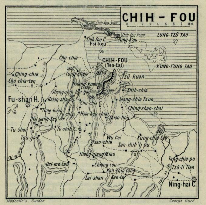
- 1912 historical map of Yantai
| Special Economic Zones |
|
|
|---|---|---|
| New open development zones | ||
- Use dmy dates from May 2013
- Articles containing simplified Chinese-language text
- Articles containing traditional Chinese-language text
- Articles containing Chinese-language text
- Articles with unsourced statements from May 2015
- Articles with unsourced statements from September 2015
- Commons category link is defined as the pagename
- Cities in Shandong
- Prefecture-level divisions of Shandong
- National Garden Cities in China
- Port cities and towns in China
- Yantai