North Iwo Jima


North Iwo Jima (北硫黄島?, officially Kita-Iōtō, also frequently Kita-Iwō-jima[1] Kita-Iōjima: "North Sulfur Island") is the northernmost island of the Volcano Islands group of the Ogasawara Islands, 80 km north of Iwo Jima. It is 1170 km south of Tokyo, 207 km SSW of Chichi-jima.
Geography
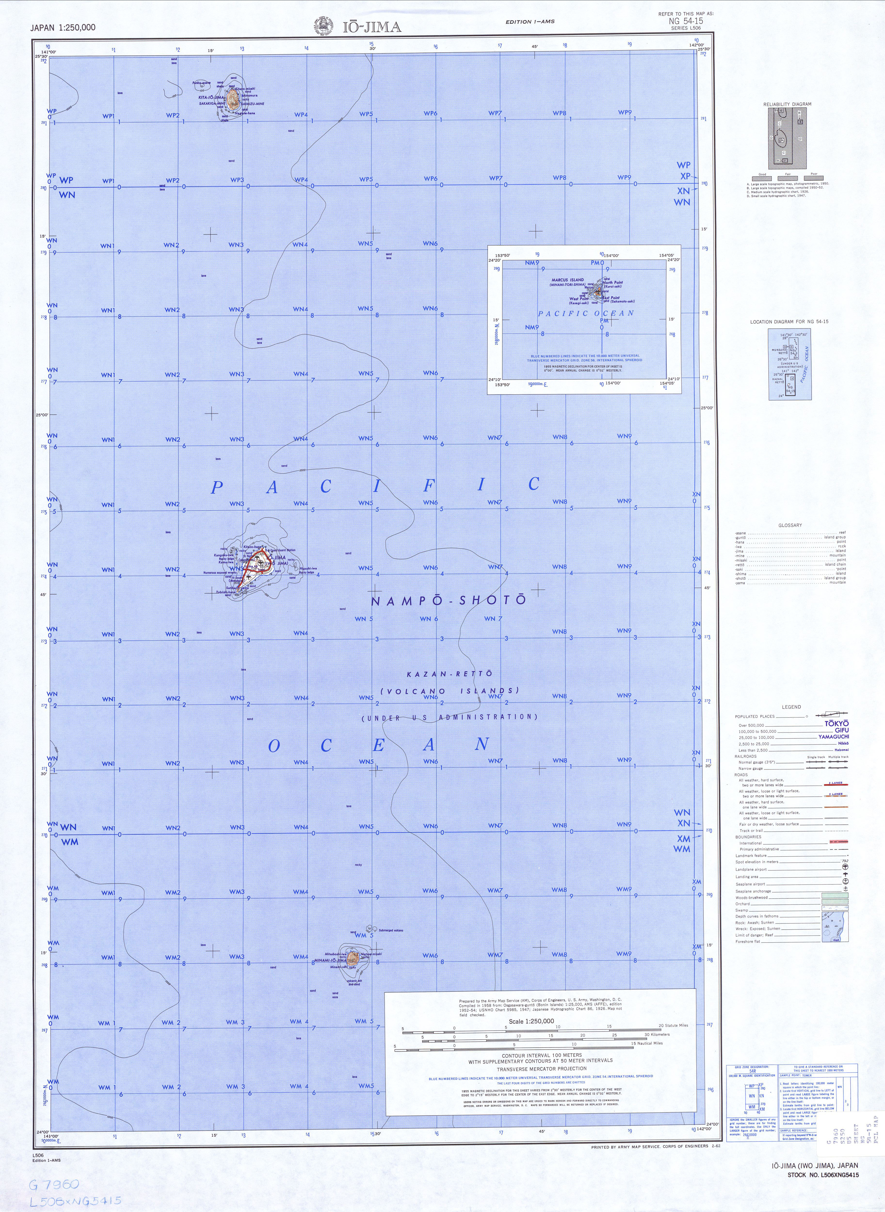
The island consists of the heavily eroded peak of a stratovolcano, which rises 792 m above sea level (804 m according to other sources). The peak is called Sakagi-ga-mine (榊ヶ峰), with another peak at Shimizu-ga-mine (清水峰, 665m). Its area is 5.57 km², and shore length 8.0 km. It is part of Ogasawara municipality and is uninhabited. Its Japanese name was changed to Kita-Iōtō on June 18, 2007.
History
First sighting by Europeans was in October 1543 by Spanish navigator Bernardo de la Torre on board of carrack San Juan de Letrán, when trying to return from Sarangani to New Spain. [2][3]
The island was formerly inhabited. It was first settled by settlers from the Izu Islands in 1889, who lived in two towns, Ishinomura (east)[4] and Nishimura (west). At the start of World War II, the population was 103. The civilian population was evacuated during the war.[5]
Unincorporated until 1940, it became part of the newly created municipality of Iōtō in 1940, which was included in Ogasawara-mura in 1968 upon the return of the islands by the United States to Japan.
Four men, flying a United States Navy S-3B Viking jet from the U.S. aircraft carrier John C. Stennis, died when their aircraft crashed on August 10, 2004 on Kita Iwo Jima during a naval exercise over the Pacific. They were Lt. Cmdr. Scott A. Zellem, 35, of Indiana, Pennsylvania; Lt. Patrick S. Myrick, 31, of Seattle; Lt. James J. Pupplo, 34, of Selden, New York; Petty Officer 2nd Class Joshua B. Showalter, 24, of Fontana, California.
2009 total solar eclipse
During the solar eclipse of July 22, 2009, the island had nearly six and a half minutes of totality, longer than any other land mass.[6]
See also
References
- ↑ Teikoku's Complete Atlas of Japan, Teikoku-Shoin Co., Ltd., Tokyo, ISBN 4-8071-0004-1
- ↑ Brand, Donald D. The Pacific Basin: A History of its Geographical Explorations The American Geographical Society (New York, 1967) p.123,131.
- ↑ Lua error in package.lua at line 80: module 'strict' not found.
- ↑ http://www.lib.utexas.edu/maps/ams/japan/txu-oclc-6900707-ng54-15.jpg
- ↑ Neal M. Bowers: "The Mariana, Volcano and Bonin Islands," in Otis W. Freeman: Geography of the Pacific, 1951, p. 229
- ↑ Eclipse Predictions by Fred Espenak, NASA's GSFC - map of Iwo Jima region
External links
- (Japanese) N. Iwo Jima page
Lua error in package.lua at line 80: module 'strict' not found.