Water on Mars
<templatestyles src="Module:Hatnote/styles.css"></templatestyles>

Water on Mars exists today almost entirely as ice, though it also exists in small quantities as vapor in the atmosphere[1] and occasionally as low-volume liquid brines in shallow Martian soil.[2][3] The only place where water ice is visible at the surface is at the north polar ice cap.[4] Abundant water ice is also present beneath the permanent carbon dioxide ice cap at the Martian south pole and in the shallow subsurface at more temperate latitudes.[5][6][7][8] More than five million cubic kilometers of ice have been identified at or near the surface of modern Mars, enough to cover the whole planet to a depth of 35 meters (115 ft).[9] Even more ice is likely to be locked away in the deep subsurface.[10]
Some liquid water may occur transiently on the Martian surface today, but only under certain conditions.[3][11][12][13] No large standing bodies of liquid water exist, because the atmospheric pressure at the surface averages just 600 pascals (0.087 psi)—about 0.6% of Earth's mean sea level pressure—and because the global average temperature is far too low (210 K (−63 °C; −82 °F)), leading to either rapid evaporation (sublimation) or rapid freezing. Before about 3.8 billion years ago, Mars may have had a denser atmosphere and higher surface temperatures,[14][15] allowing vast amounts of liquid water on the surface,[16][17] [18] possibly including a large ocean[19][20][21][22] that may have covered one-third of the planet.[23][24][25] Water has also apparently flowed across the surface for short periods at various intervals more recently in Mars' history.[26][27][28] On December 9, 2013, NASA reported that, based on evidence from the Curiosity rover studying Aeolis Palus, Gale Crater contained an ancient freshwater lake that could have been a hospitable environment for microbial life.[29][30]
Many lines of evidence indicate that water is abundant on Mars and has played a significant role in the planet's geologic history.[31][32] The present-day inventory of water on Mars can be estimated from spacecraft imagery, remote sensing techniques (spectroscopic measurements,[33][34] radar,[35] etc.), and surface investigations from landers and rovers.[36][37] Geologic evidence of past water includes enormous outflow channels carved by floods,[38] ancient river valley networks,[39][40] deltas,[41] and lakebeds;[42][43][44][45] and the detection of rocks and minerals on the surface that could only have formed in liquid water.[46] Numerous geomorphic features suggest the presence of ground ice (permafrost)[47] and the movement of ice in glaciers, both in the recent past[48][49][50][51] and present.[52] Gullies and slope lineae along cliffs and crater walls suggest that flowing water continues to shape the surface of Mars, although to a far lesser degree than in the ancient past.
Although the surface of Mars was periodically wet and could have been hospitable to microbial life billions of years ago,[53] the current environment at the surface is dry and subfreezing, probably presenting an insurmountable obstacle for living organisms. In addition, Mars lacks a thick atmosphere, ozone layer, and magnetic field, allowing solar and cosmic radiation to strike the surface unimpeded. The damaging effects of ionizing radiation on cellular structure is another one of the prime limiting factors on the survival of life on the surface.[54][55] Therefore, the best potential locations for discovering life on Mars may be in subsurface environments.[56][57][58]

Understanding water on Mars is vital to assess the planet’s potential for harboring life and for providing usable resources for future human exploration. For this reason, 'Follow the Water' was the science theme of NASA's Mars Exploration Program (MEP) in the first decade of the 21st century. Discoveries by the 2001 Mars Odyssey, Mars Exploration Rovers (MERs), Mars Reconnaissance Orbiter (MRO), and Mars Phoenix Lander have been instrumental in answering key questions about water's abundance and distribution on Mars. The ESA's Mars Express orbiter has also provided essential data in this quest.[59] The Mars Odyssey, Mars Express, MER Opportunity rover, MRO, and Mars Science Lander Curiosity rover are still sending back data from Mars, and discoveries continue to be made.
Contents
Historical background
<templatestyles src="Module:Hatnote/styles.css"></templatestyles>
The notion of water on Mars preceded the space age by hundreds of years. Early telescopic observers correctly assumed that the white polar caps and clouds were indications of water's presence. For many years, the dark regions visible on the surface were interpreted as oceans.[60] These observations, coupled with the fact that Mars has a 24-hour day, led astronomer William Herschel to declare in 1784 that Mars probably offered its inhabitants "a situation in many respects similar to ours."[61]


By the start of the 20th century, most astronomers recognized that Mars was far colder and drier than Earth. The presence of oceans was no longer accepted, so the paradigm changed to an image of Mars as a "dying" planet with only a meager amount of water. The dark areas, which could be seen to change seasonally, were now thought to be tracts of vegetation.[62] The man most responsible for popularizing this view of Mars was Percival Lowell (1855–1916), who imagined a race of Martians constructing a network of canals to bring water from the poles to the inhabitants at the equator. Although generating tremendous public enthusiasm, Lowell's ideas were rejected by most astronomers. The consensus of the scientific establishment at the time is probably best summarized by English astronomer Edward Walter Maunder (1851–1928) who compared the climate of Mars to conditions atop a twenty-thousand-foot peak on an arctic island[63] where only lichen might be expected to survive.
In the meantime, many astronomers were refining the tool of planetary spectroscopy in hope of determining the composition of the Martian atmosphere. Between 1925 and 1943, Walter Adams and Theodore Dunham at the Mount Wilson Observatory tried to identify oxygen and water vapor in the Martian atmosphere, with generally negative results. The only component of the Martian atmosphere known for certain was carbon dioxide (CO2) identified spectroscopically by Gerard Kuiper in 1947.[64] Water vapor was not unequivocally detected on Mars until 1963.[65]

The composition of the polar caps, assumed to be water ice since the time of Cassini (1666), was questioned by a few scientists in the late 1800s who favored CO2 ice, because of the planet's overall low temperature and apparent lack of appreciable water. This hypothesis was confirmed theoretically by Robert Leighton and Bruce Murray in 1966.[66] Today we know that the winter caps at both poles are primarily composed of CO2 ice, but that a permanent (or perennial) cap of water ice remains during the summer at the northern pole. At the southern pole, a small cap of CO2 ice remains during summer, but this cap too is underlain by water ice.
The final piece of the Martian climate puzzle was provided by Mariner 4 in 1965. Grainy television pictures from the spacecraft showed a surface dominated by impact craters, which implied that the surface was very old and had not experienced the level of erosion and tectonic activity seen on Earth. Little erosion meant that liquid water had probably not played a large role in the planet's geomorphology for billions of years.[67] Furthermore, the variations in the radio signal from the spacecraft as it passed behind the planet allowed scientists to calculate the density of the atmosphere. The results showed an atmospheric pressure less than 1% of Earth’s at sea level, effectively precluding the existence of liquid water, which would rapidly boil or freeze at such low pressures.[68] Thus, a vision of Mars was born of a world much like the Moon, but with just a wisp of an atmosphere to blow the dust around. This view of Mars would last nearly another decade until Mariner 9 showed a much more dynamic Mars with hints that the planet’s past environment was more clement than the present one.
On January 24, 2014, NASA reported that current studies on Mars by the Curiosity and Opportunity rovers will now be searching for evidence of ancient life, including a biosphere based on autotrophic, chemotrophic and/or chemolithoautotrophic microorganisms, as well as ancient water, including fluvio-lacustrine environments (plains related to ancient rivers or lakes) that may have been habitable.[69][70][71][72]
For many years it was thought that the observed remains of floods were caused by the release of water from a global water table, but research published in 2015 reveals regional deposits of sediment and ice emplaced 450 million years earlier to be the source.[73] "Deposition of sediment from rivers and glacial melt filled giant canyons beneath primordial ocean contained within the planet's northern lowlands. It was the water preserved in these canyon sediments that was later released as great floods, the effects of which can be seen today."[38][73]
Evidence from rocks and minerals
<templatestyles src="Module:Hatnote/styles.css"></templatestyles>
Today, it is widely accepted that Mars had abundant water very early in its history,[74][75] but all large areas of liquid water have since disappeared. A fraction of this water is retained on modern Mars as both ice and locked into the structure of abundant water-rich materials, including clay minerals (phyllosilicates) and sulfates.[76][77][78][79][80] Studies of hydrogen isotopic ratios indicate that asteroids and comets from beyond 2.5 astronomical units (AU) provide the source of Mars' water,[81] that currently totals 6% to 27% of the Earth's present ocean.[81]

Water in weathering products (aqueous minerals)
The primary rock type on the surface of Mars is basalt, a fine-grained igneous rock made up mostly of the mafic silicate minerals olivine, pyroxene, and plagioclase feldspar.[82] When exposed to water and atmospheric gases, these minerals chemically weather into new (secondary) minerals, some of which may incorporate water into their crystalline structures, either as H2O or as hydroxyl (OH). Examples of hydrated (or hydoxylated) minerals include the iron hydroxide goethite (a common component of terrestrial soils); the evaporate minerals gypsum and kieserite; opalline silica; and phyllosilicates (also called clay minerals), such as kaolinite and montmorillonite. All of these minerals have been detected on Mars.[83]
One direct effect of chemical weathering is to consume water and other reactive chemical species, taking them from mobile reservoirs like the atmosphere and hydrosphere and sequestering them in rocks and minerals.[84] The amount of water in the Martian crust stored in hydrated minerals is currently unknown, but may be quite large.[85] For example, mineralogical models of the rock outcroppings examined by instruments on the Opportunity rover at Meridiani Planum suggest that the sulfate deposits there could contain up to 22% water by weight.[86]
On Earth, all chemical weathering reactions involve water to some degree.[87] Thus, many secondary minerals do not actually incorporate water, but still require water to form. Some examples of anhydrous secondary minerals include many carbonates, some sulfates (e.g., anhydrite), and metallic oxides such as the iron oxide mineral hematite. On Mars, a few of these weathering products may theoretically form without water or with scant amounts present as ice or in thin molecular-scale films (monolayers).[88][89] The extent to which such exotic weathering processes operate on Mars is still uncertain. Minerals that incorporate water or form in the presence of water are generally termed "aqueous minerals."
Aqueous minerals are sensitive indicators of the type of environment that existed when the minerals formed. The ease with which aqueous reactions occur (see Gibbs free energy) depends on the pressure, temperature, and on the concentrations of the gaseous and soluble species involved.[90] Two important properties are pH and oxidation-reduction potential (Eh). For example, the sulfate mineral jarosite forms only in low pH (highly acidic) water. Phyllosilicates usually form in water of neutral to high pH (alkaline). Eh is a measure is the oxidation state of an aqueous system. Together Eh and pH indicate the types of minerals that are thermodynamically most likely to form from a given set of aqueous components. Thus, past environmental conditions on Mars, including those conducive to life, can be inferred from the types of minerals present in the rocks.
Hydrothermal alteration
Aqueous minerals can also form in the subsurface by hydrothermal fluids migrating through pores and fissures. The heat source driving a hydrothermal system may be nearby magma bodies or residual heat from large impacts.[91] One important type of hydrothermal alteration in the Earth’s oceanic crust is serpentinization, which occurs when seawater migrates through ultramafic and basaltic rocks. The water-rock reactions result in the oxidation of ferrous iron in olivine and pyroxene to produce ferric iron (as the mineral magnetite) yielding molecular hydrogen (H2) as a byproduct. The process creates a highly alkaline and reducing (low Eh) environment favoring the formation of certain phyllosilicates (serpentine minerals) and various carbonate minerals, which together form a rock called serpentinite.[92] The hydrogen gas produced can be an important energy source for chemosynthtetic organisms or it can react with CO2 to produce methane gas, a process that has been considered as a non-biological source for the trace amounts of methane reported in the Martian atmosphere.[93] Serpentine minerals can also store a lot of water (as hydroxyl) in their crystal structure. A recent study has argued that hypothetical serpentinites in the ancient highland crust of Mars could hold as much as a 500 metres (1,600 ft)-thick global equivalent layer (GEL) of water.[94] Although some serpentine minerals have been detected on Mars, no widespread outcroppings are evident from remote sensing data.[95] This fact does not preclude the presence of large amounts of sepentinite hidden at depth in the Martian crust.
Weathering rates
The rates at which primary minerals convert to secondary aqueous minerals vary. Primary silicate minerals crystallize from magma under pressures and temperatures vastly higher than conditions at the surface of a planet. When exposed to a surface environment these minerals are out of equilibrium and will tend to interact with available chemical components to form more stable mineral phases. In general, the silicate minerals that crystallize at the highest temperatures (solidify first in a cooling magma) weather the most rapidly.[96] On the Earth and Mars, the most common mineral to meet this criterion is olivine, which readily weathers to clay minerals in the presence of water.
Olivine is widespread on Mars,[97] suggesting that Mars' surface has not been pervasively altered by water; abundant geological evidence suggests otherwise.[98][99][100][101][102]
Martian meteorites

Over 60 meteorites have been found that came from Mars.[103] Some of them contain evidence that they were exposed to water when on Mars. Some Martian meteorites called basaltic shergottites, appear (from the presence of hydrated carbonates and sulfates) to have been exposed to liquid water prior to ejection into space.[104][105] It has been shown that another class of meteorites, the nakhlites, were suffused with liquid water around 620 million years ago and that they were ejected from Mars around 10.75 million years ago by an asteroid impact. They fell to Earth within the last 10,000 years.[106]
In 1996, a group of scientists reported the possible presence of microfossils in the Allan Hills 84001, a meteorite from Mars.[107] Many studies disputed the validity of the fossils.[108][109] It was found that most of the organic matter in the meteorite was of terrestrial origin.[110]
Geomorphic evidence
Lakes and river valleys
The 1971 Mariner 9 spacecraft caused a revolution in our ideas about water on Mars. Huge river valleys were found in many areas. Images showed that floods of water broke through dams, carved deep valleys, eroded grooves into bedrock, and traveled thousands of kilometers.[38] Areas of branched streams, in the southern hemisphere, suggested that rain once fell.[111][112][113] The numbers of recognised valleys has increased through time. Research published in June 2010 mapped 40,000 river valleys on Mars, roughly quadrupling the number of river valleys that had previously been identified.[25] Martian water-worn features can be classified into two distinct classes: 1) dendritic (branched), terrestrial-scale, widely distributed, Noachian-age valley networks and 2) exceptionally large, long, single-thread, isolated, Hesperian-age outflow channels. Recent work suggests that there may also be a class of currently enigmatic, smaller, younger (Hesperian to Amazonian) channels in the midlatitudes, perhaps associated with the occasional local melting of ice deposits.[114][115]
Some parts of Mars show inverted relief. This occurs when sediments are deposited on the floor of a stream and then become resistant to erosion, perhaps by cementation. Later the area may be buried. Eventually, erosion removes the covering layer and the former streams become visible since they are resistant to erosion. Mars Global Surveyor found several examples of this process.[116][117] Many inverted streams have been discovered in various regions of Mars, especially in the Medusae Fossae Formation,[118] Miyamoto Crater,[119] Saheki Crater,[120] and the Juventae Plateau.[121][122]

A variety of lake basins have been discovered on Mars.[123] Some are comparable in size to the largest lakes on Earth, such as the Caspian Sea, Black Sea, and Lake Baikal. Lakes that were fed by valley networks are found in the southern highlands. There are places that are closed depressions with river valleys leading into them. These areas are thought to have once contained lakes; one is in Terra Sirenum that had its overflow move through Ma'adim Vallis into Gusev Crater, explored by the Mars Exploration Rover Spirit. Another is near Parana Valles and Loire Vallis.[124] Some lakes are thought to have formed by precipitation, while others were formed from groundwater.[42][43] Lakes are estimated to have existed in the Argyre basin,[31][32] the Hellas basin,[44][125] and maybe in Valles Marineris.[45][125][126][127] It is likely that at times in the Noachian, very many craters hosted lakes. These lakes are consistent with a cold, dry (by Earth standards) hydrological environment somewhat like that of the Great Basin of the western USA during the Last Glacial Maximum.[128]
Research from 2010 suggests that Mars also had lakes along parts of the equator. Although earlier research had showed that Mars had a warm and wet early history that has long since dried up, these lakes existed in the Hesperian Epoch, a much later period. Using detailed images from NASA's Mars Reconnaissance Orbiter, the researchers speculate that there may have been increased volcanic activity, meteorite impacts or shifts in Mars' orbit during this period to warm Mars' atmosphere enough to melt the abundant ice present in the ground. Volcanoes would have released gases that thickened the atmosphere for a temporary period, trapping more sunlight and making it warm enough for liquid water to exist. In this study, channels were discovered that connected lake basins near Ares Vallis. When one lake filled up, its waters overflowed the banks and carved the channels to a lower area where another lake would form.[129][130] These dry lakes would be targets to look for evidence (biosignatures) of past life.
On September 27, 2012, NASA scientists announced that the Curiosity rover found direct evidence for an ancient streambed in Gale Crater, suggesting an ancient "vigorous flow" of water on Mars.[131][132][133][134] In particular, analysis of the now dry streambed indicated that the water ran at 3.3 km/h (0.92 m/s),[131] possibly at hip-depth. Proof of running water came in the form of rounded pebbles and gravel fragments that could have only been weathered by strong liquid currents. Their shape and orientation suggests long-distance transport from above the rim of the crater, where a channel named Peace Vallis feeds into the alluvial fan.
Lake deltas

Researchers have found a number of examples of deltas that formed in Martian lakes.[24] Finding deltas is a major sign that Mars once had a lot of liquid water. Deltas usually require deep water over a long period of time to form. Also, the water level needs to be stable to keep sediment from washing away. Deltas have been found over a wide geographical range,[42] though there is some indication that deltas may be concentrated around the edges of the putative former northern ocean of Mars.[135]
Groundwater
<templatestyles src="Module:Hatnote/styles.css"></templatestyles>

By 1979 it was thought that outflow channels formed in single, catastrophic ruptures of subsurface water reservoirs, possibly sealed by ice, discharging colossal quantities of water across an otherwise arid Mars surface.[136][137] In addition, evidence in favor of heavy or even catastrophic flooding is found in the giant ripples in the Athabasca Vallis.[138][139] Many outflow channels begin at Chaos or Chasma features, providing evidence for the rupture that could have breached a subsurface ice seal.[125]
The branching valley networks of Mars are not consistent with formation by sudden catastrophic release of groundwater, both in terms of their dendritic shapes that do not come from a single outflow point, and in terms of the discharges that apparently flowed along them.[140] Instead, some authors have argued that they were formed by slow seepage of groundwater from the subsurface essentially as springs.[141] In support of this interpretation, the upstream ends of many valleys in such networks begin with box canyon or "amphitheater" heads, which on Earth are typically associated with groundwater seepage. There is also little evidence of finer scale channels or valleys at the tips of the channels, which some authors have interpreted as showing the flow appeared suddenly from the subsurface with appreciable discharge, rather than accumulating gradually across the surface.[125] Others have disputed the strong link between amphitheater heads of valleys and formation by groundwater for terrestrial examples,[142] and have argued that the lack of fine scale heads to valley networks is due to their removal by weathering or impact gardening.[125] Most authors accept that most valley networks are at least partly influenced and shaped by groundwater seep processes.

Groundwater also plays a vital role in controlling broad scale sedimentation patterns and processes on Mars.[144] According to this hypothesis, groundwater with dissolved minerals came to the surface, in and around craters, and helped to form layers by adding minerals —especially sulfate— and cementing sediments.[143][145][146][147][148][149] In other words, some layers may be formed by groundwater rising up depositing minerals and cementing existing, loose, aeolian sediments. The hardened layers are consequently more protected from erosion. This process may occur instead of layers forming under lakes. A study published in 2011 using data from the Mars Reconnaissance Orbiter, show that the same kinds of sediments exist in a large area that includes Arabia Terra.[150] It has been argued that areas that we know from satellite remote sensing are rich in sedimentary rocks are also those areas that are most likely to experience groundwater upwelling on a regional scale.[151]
Mars ocean hypothesis
<templatestyles src="Module:Hatnote/styles.css"></templatestyles>
The Mars ocean hypothesis proposes that the Vastitas Borealis basin was the site of an ocean of liquid water at least once,[18] and presents evidence that nearly a third of the surface of Mars was covered by a liquid ocean early in the planet's geologic history.[123][152] This ocean, dubbed Oceanus Borealis,[18] would have filled the Vastitas Borealis basin in the northern hemisphere, a region that lies 4–5 kilometres (2.5–3.1 mi) below the mean planetary elevation. Two major putative shorelines have been suggested: a higher one, dating to a time period of approximately 3.8 billion years ago and concurrent with the formation of the valley networks in the Highlands, and a lower one, perhaps correlated with the younger outflow channels. The higher one, the 'Arabia shoreline', can be traced all around Mars except through the Tharsis volcanic region. The lower, the 'Deuteronilus', follows the Vastitas Borealis formation.[125]
A study in June 2010 concluded that the more ancient ocean would have covered 36% of Mars.[24][25] Data from the Mars Orbiter Laser Altimeter (MOLA), which measures the altitude of all terrain on Mars, was used in 1999 to determine that the watershed for such an ocean would have covered about 75% of the planet.[153] Early Mars would have required a warmer climate and denser atmosphere to allow liquid water to exist at the surface.[154][155] In addition, the large number of valley networks strongly supports the possibility of a hydrological cycle on the planet in the past.[145][156]
The existence of a primordial Martian ocean remains controversial among scientists, and the interpretations of some features as 'ancient shorelines' has been challenged.[157][158] One problem with the conjectured 2-billion-year-old (2 Ga) shoreline is that it is not flat—i.e., does not follow a line of constant gravitational potential. This could be due to a change in distribution in Mars' mass, perhaps due to volcanic eruption or meteor impact;[159] the Elysium volcanic province or the massive Utopia basin that is buried beneath the northern plains have been put forward as the most likely causes.[145]
In March 2015, scientists stated that evidence exists for an ancient Martian ocean, likely in the planet's northern hemisphere and about the size of Earth's Arctic Ocean, or approximately 19% of the Martian surface. This finding was derived from the ratio of water and deuterium in the modern Martian atmosphere compared to the ratio found on Earth. Eight times as much deuterium was found at Mars than exists on Earth, suggesting that ancient Mars had significantly higher levels of water. Results from the Curiosity rover had previously found a high ratio of deuterium in Gale Crater, though not significantly high enough to suggest the presence of an ocean. Other scientists caution that this new study has not been confirmed, and point out that Martian climate models have not yet shown that the planet was warm enough in the past to support bodies of liquid water.[160]
New evidence for a northern ocean was published in May 2016. A large team of scientists described how some of the surface in Ismenius Lacus quadrangle was altered by two Tsunamis. The Tsunamis were caused by asteroids striking the ocean. Both were thought to have been strong enough to create 30 Km diameter craters. The first Tsunami picked up and carried boulders the size of cars or small houses. The backwash from the wave formed channels by rearranging the boulders. The second came in when the ocean was 300 m lower. The second carried a great deal of ice which was dropped in valleys. Calculations show that the average height of the waves would have been 50 m, but the heights would vary from 10 m to 120 m. Numerical simulations show that in this particular part of the ocean two impact craters of the size of 30 km in diameter would form every 30 million years. The implication here is that a great northern ocean may have existed for millions of years. One argument against an ocean has been the lack of shoreline features. These features may have been washed away by these Tsunami events. The parts of Mars studied in this research are Chryse Planitia and northwestern Arabia Terra. These tsunamis affected some surfaces in the Ismenius Lacus quadrangle and in the Mare Acidalium quadrangle.[161][162][163][164]
Present water ice


A significant amount of surface hydrogen has been observed globally by the Mars Odyssey Neutron Spectrometer and Gamma Ray Spectrometer.[165] This hydrogen is thought to be incorporated into the molecular structure of ice, and through stoichiometric calculations the observed fluxes have been converted into concentrations of water ice in the upper meter of the Martian surface. This process has revealed that ice is both widespread and abundant on the modern surface. Below 60 degrees of latitude, ice is concentrated in several regional patches, particularly around the Elysium volcanoes, Terra Sabaea, and northwest of Terra Sirenum, and exists in concentrations up to 18% ice in the subsurface. Above 60 degrees latitude, ice is highly abundant. Polewards on 70 degrees of latitude, ice concentrations exceed 25% almost everywhere, and approach 100% at the poles.[166] More recently, the SHARAD and MARSIS radar sounding instruments have begun to be able to confirm whether individual surface features are ice rich. Due to the known instability of ice at current Martian surface conditions, it is thought that almost all of this ice must be covered by a veneer of rocky or dusty material.
The Mars Odyssey neutron spectrometer observations indicate that if all the ice in the top meter of the Martian surface were spread evenly, it would give a Water Equivalent Global layer (WEG) of at least ≈14 centimetres (5.5 in)—in other words, the globally averaged Martian surface is approximately 14% water.[167] The water ice currently locked in both Martian poles corresponds to a WEG of 30 metres (98 ft), and geomorphic evidence favors significantly larger quantities of surface water over geologic history, with WEG as deep as 500 metres (1,600 ft).[167] It is believed that part of this past water has been lost to the deep subsurface, and part to space, although the detailed mass balance of these processes remains poorly understood.[125] The current atmospheric reservoir of water is important as a conduit allowing gradual migration of ice from one part of the surface to another on both seasonal and longer timescales. It is insignificant in volume, with a WEG of no more than 10 micrometres (0.00039 in).[167]
Ice patches
On July 28, 2005, the European Space Agency announced the existence of a crater partially filled with frozen water;[168] some then interpreted the discovery as an "ice lake".[169] Images of the crater, taken by the High Resolution Stereo Camera on board the European Space Agency's Mars Express orbiter, clearly show a broad sheet of ice in the bottom of an unnamed crater located on Vastitas Borealis, a broad plain that covers much of Mars' far northern latitudes, at approximately 70.5° North and 103° East. The crater is 35 kilometres (22 mi) wide and about 2 kilometres (1.2 mi) deep. The height difference between the crater floor and the surface of the water ice is about 200 metres (660 ft). ESA scientists have attributed most of this height difference to sand dunes beneath the water ice, which are partially visible. While scientists do not refer to the patch as a "lake", the water ice patch is remarkable for its size and for being present throughout the year. Deposits of water ice and layers of frost have been found in many different locations on the planet.
As more and more of the surface of Mars has been imaged by the modern generation of orbiters, it has become gradually more apparent that there are probably many more patches of ice scattered across the Martian surface. Many of these putative patches of ice are concentrated in the Martian midlatitudes (≈30–60° N/S of the equator). For example, many scientists believe that the widespread features in those latitude bands variously described as "latitude dependent mantle" or "pasted-on terrain" consist of dust- or debris-covered ice patches, which are slowly degrading.[125] A cover of debris is required both to explain the dull surfaces seen in the images that do not reflect like ice, and also to allow the patches to exist for an extended period of time without subliming away completely. These patches have been suggested as possible water sources for some of the enigmatic channelized flow features like gullies also seen in those latitudes.
Equatorial frozen sea
Surface features consistent with existing pack ice have been discovered in the southern Elysium Planitia.[123] What appear to be plates, ranging in size from 30 metres (98 ft) to 30 kilometres (19 mi), are found in channels leading to a flooded area of approximately the same depth and width as the North Sea. The plates show signs of break up and rotation that clearly distinguish them from lava plates elsewhere on the surface of Mars. The source for the flood is thought to be the nearby geological fault Cerberus Fossae that spewed water as well as lava aged some 2 to 10 million years. It was suggested that the water exited the Cerberus Fossae then pooled and froze in the low, level plains and that such lakes may still exist.[170] Not all scientists agree with these conclusions.[125][171][172]
Polar ice caps
<templatestyles src="Module:Hatnote/styles.css"></templatestyles>

Both the northern polar cap (Planum Boreum) and the southern polar cap (Planum Australe) are thought to grow in thickness during the winter and partially sublime during the summer. In 2004, the MARSIS radar sounder on the Mars Express satellite targeted the southern polar cap, and was able to confirm that ice there extends to a depth of 3.7 kilometres (2.3 mi) below the surface.[173] In the same year, the OMEGA instrument on the same orbiter revealed that the cap is divided into three distinct parts, with varying contents of frozen water depending on latitude. The first part is the bright part of the polar cap seen in images, centered on the pole, which is a mixture of 85% CO2 ice to 15% water ice.[6] The second part comprises steep slopes known as scarps, made almost entirely of water ice, that ring and fall away from the polar cap to the surrounding plains.[6] The third part encompasses the vast permafrost fields that stretch for tens of kilometres away from the scarps, and is not obviously part of the cap until the surface composition is analysed.[6][174] NASA scientists calculate that the volume of water ice in the south polar ice cap, if melted, would be sufficient to cover the entire planetary surface to a depth of 11 meters (36 ft).[173][175] Observations over both poles and more widely over the planet suggest melting all the surface ice would produce a water equivalent global layer 35 meters deep.[9]

On July 2008, NASA announced that the Phoenix lander had confirmed the presence of water ice at its landing site near the northern polar ice cap (at 68.2° latitude). This was the first ever direct observation of ice from the surface.[176] Two years later, the shallow radar on board the Mars Reconnaissance Orbiter took measurements of the north polar ice cap and determined that the total volume of water ice in the cap is 821,000 cubic kilometres (197,000 cu mi). That is equal to 30% of the Earth's Greenland ice sheet, or enough to cover the surface of Mars to a depth of 5.6 metres (18 ft).[177] Both polar caps reveal abundant fine internal layers when examined in HiRISE and Mars Global Surveyor imagery. Many researchers have attempted to use this layering to attempt to understand the structure, history, and flow properties of the caps,[125] although their interpretation is not straightforward.[178]
Lake Vostok in Antarctica may have implications for liquid water still existing on Mars, because if water existed before the polar ice caps on Mars, it is possible that there is still liquid water below the ice caps.[179]
Ground ice
For many years, various scientists have suggested that some Martian surfaces look like periglacial regions on Earth.[180] By analogy with these terrestrial features, it has been argued for many years that these are regions of permafrost. This would suggest that frozen water lies right beneath the surface. A common feature in the higher latitudes, patterned ground, can occur in a number of shapes, including stripes and polygons. On the Earth, these shapes are caused by the freezing and thawing of soil.[181] There are other types of evidence for large amounts of frozen water under the surface of Mars, such as terrain softening, which rounds sharp topographical features.[182] Theoretical calculations and analysis have tended to bear out the possibility that these are features are formed by the effects of ground ice. Evidence from Mars Odyssey's Gamma Ray Spectrometer and direct measurements with the Phoenix lander have corroborated that many of these features are intimately associated with the presence of ground ice.[183]

Some areas of Mars are covered with cones that resemble those on Earth where lava has flowed on top of frozen ground. The heat of the lava melts the ice, then changes it into steam. The powerful force of the steam works its way through the lava and produces such rootless cones. These features can be found for example in Athabasca Valles, associated with lava flowing along this outflow channel. Larger cones may be made when the steam passes through thicker layers of lava.[184]
- Scalloped topography
Certain regions of Mars display scalloped-shaped depressions. The depressions are suspected to be the remains of a degrading ice-rich mantle deposit. Scallops are caused by ice sublimating from frozen soil. A study published in Icarus, found that the landforms of scalloped topography can be made by the subsurface loss of water ice by sublimation under current Martian climate conditions. Their model predicts similar shapes when the ground has large amounts of pure ice, up to many tens of meters in depth.[185] This mantle material was probably deposited from the atmosphere as ice formed on dust when the climate was different due to changes in the tilt of the Mars pole (see "Ice ages", below).[186][187] The scallops are typically tens of meters deep and from a few hundred to a few thousand meters across. They can be almost circular or elongated. Some appear to have coalesced causing a large heavily pitted terrain to form. The process of forming the terrain may begin with sublimation from a crack. There are often polygonal cracks where scallops form, and the presence of scalloped topography seems to be an indication of frozen ground.[122][188]
These scalloped features are superficially similar to Swiss cheese features, found around the south polar cap. Swiss cheese features are thought to be due to cavities forming in a surface layer of solid carbon dioxide, rather than water ice—although the floors of these holes are probably H2O-rich.[189]
Glaciers
<templatestyles src="Module:Hatnote/styles.css"></templatestyles>

Many large areas of Mars either appear to host glaciers, or carry evidence that they used to be present. Much of the areas in high latitudes, especially the Ismenius Lacus quadrangle, are suspected to still contain enormous amounts of water ice.[190][191] Recent evidence has led many planetary scientists to believe that water ice still exists as glaciers across much of the Martian mid- and high latitudes, protected from sublimation by thin coverings of insulating rock and/or dust.[35][52] In January 2009, scientists released the results of a radar study of the glacier-like features called lobate debris aprons in an area called Deuteronilus Mensae, which found widespread evidence of ice lying beneath a few meters of rock debris.[52] Glaciers are associated with fretted terrain, and many volcanoes. Researchers have described glacial deposits on Hecates Tholus,[192] Arsia Mons,[193] Pavonis Mons,[194] and Olympus Mons.[195] Glaciers have also been reported in a number of larger Martian craters in the midlatitudes and above.
Glacier-like features on Mars are known variously as viscous flow features,[196] Martian flow features, lobate debris aprons,[52] or lineated valley fill,[48] depending on the form of the feature, its location, the landforms it is associated with, and the author describing it. Many, but not all, small glaciers seem to be associated with gullies on the walls of craters and mantling material.[197] The lineated deposits known as lineated valley fill are probably rock-covered glaciers that are found on the floors most channels within the fretted terrain found around Arabia Terra in the northern hemisphere. Their surfaces have ridged and grooved materials that deflect around obstacles. Lineated floor deposits may be related to lobate debris aprons, which have been proven to contain large amounts of ice by orbiting radar.[35][52] For many years, researchers interpreted that features called 'lobate debris aprons' were glacial flows and it was thought that ice existed under a layer of insulating rocks.[51][198][199] With new instrument readings, it has been confirmed that lobate debris aprons contain almost pure ice that is covered with a layer of rocks.[35][52]

Moving ice carries rock material, then drops it as the ice disappears. This typically happens at the snout or edges of the glacier. On Earth, such features would be called moraines, but on Mars they are typically known as moraine-like ridges, concentric ridges, or arcuate ridges.[200] Because ice tends to sublime rather than melt on Mars, and because Mars's low temperatures tend to make glaciers "cold based" (frozen down to their beds, and unable to slide), the remains of these glaciers and the ridges they leave do not appear the exactly same as normal glaciers on Earth. In particular, Martian moraines tend to be deposited without being deflected by the underlying topography, which is thought to reflect the fact that the ice in Martian glaciers is normally frozen down and cannot slide.[125] Ridges of debris on the surface of the glaciers indicate the direction of ice movement. The surface of some glaciers have rough textures due to sublimation of buried ice. The ice evaporates without melting and leaves behind an empty space. Overlying material then collapses into the void.[201] Sometimes chunks of ice fall from the glacier and get buried in the land surface. When they melt, a more or less round hole remains. Many of these "kettle holes" have been identified on Mars.[202]
Despite strong evidence for glacial flow on Mars, there is little convincing evidence for landforms carved by glacial erosion, e.g., U-shaped valleys, crag and tail hills, arêtes, drumlins. Such features are abundant in glaciated regions on Earth, so their absence on Mars has proven puzzling. The lack of these landforms is thought to be related to the cold-based nature of the ice in most recent glaciers on Mars. Because the solar insolation reaching the planet, the temperature and density of the atmosphere, and the geothermal heat flux are all lower on Mars than they are on Earth, modelling suggests the temperature of the interface between a glacier and its bed stays below freezing and the ice is literally frozen down to the ground. This prevents it from sliding across the bed, which is thought to inhibit the ice's ability to erode the surface.[125]
Development of Mars' water inventory
The variation in Mars's surface water content is strongly coupled to the evolution of its atmosphere and may have been marked by several key stages.
Early Noachian era (4.6 Ga to 4.1 Ga)
Atmospheric loss to space from heavy meteoritic bombardment and hydrodynamic escape.[203] Ejection by meteorites may have removed ~60% of the early atmosphere.[203][204] Significant quantities of phyllosilicates may have formed during this period requiring a sufficiently dense atmosphere to sustain surface water, as the spectrally dominant phyllosilicate group, smectite, suggests moderate water-to-rock ratios.[205] However, the pH-pCO2 between smectite and carbonate show that the precipitation of smectite would constrain pCO2 to a value not more than 1×10⁻² atm (1.0 kPa).[205] As a result, the dominant component of a dense atmosphere on early Mars becomes uncertain, if the clays formed in contact with the Martian atmosphere,[206] particularly given the lack of evidence for carbonate deposits. An additional complication is that the ~25% lower brightness of the young Sun would have required an ancient atmosphere with a significant greenhouse effect to raise surface temperatures to sustain liquid water.[206] Higher CO2 content alone would have been insufficient, as CO2 precipitates at partial pressures exceeding 1.5 atm (1,500 hPa), reducing its effectiveness as a greenhouse gas.[206]
Middle to late Noachian era (4.1 Ga to 3.8 Ga)
Potential formation of a secondary atmosphere by outgassing dominated by the Tharsis volcanoes, including significant quantities of H2O, CO2, and SO2.[203][204] Martian valley networks date to this period, indicating globally widespread and temporally sustained surface water as opposed to catastrophic floods.[203] The end of this period coincides with the termination of the internal magnetic field and a spike in meteoritic bombardment.[203][204] The cessation of the internal magnetic field and subsequent weakening of any local magnetic fields allowed unimpeded atmospheric stripping by the solar wind. For example, when compared with their terrestrial counterparts, 38Ar/36Ar, 15N/14N, and 13C/12C ratios of the Martian atmosphere are consistent with ~60% loss of Ar, N2, and CO2 by solar wind stripping of an upper atmosphere enriched in the lighter isotopes via Rayleigh fractionation.[203] Supplementing the solar wind activity, impacts would have ejected atmospheric components in bulk without isotopic fractionation. Nevertheless, cometary impacts in particular may have contributed volatiles to the planet.[203]
Hesperian era to the present (~3.8 Ga to ~3.5 Ga)
Atmospheric enhancement by sporadic outgassing events were countered by solar wind stripping of the atmosphere, albeit less intensely than by the young Sun.[204] Catastrophic floods date to this period, favoring sudden subterranean release of volatiles, as opposed to sustained surface flows.[203] While the earlier portion of this era may have been marked by aqueous acidic environments and Tharsis-centric groundwater discharge[207] dating to the late Noachian, much of the surface alteration processes during the latter portion is marked by oxidative processes including the formation of Fe3+ oxides that impart a reddish hue to the Martian surface.[204] Such oxidation of primary mineral phases can be achieved by low-pH (and possibly high temperature) processes related to the formation of palagonitic tephra,[208] by the action of H2O2 that forms photochemically in the Martian atmosphere,[209] and by the action of water,[205] none of which require free O2. The action of H2O2 may have dominated temporally given the drastic reduction in aqueous and igneous activity in this recent era, making the observed Fe3+ oxides volumetrically small, though pervasive and spectrally dominant.[210] Nevertheless, aquifers may have driven sustained, but highly localized surface water in recent geologic history, as evident in the geomorphology of craters such as Mojave.[211] Furthermore, the Lafayette Martian meteorite shows evidence of aqueous alteration as recently as 650 Ma.[203]
Ice ages

Mars has experienced large scale changes in the amount and distribution of ice on its surface in its relatively recent geological past, and as on Earth, these are known as ice ages.[212] Ice ages on Mars are very different from the ones that the Earth experiences. During a Martian ice age, the poles get warmer, and water ice then leaves the ice caps and is redeposited in mid latitudes.[213] The moisture from the ice caps travels to lower latitudes in the form of deposits of frost or snow mixed with dust. The atmosphere of Mars contains a great deal of fine dust particles, the water vapor condenses on these particles that then fall down to the ground due to the additional weight of the water coating. When ice at the top of the mantling layer returns to the atmosphere, it leaves behind dust that serves to insulate the remaining ice.[213] The total volume of water removed is a few percent of the ice caps, or enough to cover the entire surface of the planet under one meter of water. Much of this moisture from the ice caps results in a thick smooth mantle with a mixture of ice and dust.[186][214][215] This ice-rich mantle, a few meters thick, smoothes the land at lower latitudes, but in places it displays a bumpy texture. Multiple stages of glaciations probably occurred.[216] Because there are few craters on the current mantle, it is thought to be relatively young. It is thought that this mantle was laid in place during a relatively recent ice age.
Ice ages are driven by changes in Mars's orbit and tilt, which can be compared to terrestrial Milankovich cycles. Orbital calculations show that Mars wobbles on its axis far more than Earth does. The Earth is stabilized by its proportionally large moon, so it only wobbles a few degrees. Mars may change its tilt—also known as its obliquity—by many tens of degrees.[187] When this obliquity is high, its poles get much more direct sunlight and heat; this causes the ice caps to warm and become smaller as ice sublimes. Adding to the variability of the climate, the eccentricity of the orbit of Mars changes twice as much as Earth's eccentricity. As the poles sublime, the ice is redeposited closer to the equator, which receive somewhat less solar insolation at these high obliquities. Computer simulations have shown that a 45° tilt of the Martian axis would result in ice accumulation in areas that display glacial landforms.[217] A 2008 study provided evidence for multiple glacial phases during Late Amazonian glaciation at the dichotomy boundary on Mars.[218]
Evidence for recent flows
<templatestyles src="Module:Hatnote/styles.css"></templatestyles>
<templatestyles src="Module:Hatnote/styles.css"></templatestyles>
.gif)


Pure liquid water cannot exist in a stable form on the surface of Mars with its present low atmospheric pressure and low temperature, except at the lowest elevations for a few hours.[174][219] So, a geological mystery commenced in 2006 when observations from NASA's Mars Reconnaissance Orbiter revealed gully deposits that were not there ten years prior, possibly caused by flowing liquid brine during the warmest months on Mars.[220][221][222] The images were of two craters called Terra Sirenum and Centauri Montes that appear to show the presence of liquid water flows on Mars at some point between 1999 and 2001.[221][223][224][225]
There is disagreement in the scientific community as to whether or not gullies are formed by liquid water. It is also possible that the flows that carve gullies are dry,[226] or perhaps lubricated by carbon dioxide.[227][228] Even if gullies are carved by flowing water at the surface, the exact source of the water and the mechanisms behind its motion are not well understood.[229]
In August 2011, NASA announced the discovery by Nepalese American undergraduate student Lujendra Ojha[230] of current seasonal changes on steep slopes below rocky outcrops near crater rims in the Southern hemisphere. These dark streaks, now called recurrent slope lineae, were seen to grow downslope during the warmest part of the Martian Summer, then to gradually fade through the rest of the year, recurring cyclically between years.[12] The researchers suggested these marks were consistent with salty water (brines) flowing downslope and then evaporating, possibly leaving some sort of residue.[231][232] The CRISM spectroscopic instrument has since made direct observations of hydrous salts appearing at the same time that these recurrent slope lineae form, confirming in 2015 that these lineae are produced by the flow of liquid brines through shallow soils. The lineae contain hydrated chlorate and perchlorate salts (ClO
4-), which contain liquid water molecules.[233] The lineae flow downhill in Martian summer, when the temperature is above −23 °C (−9 °F; 250 K).[234] However, the source of the water remains unknown.[3][235][236]
Habitability assessment
<templatestyles src="Module:Hatnote/styles.css"></templatestyles>
Life is understood to require liquid water, but it is not the only essential requirement for life.[237][238][239] These requirements include water, an energy source, and materials necessary for cellular growth, while all under appropriate environmental conditions.[240] The confirmation that liquid water once flowed on Mars, the existence of nutrients, and the previous discovery of a past magnetic field that protected the planet from cosmic and solar radiation,[241][242] together strongly suggest that Mars could have had the environmental factors to support life.[53] To be clear, the find of past habitability is not evidence that Martian life has ever actually existed.

When there is a magnetic field, the atmosphere is protected from erosion by solar wind, and ensures the maintenance of a dense atmosphere, necessary for liquid water to exist on the surface of Mars.[243][244] The two current ecological approaches for predicting the potential habitability of the Martian surface use 19 or 20 environmental factors, with emphasis on water availability, temperature, presence of nutrients, an energy source, and protection from solar ultraviolet and galactic cosmic radiation.[238][239] In particular, the damaging effect of ionising radiation on cellular structure is one of the prime limiting factors on the survival of life in potential astrobiological habitats.[54][55] Even at a depth of 2 meters beneath the surface, any microbes would likely be dormant, cryopreserved by the current freezing conditions, and so metabolically inactive and unable to repair cellular degradation as it occurs.[54][55][57][245]
Therefore, the best potential locations for discovering life on Mars may be at subsurface environments that have not been studied yet.[58][246][247] The extensive volcanism in the past, possibly created subsurface cracks and caves within different strata, and liquid water could have been stored in these subterraneous places, forming large aquifers with deposits of saline liquid water, minerals, organic molecules, and geothermal heat – potentially providing a current habitable environment away from the harsh surface conditions.[56][57][144][248][249][250][251]
Findings by probes
<templatestyles src="Module:Hatnote/styles.css"></templatestyles>
Mariner 9

The images acquired by the Mariner 9 Mars orbiter, launched in 1971, revealed the first direct evidence of past water in the form of dry river beds, canyons (including the Valles Marineris, a system of canyons over about 4,020 kilometres (2,500 mi) long), evidence of water erosion and deposition, weather fronts, fogs, and more.[252] The findings from the Mariner 9 missions underpinned the later Viking program. The enormous Valles Marineris canyon system is named after Mariner 9 in honor of its achievements.
Viking program
<templatestyles src="Module:Hatnote/styles.css"></templatestyles>

By discovering many geological forms that are typically formed from large amounts of water, the two Viking orbiters and the two landers caused a revolution in our knowledge about water on Mars. Huge outflow channels were found in many areas. They showed that floods of water broke through dams, carved deep valleys, eroded grooves into bedrock, and traveled thousands of kilometers.[253] Large areas in the southern hemisphere contained branched valley networks, suggesting that rain once fell.[254] Many craters look as if the impactor fell into mud. When they were formed, ice in the soil may have melted, turned the ground into mud, then the mud flowed across the surface.[111][112][180][255] Regions, called "Chaotic Terrain," seemed to have quickly lost great volumes of water that caused large channels to form downstream. Estimates for some channel flows run to ten thousand times the flow of the Mississippi River.[256] Underground volcanism may have melted frozen ice; the water then flowed away and the ground collapsed to leave chaotic terrain. Also, general chemical analysis by the two Viking landers suggested the surface has been either exposed to or submerged in water in the past.[257][258]
Mars Global Surveyor
<templatestyles src="Module:Hatnote/styles.css"></templatestyles>

The Mars Global Surveyor's Thermal Emission Spectrometer (TES) is an instrument able to determine the mineral composition on the surface of Mars. Mineral composition gives information on the presence or absence of water in ancient times. TES identified a large (30,000 square kilometres (12,000 sq mi)) area in the Nili Fossae formation that contains the mineral olivine.[259] It is thought that the ancient asteroid impact that created the Isidis basin resulted in faults that exposed the olivine. The discovery of olivine is strong evidence that parts of Mars have been extremely dry for a long time. Olivine was also discovered in many other small outcrops within 60 degrees north and south of the equator.[260] The probe has imaged several channels that suggest past sustained liquid flows, two of them are found in Nanedi Valles and in Nirgal Vallis.[261]

Mars Pathfinder
<templatestyles src="Module:Hatnote/styles.css"></templatestyles>
The Pathfinder lander recorded the variation of diurnal temperature cycle. It was coldest just before sunrise, about −78 °C (−108 °F; 195 K), and warmest just after Mars noon, about −8 °C (18 °F; 265 K). At this location, the highest temperature never reached the freezing point of water (0 °C (32 °F; 273 K)), too cold for pure liquid water to exist on the surface.
The atmospheric pressure measured by the Pathfinder on Mars is very low —about 0.6% of Earth's, and it would not permit pure liquid water to exist on the surface.[262]
Other observations were consistent with water being present in the past. Some of the rocks at the Mars Pathfinder site leaned against each other in a manner geologists term imbricated. It is suspected that strong flood waters in the past pushed the rocks around until they faced away from the flow. Some pebbles were rounded, perhaps from being tumbled in a stream. Parts of the ground are crusty, maybe due to cementing by a fluid containing minerals.[263] There was evidence of clouds and maybe fog.[263]
Mars Odyssey
<templatestyles src="Module:Hatnote/styles.css"></templatestyles>
The 2001 Mars Odyssey found much evidence for water on Mars in the form of images, and with its spectrometer, it proved that much of the ground is loaded with water ice. Mars has enough ice just beneath the surface to fill Lake Michigan twice.[7] In both hemispheres, from 55° latitude to the poles, Mars has a high density of ice just under the surface; one kilogram of soil contains about 500 grams (18 oz) of water ice. But close to the equator, there is only 2% to 10% of water in the soil.[8] Scientists think that much of this water is also locked up in the chemical structure of minerals, such as clay and sulfates.[264][265] Although the upper surface contains a few percent of chemically-bound water, ice lies just a few meters deeper, as it has been shown in Arabia Terra, Amazonis quadrangle, and Elysium quadrangle that contain large amounts of water ice.[266] Analysis of the data suggests that the southern hemisphere may have a layered structure, suggestive of stratified deposits beneath a now extinct large water mass.[267]

The instruments aboard the Mars Odyssey are only able to study the top meter of soil, while the radar aboard the Mars Reconnaissance Orbiter can measure a few kilometers deep. In 2002, available data were used to calculate that if all soil surfaces were covered by an even layer of water, this would correspond to a global layer of water (GLW) 0.5–1.5 kilometres (0.31–0.93 mi).[268]
Thousands of images returned from Odyssey orbiter also support the idea that Mars once had great amounts of water flowing across its surface. Some images show patterns of branching valleys; others show layers that may have been formed under lakes; even river and lake deltas have been identified.[42][269] For many years researchers thought that glaciers existed under a layer of insulating rocks.[35][51][52][198][199] Lineated valley fill is one example of these rock-covered glaciers. They are found on the floors of some channels. Their surfaces have ridged and grooved materials that deflect around obstacles. Lineated floor deposits may be related to lobate debris aprons, which have been shown by orbiting radar to contain large amounts of ice.[35][52]
Phoenix
<templatestyles src="Module:Hatnote/styles.css"></templatestyles>

The Phoenix lander also confirmed the existence of large amounts of water ice in the northern region of Mars.[270][271] This finding was predicted by previous orbital data and theory,[272] and was measured from orbit by the Mars Odyssey instruments.[8] On June 19, 2008, NASA announced that dice-sized clumps of bright material in the "Dodo-Goldilocks" trench, dug by the robotic arm, had vaporized over the course of four days, strongly indicating that the bright clumps were composed of water ice that sublimes following exposure. Even though CO2 (dry ice) also sublimes under the conditions present, it would do so at a rate much faster than observed.[273] On July 31, 2008, NASA announced that Phoenix further confirmed the presence of water ice at its landing site. During the initial heating cycle of a sample, the mass spectrometer detected water vapor when the sample temperature reached 0 °C (32 °F; 273 K).[176] Liquid water cannot exist on the surface of Mars with its present low atmospheric pressure and temperature, except at the lowest elevations for short periods.[174][219][270][274]
Perchlorate (ClO4), a strong oxidizer, was confirmed to be in the soil. The chemical, when mixed with water, can lower the water freezing point in a manner similar to how salt is applied to roads to melt ice.

When Phoenix landed, the retrorockets splashed soil and melted ice onto the vehicle.[275] Photographs showed the landing had left blobs of material stuck to the landing struts.[275] The blobs expanded at a rate consistent with deliquescence, darkened before disappearing (consistent with liquefaction followed by dripping), and appeared to merge. These observations, combined with thermodynamic evidence, indicated that the blobs were likely liquid brine droplets.[275][276] Other researchers suggested the blobs could be "clumps of frost."[277][278][279] In 2015 it was confirmed that perchlorate plays a role in forming recurring slope lineae on steep gullies.[3][280]
For about as far as the camera can see, the landing site is flat, but shaped into polygons between 2–3 metres (6 ft 7 in – 9 ft 10 in) in diameter and are bounded by troughs that are 20–50 centimetres (7.9–19.7 in) deep. These shapes are due to ice in the soil expanding and contracting due to major temperature changes. The microscope showed that the soil on top of the polygons is composed of rounded particles and flat particles, probably a type of clay.[281] Ice is present a few inches below the surface in the middle of the polygons, and along its edges, the ice is at least 8 inches (200 mm) deep.[274]
Snow was observed to fall from cirrus clouds. The clouds formed at a level in the atmosphere that was around −65 °C (−85 °F; 208 K), so the clouds would have to be composed of water-ice, rather than carbon dioxide-ice (CO2 or dry ice), because the temperature for forming carbon dioxide ice is much lower than −120 °C (−184 °F; 153 K). As a result of mission observations, it is now suspected that water ice (snow) would have accumulated later in the year at this location.[282] The highest temperature measured during the mission, which took place during the Martian summer, was −19.6 °C (−3.3 °F; 253.6 K), while the coldest was −97.7 °C (−143.9 °F; 175.5 K). So, in this region the temperature remained far below the freezing point (0 °C (32 °F; 273 K)) of water.[283]
Mars Exploration Rovers
<templatestyles src="Module:Hatnote/styles.css"></templatestyles>


The Mars Exploration Rovers, Spirit and Opportunity found a great deal of evidence for past water on Mars. The Spirit rover landed in what was thought to be a large lake bed. The lake bed had been covered over with lava flows, so evidence of past water was initially hard to detect. On March 5, 2004, NASA announced that Spirit had found hints of water history on Mars in a rock dubbed "Humphrey".[284]
As Spirit traveled in reverse in December 2007, pulling a seized wheel behind, the wheel scraped off the upper layer of soil, uncovering a patch of white ground rich in silica. Scientists think that it must have been produced in one of two ways.[285] One: hot spring deposits produced when water dissolved silica at one location and then carried it to another (i.e. a geyser). Two: acidic steam rising through cracks in rocks stripped them of their mineral components, leaving silica behind.[286] The Spirit rover also found evidence for water in the Columbia Hills of Gusev crater. In the Clovis group of rocks the Mössbauer spectrometer (MB) detected goethite,[287] that forms only in the presence of water.[288][289][290] iron in the oxidized form Fe3+,[291] carbonate-rich rocks, which means that regions of the planet once harbored water.[292][293]
The Opportunity rover was directed to a site that had displayed large amounts of hematite from orbit. Hematite often forms from water. The rover indeed found layered rocks and marble- or blueberry-like hematite concretions. Elsewhere on its traverse, Opportunity investigated aeolian dune stratigraphy in Burns Cliff in Endurance Crater. Its operators concluded that the preservation and cementation of these outcrops had been controlled by flow of shallow groundwater.[143] In its years of continuous operation, Opportunity is still sending back evidence that this area on Mars was soaked in liquid water in the past.[294][295]
The MER rovers had been finding evidence for ancient wet environments that were very acidic. In fact, what Opportunity has mostly discovered, or found evidence for, was sulphuric acid, a harsh chemical for life.[36][37][296][297] But in May 17, 2013, NASA announced that Opportunity found clay deposits that typically form in wet environments that are near neutral acidity. This find provides additional evidence about a wet ancient environment possibly favorable for life.[36][37]
Mars Reconnaissance Orbiter
<templatestyles src="Module:Hatnote/styles.css"></templatestyles>

The Mars Reconnaissance Orbiter's HiRISE instrument has taken many images that strongly suggest that Mars has had a rich history of water-related processes. A major discovery was finding evidence of ancient hot springs. If they have hosted microbial life, they may contain biosignatures.[298] Research published in January 2010, described strong evidence for sustained precipitation in the area around Valles Marineris.[121][122] The types of minerals there are associated with water. Also, the high density of small branching channels indicates a great deal of precipitation.
Rocks on Mars have been found to frequently occur as layers, called strata, in many different places.[299] Layers form by various ways, including volcanoes, wind, or water.[300] Light-toned rocks on Mars have been associated with hydrated minerals like sulfates and clay.[301]

The orbiter helped scientists determine that much of the surface of Mars is covered by a thick smooth mantle that is thought to be a mixture of ice and dust.[186][302][303]
The ice mantle under the shallow subsurface is thought to result from frequent, major climate changes. Changes in Mars' orbit and tilt cause significant changes in the distribution of water ice from polar regions down to latitudes equivalent to Texas. During certain climate periods water vapor leaves polar ice and enters the atmosphere. The water returns to the ground at lower latitudes as deposits of frost or snow mixed generously with dust. The atmosphere of Mars contains a great deal of fine dust particles.[222] Water vapor condenses on the particles, then they fall down to the ground due to the additional weight of the water coating. When ice at the top of the mantling layer goes back into the atmosphere, it leaves behind dust, which insulates the remaining ice.[213]
In 2008, research with the Shallow Radar on the Mars Reconnaissance Orbiter provided strong evidence that the lobate debris aprons (LDA) in Hellas Planitia and in mid northern latitudes are glaciers that are covered with a thin layer of rocks. Its radar also detected a strong reflection from the top and base of LDAs, meaning that pure water ice made up the bulk of the formation.[35] The discovery of water ice in LDAs demonstrates that water is found at even lower latitudes.[180]
Research published in September 2009, demonstrated that some new craters on Mars show exposed, pure water ice.[304] After a time, the ice disappears, evaporating into the atmosphere. The ice is only a few feet deep. The ice was confirmed with the Compact Imaging Spectrometer (CRISM) on board the Mars Reconnaissance Orbiter.[305]
Curiosity rover
<templatestyles src="Module:Hatnote/styles.css"></templatestyles>


Very early in its ongoing mission, NASA's Curiosity rover discovered unambiguous fluvial sediments on Mars. The properties of the pebbles in these outcrops suggested former vigorous flow on a streambed, with flow between ankle- and waist-deep. These rocks were found at the foot of an alluvial fan system descending from the crater wall, which had previously been identified from orbit.[131][132][133]
On October 2012, the first X-ray diffraction analysis of a Martian soil was performed by Curiosity. The results revealed the presence of several minerals, including feldspar, pyroxenes and olivine, and suggested that the Martian soil in the sample was similar to the weathered basaltic soils of Hawaiian volcanoes. The sample used is composed of dust distributed from global dust storms and local fine sand. So far, the materials Curiosity has analyzed are consistent with the initial ideas of deposits in Gale Crater recording a transition through time from a wet to dry environment.[306]
In December 2012, NASA reported that Curiosity performed its first extensive soil analysis, revealing the presence of water molecules, sulfur and chlorine in the Martian soil.[307][308] And on March 2013, NASA reported evidence of mineral hydration, likely hydrated calcium sulfate, in several rock samples including the broken fragments of "Tintina" rock and "Sutton Inlier" rock as well as in veins and nodules in other rocks like "Knorr" rock and "Wernicke" rock.[309][310][311] Analysis using the rover's DAN instrument provided evidence of subsurface water, amounting to as much as 4% water content, down to a depth of 60 cm (2.0 ft), in the rover's traverse from the Bradbury Landing site to the Yellowknife Bay area in the Glenelg terrain.[309]
On September 26, 2013, NASA scientists reported the Mars Curiosity rover detected abundant chemically-bound water (1.5 to 3 weight percent) in soil samples at the Rocknest region of Aeolis Palus in Gale Crater.[312][313][314][315][316][317] In addition, NASA reported the rover found two principal soil types: a fine-grained mafic type and a locally derived, coarse-grained felsic type.[314][316][318] The mafic type, similar to other martian soils and martian dust, was associated with hydration of the amorphous phases of the soil.[318] Also, perchlorates, the presence of which may make detection of life-related organic molecules difficult, were found at the Curiosity rover landing site (and earlier at the more polar site of the Phoenix lander) suggesting a "global distribution of these salts".[317] NASA also reported that Jake M rock, a rock encountered by Curiosity on the way to Glenelg, was a mugearite and very similar to terrestrial mugearite rocks.[319]
On December 9, 2013, NASA reported that the planet Mars had a large freshwater lake (that could have been a hospitable environment for microbial life) based on evidence from the Curiosity rover studying the plain Aeolis Palus near Mount Sharp in Gale Crater.[29][30]
On December 16, 2014, NASA reported detecting an unusual increase, then decrease, in the amounts of methane in the atmosphere of the planet Mars; in addition, organic chemicals were detected in powder drilled from a rock by the Curiosity rover. Also, based on deuterium to hydrogen ratio studies, much of the water at Gale Crater on Mars was found to have been lost during ancient times, before the lakebed in the crater was formed; afterwards, large amounts of water continued to be lost.[320][321][322]
On April 13, 2015, Nature published an analysis of humidity and ground temperature data collected by Curiosity, showing evidence that films of liquid brine water form in the upper 5 cm of Mars's subsurface at night. The water activity and temperature remain below the requirements for reproduction and metabolism of known terrestrial microorganisms.[2][323]
On October 8, 2015, NASA confirmed that lakes and streams existed in Gale crater 3.3 - 3.8 billion years ago delivering sediments to build up the lower layers of Mount Sharp.[324][325]
See also
<templatestyles src="Div col/styles.css"/>
- Atmosphere of Mars#Water
- Climate of Mars
- Colonization of Mars
- Evolution of water on Mars and Earth
- Extraterrestrial life
- Extraterrestrial liquid water
- Glaciers on Mars
- Groundwater on Mars
- Jezero crater
- Lakes on Mars
- Life on Mars
- List of quadrangles on Mars
- List of rocks on Mars
- Lobate debris apron
- Mars Express § Scientific discoveries and important events
- Mars Global Surveyor § Discovery of water ice on Mars
- Mars § Hydrology
- Martian canal
- Scalloped topography
- Scientific information from the Mars Exploration Rover mission
- Uzboi-Landon-Morava (ULM)
- Vallis
- Water vapor § Extraterrestrial water vapor
References
- ↑ Lua error in package.lua at line 80: module 'strict' not found.
- ↑ 2.0 2.1 Lua error in package.lua at line 80: module 'strict' not found.
- ↑ 3.0 3.1 3.2 3.3 Lua error in package.lua at line 80: module 'strict' not found.
- ↑ Lua error in package.lua at line 80: module 'strict' not found.
- ↑ Lua error in package.lua at line 80: module 'strict' not found.
- ↑ 6.0 6.1 6.2 6.3 Lua error in package.lua at line 80: module 'strict' not found.
- ↑ 7.0 7.1 Lua error in package.lua at line 80: module 'strict' not found.
- ↑ 8.0 8.1 8.2 Lua error in package.lua at line 80: module 'strict' not found.
- ↑ 9.0 9.1 Lua error in package.lua at line 80: module 'strict' not found.
- ↑ Carr, 2006, p. 173.
- ↑ Lua error in package.lua at line 80: module 'strict' not found.
- ↑ 12.0 12.1 Lua error in package.lua at line 80: module 'strict' not found.
- ↑ Lua error in package.lua at line 80: module 'strict' not found.
- ↑ Lua error in package.lua at line 80: module 'strict' not found.
- ↑ Lua error in package.lua at line 80: module 'strict' not found.
- ↑ Lua error in package.lua at line 80: module 'strict' not found.
- ↑ Lua error in package.lua at line 80: module 'strict' not found.
- ↑ 18.0 18.1 18.2 Lua error in package.lua at line 80: module 'strict' not found.
- ↑ Lua error in package.lua at line 80: module 'strict' not found.
- ↑ Lua error in package.lua at line 80: module 'strict' not found.
- ↑ Lua error in package.lua at line 80: module 'strict' not found.
- ↑ Lua error in package.lua at line 80: module 'strict' not found.
- ↑ Lua error in package.lua at line 80: module 'strict' not found.
- ↑ 24.0 24.1 24.2 Lua error in package.lua at line 80: module 'strict' not found.
- ↑ 25.0 25.1 25.2 Lua error in package.lua at line 80: module 'strict' not found.
- ↑ Carr, 2006, pp 144–147.
- ↑ Lua error in package.lua at line 80: module 'strict' not found.
- ↑ Lua error in package.lua at line 80: module 'strict' not found.
- ↑ 29.0 29.1 Lua error in package.lua at line 80: module 'strict' not found.
- ↑ 30.0 30.1 Lua error in package.lua at line 80: module 'strict' not found.
- ↑ 31.0 31.1 Lua error in package.lua at line 80: module 'strict' not found.
- ↑ 32.0 32.1 Lua error in package.lua at line 80: module 'strict' not found.
- ↑ Lua error in package.lua at line 80: module 'strict' not found.
- ↑ Lua error in package.lua at line 80: module 'strict' not found.
- ↑ 35.0 35.1 35.2 35.3 35.4 35.5 35.6 Lua error in package.lua at line 80: module 'strict' not found.
- ↑ 36.0 36.1 36.2 Lua error in package.lua at line 80: module 'strict' not found.
- ↑ 37.0 37.1 37.2 Lua error in package.lua at line 80: module 'strict' not found.
- ↑ 38.0 38.1 38.2 Lua error in package.lua at line 80: module 'strict' not found.
- ↑ Lua error in package.lua at line 80: module 'strict' not found.
- ↑ Lua error in package.lua at line 80: module 'strict' not found.
- ↑ Salese, F., G. Di Achille, A. Neesemann, G. G. Ori, and E. Hauber (2016), Hydrological and sedimentary analyses of well-preserved paleofluvial-paleolacustrine systems at Moa Valles, Mars, J. Geophys. Res. Planets, 121, 194–232, doi:10.1002/2015JE004891.
- ↑ 42.0 42.1 42.2 42.3 Lua error in package.lua at line 80: module 'strict' not found.
- ↑ 43.0 43.1 Lua error in package.lua at line 80: module 'strict' not found.
- ↑ 44.0 44.1 Lua error in package.lua at line 80: module 'strict' not found.
- ↑ 45.0 45.1 Lua error in package.lua at line 80: module 'strict' not found.
- ↑ Lua error in package.lua at line 80: module 'strict' not found.
- ↑ Lua error in package.lua at line 80: module 'strict' not found.
- ↑ 48.0 48.1 Lua error in package.lua at line 80: module 'strict' not found.
- ↑ Lua error in package.lua at line 80: module 'strict' not found.
- ↑ Lua error in package.lua at line 80: module 'strict' not found.
- ↑ 51.0 51.1 51.2 Lua error in package.lua at line 80: module 'strict' not found.
- ↑ 52.0 52.1 52.2 52.3 52.4 52.5 52.6 52.7 Lua error in package.lua at line 80: module 'strict' not found.
- ↑ 53.0 53.1 Lua error in package.lua at line 80: module 'strict' not found.
- ↑ 54.0 54.1 54.2 Lua error in package.lua at line 80: module 'strict' not found.
- ↑ 55.0 55.1 55.2 Lua error in package.lua at line 80: module 'strict' not found.
- ↑ 56.0 56.1 Lua error in package.lua at line 80: module 'strict' not found.
- ↑ 57.0 57.1 57.2 Lua error in package.lua at line 80: module 'strict' not found.
- ↑ 58.0 58.1 Lua error in package.lua at line 80: module 'strict' not found.
- ↑ NASA Mars Exploration Program Overview. http://www.nasa.gov/mission_pages/mars/overview/index.html.
- ↑ Hartmann, 2003, p. 11.
- ↑ Sheehan, 1996, p. 35.
- ↑ Lua error in package.lua at line 80: module 'strict' not found.
- ↑ hartmann, 2003, p. 20.
- ↑ Sheehan, 1996, p. 150.
- ↑ Lua error in package.lua at line 80: module 'strict' not found.
- ↑ Lua error in package.lua at line 80: module 'strict' not found.
- ↑ Lua error in package.lua at line 80: module 'strict' not found.
- ↑ Lua error in package.lua at line 80: module 'strict' not found.
- ↑ Lua error in package.lua at line 80: module 'strict' not found.
- ↑ Lua error in package.lua at line 80: module 'strict' not found.
- ↑ Lua error in package.lua at line 80: module 'strict' not found.
- ↑ Lua error in package.lua at line 80: module 'strict' not found.
- ↑ 73.0 73.1 Lua error in package.lua at line 80: module 'strict' not found.
- ↑ Lua error in package.lua at line 80: module 'strict' not found.
- ↑ Lua error in package.lua at line 80: module 'strict' not found.
- ↑ Lua error in package.lua at line 80: module 'strict' not found.
- ↑ Lua error in package.lua at line 80: module 'strict' not found.
- ↑ Lua error in package.lua at line 80: module 'strict' not found.
- ↑ Lua error in package.lua at line 80: module 'strict' not found.
- ↑ Lua error in package.lua at line 80: module 'strict' not found.
- ↑ 81.0 81.1 Lua error in package.lua at line 80: module 'strict' not found.
- ↑ Lua error in package.lua at line 80: module 'strict' not found.
- ↑ Lua error in package.lua at line 80: module 'strict' not found.
- ↑ Lua error in package.lua at line 80: module 'strict' not found.
- ↑ Lua error in package.lua at line 80: module 'strict' not found.
- ↑ Lua error in package.lua at line 80: module 'strict' not found.
- ↑ Lua error in package.lua at line 80: module 'strict' not found.
- ↑ Lua error in package.lua at line 80: module 'strict' not found.
- ↑ Lua error in package.lua at line 80: module 'strict' not found.
- ↑ Lua error in package.lua at line 80: module 'strict' not found.
- ↑ Lua error in package.lua at line 80: module 'strict' not found.
- ↑ Lua error in package.lua at line 80: module 'strict' not found.
- ↑ Lua error in package.lua at line 80: module 'strict' not found.
- ↑ Lua error in package.lua at line 80: module 'strict' not found.
- ↑ Lua error in package.lua at line 80: module 'strict' not found.
- ↑ Lua error in package.lua at line 80: module 'strict' not found.., p. 120
- ↑ Lua error in package.lua at line 80: module 'strict' not found.
- ↑ Lua error in package.lua at line 80: module 'strict' not found.
- ↑ Lua error in package.lua at line 80: module 'strict' not found.
- ↑ Lua error in package.lua at line 80: module 'strict' not found.
- ↑ Lua error in package.lua at line 80: module 'strict' not found.
- ↑ Lua error in package.lua at line 80: module 'strict' not found.
- ↑ Meyer, C. (2012) The Martian Meteorite Compendium; National Aronautics and Space Administration. http://curator.jsc.nasa.gov/antmet/mmc/.
- ↑ Lua error in package.lua at line 80: module 'strict' not found.
- ↑ Lua error in package.lua at line 80: module 'strict' not found.
- ↑ Lua error in package.lua at line 80: module 'strict' not found.
- ↑ Lua error in package.lua at line 80: module 'strict' not found.
- ↑ Lua error in package.lua at line 80: module 'strict' not found.
- ↑ Lua error in package.lua at line 80: module 'strict' not found.
- ↑ Lua error in package.lua at line 80: module 'strict' not found.
- ↑ 111.0 111.1 Lua error in package.lua at line 80: module 'strict' not found.
- ↑ 112.0 112.1 Lua error in package.lua at line 80: module 'strict' not found.
- ↑ Lua error in package.lua at line 80: module 'strict' not found.
- ↑ Lua error in package.lua at line 80: module 'strict' not found.
- ↑ Lua error in package.lua at line 80: module 'strict' not found.
- ↑ Lua error in package.lua at line 80: module 'strict' not found.
- ↑ Lua error in package.lua at line 80: module 'strict' not found.
- ↑ Lua error in package.lua at line 80: module 'strict' not found.
- ↑ Lua error in package.lua at line 80: module 'strict' not found.
- ↑ Lua error in package.lua at line 80: module 'strict' not found.
- ↑ 121.0 121.1 Lua error in package.lua at line 80: module 'strict' not found.
- ↑ 122.0 122.1 122.2 Lua error in package.lua at line 80: module 'strict' not found.
- ↑ 123.0 123.1 123.2 Lua error in package.lua at line 80: module 'strict' not found.
- ↑ Lua error in package.lua at line 80: module 'strict' not found.
- ↑ 125.00 125.01 125.02 125.03 125.04 125.05 125.06 125.07 125.08 125.09 125.10 125.11 Lua error in package.lua at line 80: module 'strict' not found.
- ↑ McCauley, J. 1978. Geologic map of the Coprates quadrangle of Mars. U.S. Geol. Misc. Inv. Map I-897
- ↑ Lua error in package.lua at line 80: module 'strict' not found.
- ↑ Matsubara, Yo, Alan D. Howard, and Sarah A. Drummond. "Hydrology of early Mars: Lake basins." Journal of Geophysical Research: Planets (1991–2012) 116.E4 (2011).
- ↑ Lua error in package.lua at line 80: module 'strict' not found.
- ↑ Lua error in package.lua at line 80: module 'strict' not found.
- ↑ 131.0 131.1 131.2 131.3 Lua error in package.lua at line 80: module 'strict' not found.
- ↑ 132.0 132.1 132.2 Lua error in package.lua at line 80: module 'strict' not found.
- ↑ 133.0 133.1 133.2 Lua error in package.lua at line 80: module 'strict' not found.
- ↑ Lua error in package.lua at line 80: module 'strict' not found.
- ↑ Di Achille, Gaetano, and Brian M. Hynek. "Ancient ocean on Mars supported by global distribution of deltas and valleys." Nature Geoscience 3.7 (2010) 459-463.
- ↑ Lua error in package.lua at line 80: module 'strict' not found.
- ↑ Lua error in package.lua at line 80: module 'strict' not found.
- ↑ Lua error in package.lua at line 80: module 'strict' not found.
- ↑ Lua error in package.lua at line 80: module 'strict' not found.
- ↑ Lua error in package.lua at line 80: module 'strict' not found.
- ↑ Lua error in package.lua at line 80: module 'strict' not found.
- ↑ Lamb, Michael P., et al. "Can springs cut canyons into rock?." Journal of Geophysical Research: Planets (1991–2012) 111.E7 (2006).
- ↑ 143.0 143.1 143.2 Lua error in package.lua at line 80: module 'strict' not found.
- ↑ 144.0 144.1 Lua error in package.lua at line 80: module 'strict' not found.
- ↑ 145.0 145.1 145.2 Lua error in package.lua at line 80: module 'strict' not found.
- ↑ Lua error in package.lua at line 80: module 'strict' not found.
- ↑ Lua error in package.lua at line 80: module 'strict' not found.
- ↑ Lua error in package.lua at line 80: module 'strict' not found..
- ↑ Lua error in package.lua at line 80: module 'strict' not found..
- ↑ Lua error in package.lua at line 80: module 'strict' not found.
- ↑ Lua error in package.lua at line 80: module 'strict' not found.
- ↑ Lua error in package.lua at line 80: module 'strict' not found.
- ↑ Lua error in package.lua at line 80: module 'strict' not found.
- ↑ Lua error in package.lua at line 80: module 'strict' not found.
- ↑ Lua error in package.lua at line 80: module 'strict' not found.
- ↑ Lua error in package.lua at line 80: module 'strict' not found.
- ↑ Lua error in package.lua at line 80: module 'strict' not found.
- ↑ Lua error in package.lua at line 80: module 'strict' not found.
- ↑ Lua error in package.lua at line 80: module 'strict' not found.
- ↑ Lua error in package.lua at line 80: module 'strict' not found.
- ↑ http://astrobiology.com/2016/05/ancient-tsunami-evidence-on-mars-reveals-life-potential.html
- ↑ Rodriguez, J., et al. 2016. Tsunami waves extensively resurfaced the shorelines of an early Martian ocean. Scientific Reports: 6, 25106.
- ↑ http://www.nature.com/articles/srep25106
- ↑ Cornell University. "Ancient tsunami evidence on Mars reveals life potential." ScienceDaily. ScienceDaily, 19 May 2016. <www.sciencedaily.com/releases/2016/05/160519101756.htm>.
- ↑ Lua error in package.lua at line 80: module 'strict' not found.
- ↑ Lua error in package.lua at line 80: module 'strict' not found.
- ↑ 167.0 167.1 167.2 Lua error in package.lua at line 80: module 'strict' not found.
- ↑ Lua error in package.lua at line 80: module 'strict' not found.
- ↑ Lua error in package.lua at line 80: module 'strict' not found.
- ↑ Lua error in package.lua at line 80: module 'strict' not found.
- ↑ Lua error in package.lua at line 80: module 'strict' not found.
- ↑ Lua error in package.lua at line 80: module 'strict' not found.
- ↑ 173.0 173.1 Lua error in package.lua at line 80: module 'strict' not found.
- ↑ 174.0 174.1 174.2 Lua error in package.lua at line 80: module 'strict' not found.
- ↑ Lua error in package.lua at line 80: module 'strict' not found.
- ↑ 176.0 176.1 Lua error in package.lua at line 80: module 'strict' not found.
- ↑ Lua error in package.lua at line 80: module 'strict' not found.
- ↑ Lua error in package.lua at line 80: module 'strict' not found.
- ↑ Lua error in package.lua at line 80: module 'strict' not found.
- ↑ 180.0 180.1 180.2 Lua error in package.lua at line 80: module 'strict' not found.
- ↑ Lua error in package.lua at line 80: module 'strict' not found.
- ↑ Lua error in package.lua at line 80: module 'strict' not found.
- ↑ Lua error in package.lua at line 80: module 'strict' not found.
- ↑ Lua error in package.lua at line 80: module 'strict' not found.
- ↑ Dundas, C., S. Bryrne, A. McEwen. 2015. Modeling the development of martian sublimation thermokarst landforms. Icarus: 262, 154-169.
- ↑ 186.0 186.1 186.2 Lua error in package.lua at line 80: module 'strict' not found.
- ↑ 187.0 187.1 Lua error in package.lua at line 80: module 'strict' not found.
- ↑ Lua error in package.lua at line 80: module 'strict' not found.
- ↑ Lua error in package.lua at line 80: module 'strict' not found.
- ↑ Lua error in package.lua at line 80: module 'strict' not found.
- ↑ Lua error in package.lua at line 80: module 'strict' not found.
- ↑ Lua error in package.lua at line 80: module 'strict' not found.
- ↑ Lua error in package.lua at line 80: module 'strict' not found.
- ↑ Lua error in package.lua at line 80: module 'strict' not found.
- ↑ Lua error in package.lua at line 80: module 'strict' not found.
- ↑ Lua error in package.lua at line 80: module 'strict' not found.
- ↑ Lua error in package.lua at line 80: module 'strict' not found.
- ↑ 198.0 198.1 Lua error in package.lua at line 80: module 'strict' not found.
- ↑ 199.0 199.1 Lua error in package.lua at line 80: module 'strict' not found.
- ↑ Lua error in package.lua at line 80: module 'strict' not found.
- ↑ Lua error in package.lua at line 80: module 'strict' not found.
- ↑ Lua error in package.lua at line 80: module 'strict' not found.
- ↑ 203.0 203.1 203.2 203.3 203.4 203.5 203.6 203.7 203.8 Lua error in package.lua at line 80: module 'strict' not found.
- ↑ 204.0 204.1 204.2 204.3 204.4 Lua error in package.lua at line 80: module 'strict' not found.
- ↑ 205.0 205.1 205.2 Lua error in package.lua at line 80: module 'strict' not found.
- ↑ 206.0 206.1 206.2 Lua error in package.lua at line 80: module 'strict' not found.
- ↑ Lua error in package.lua at line 80: module 'strict' not found.
- ↑ Lua error in package.lua at line 80: module 'strict' not found.
- ↑ Lua error in package.lua at line 80: module 'strict' not found.
- ↑ Lua error in package.lua at line 80: module 'strict' not found.
- ↑ Lua error in package.lua at line 80: module 'strict' not found.
- ↑ Lua error in package.lua at line 80: module 'strict' not found.
- ↑ 213.0 213.1 213.2 Lua error in package.lua at line 80: module 'strict' not found.
- ↑ Lua error in package.lua at line 80: module 'strict' not found.
- ↑ Lua error in package.lua at line 80: module 'strict' not found.
- ↑ Lua error in package.lua at line 80: module 'strict' not found.
- ↑ Lua error in package.lua at line 80: module 'strict' not found.
- ↑ Lua error in package.lua at line 80: module 'strict' not found.
- ↑ 219.0 219.1 Lua error in package.lua at line 80: module 'strict' not found. 'conditions such as now occur on Mars, outside of the temperature-pressure stability regime of liquid water' … 'Liquid water is typically stable at the lowest elevations and at low latitudes on the planet, because the atmospheric pressure is greater than the vapor pressure of water and surface temperatures in equatorial regions can reach 220 K (−53 °C; −64 °F) for parts of the day.
- ↑ Lua error in package.lua at line 80: module 'strict' not found.
- ↑ 221.0 221.1 Lua error in package.lua at line 80: module 'strict' not found.
- ↑ 222.0 222.1 Lua error in package.lua at line 80: module 'strict' not found.
- ↑ Lua error in package.lua at line 80: module 'strict' not found.
- ↑ Lua error in package.lua at line 80: module 'strict' not found.
- ↑ Lua error in package.lua at line 80: module 'strict' not found.
- ↑ Lua error in package.lua at line 80: module 'strict' not found.
- ↑ Lua error in package.lua at line 80: module 'strict' not found.
- ↑ Lua error in package.lua at line 80: module 'strict' not found.
- ↑ Lua error in package.lua at line 80: module 'strict' not found.
- ↑ Lua error in package.lua at line 80: module 'strict' not found.
- ↑ Lua error in package.lua at line 80: module 'strict' not found.
- ↑ Lua error in package.lua at line 80: module 'strict' not found.
- ↑ Lua error in package.lua at line 80: module 'strict' not found.
- ↑ Lua error in package.lua at line 80: module 'strict' not found.
- ↑ Lua error in package.lua at line 80: module 'strict' not found.
- ↑ Lua error in package.lua at line 80: module 'strict' not found.
- ↑ Lua error in package.lua at line 80: module 'strict' not found.
- ↑ 238.0 238.1 Lua error in package.lua at line 80: module 'strict' not found.
- ↑ 239.0 239.1 Lua error in package.lua at line 80: module 'strict' not found.
- ↑ Lua error in package.lua at line 80: module 'strict' not found.
- ↑ Lua error in package.lua at line 80: module 'strict' not found.
- ↑ Lua error in package.lua at line 80: module 'strict' not found.
- ↑ Lua error in package.lua at line 80: module 'strict' not found.
- ↑ Lua error in package.lua at line 80: module 'strict' not found.
- ↑ Lua error in package.lua at line 80: module 'strict' not found.
- ↑ Lua error in package.lua at line 80: module 'strict' not found.
- ↑ Lua error in package.lua at line 80: module 'strict' not found.
- ↑ Lua error in package.lua at line 80: module 'strict' not found.
- ↑ Lua error in package.lua at line 80: module 'strict' not found.
- ↑ Lua error in package.lua at line 80: module 'strict' not found.
- ↑ Lua error in package.lua at line 80: module 'strict' not found.
- ↑ Lua error in package.lua at line 80: module 'strict' not found.
- ↑ Lua error in package.lua at line 80: module 'strict' not found.
- ↑ Lua error in package.lua at line 80: module 'strict' not found.
- ↑ Lua error in package.lua at line 80: module 'strict' not found.
- ↑ Lua error in package.lua at line 80: module 'strict' not found.
- ↑ Lua error in package.lua at line 80: module 'strict' not found.
- ↑ Lua error in package.lua at line 80: module 'strict' not found.
- ↑ Lua error in package.lua at line 80: module 'strict' not found.
- ↑ Lua error in package.lua at line 80: module 'strict' not found.
- ↑ Lua error in package.lua at line 80: module 'strict' not found.
- ↑ Lua error in package.lua at line 80: module 'strict' not found.
- ↑ 263.0 263.1 Lua error in package.lua at line 80: module 'strict' not found.
- ↑ Lua error in package.lua at line 80: module 'strict' not found.
- ↑ Lua error in package.lua at line 80: module 'strict' not found.
- ↑ Lua error in package.lua at line 80: module 'strict' not found.
- ↑ Lua error in package.lua at line 80: module 'strict' not found.
- ↑ Lua error in package.lua at line 80: module 'strict' not found.
- ↑ Lua error in package.lua at line 80: module 'strict' not found.
- ↑ 270.0 270.1 Lua error in package.lua at line 80: module 'strict' not found.
- ↑ Lua error in package.lua at line 80: module 'strict' not found.
- ↑ Lua error in package.lua at line 80: module 'strict' not found.
- ↑ Lua error in package.lua at line 80: module 'strict' not found.
- ↑ 274.0 274.1 Lua error in package.lua at line 80: module 'strict' not found.
- ↑ 275.0 275.1 275.2 Lua error in package.lua at line 80: module 'strict' not found.
- ↑ Lua error in package.lua at line 80: module 'strict' not found.
- ↑ Lua error in package.lua at line 80: module 'strict' not found.
- ↑ Lua error in package.lua at line 80: module 'strict' not found.
- ↑ Lua error in package.lua at line 80: module 'strict' not found.
- ↑ Lua error in package.lua at line 80: module 'strict' not found.
- ↑ Lua error in package.lua at line 80: module 'strict' not found.
- ↑ Lua error in package.lua at line 80: module 'strict' not found.
- ↑ Lua error in package.lua at line 80: module 'strict' not found.
- ↑ Lua error in package.lua at line 80: module 'strict' not found.
- ↑ Lua error in package.lua at line 80: module 'strict' not found.
- ↑ Lua error in package.lua at line 80: module 'strict' not found.
- ↑ Lua error in package.lua at line 80: module 'strict' not found.
- ↑ Lua error in package.lua at line 80: module 'strict' not found.
- ↑ Lua error in package.lua at line 80: module 'strict' not found.
- ↑ Lua error in package.lua at line 80: module 'strict' not found.
- ↑ Lua error in package.lua at line 80: module 'strict' not found.
- ↑ Lua error in package.lua at line 80: module 'strict' not found.
- ↑ Lua error in package.lua at line 80: module 'strict' not found.
- ↑ Lua error in package.lua at line 80: module 'strict' not found.
- ↑ Lua error in package.lua at line 80: module 'strict' not found.
- ↑ Lua error in package.lua at line 80: module 'strict' not found.
- ↑ Lua error in package.lua at line 80: module 'strict' not found.
- ↑ Lua error in package.lua at line 80: module 'strict' not found.
- ↑ Lua error in package.lua at line 80: module 'strict' not found.
- ↑ Lua error in package.lua at line 80: module 'strict' not found.
- ↑ Lua error in package.lua at line 80: module 'strict' not found.
- ↑ Lua error in package.lua at line 80: module 'strict' not found.
- ↑ Lua error in package.lua at line 80: module 'strict' not found.
- ↑ Lua error in package.lua at line 80: module 'strict' not found.
- ↑ Lua error in package.lua at line 80: module 'strict' not found.
- ↑ Lua error in package.lua at line 80: module 'strict' not found.
- ↑ Lua error in package.lua at line 80: module 'strict' not found.
- ↑ Lua error in package.lua at line 80: module 'strict' not found.
- ↑ 309.0 309.1 Lua error in package.lua at line 80: module 'strict' not found.
- ↑ Lua error in package.lua at line 80: module 'strict' not found.
- ↑ Lua error in package.lua at line 80: module 'strict' not found.
- ↑ Lua error in package.lua at line 80: module 'strict' not found.
- ↑ Lua error in package.lua at line 80: module 'strict' not found.
- ↑ 314.0 314.1 Lua error in package.lua at line 80: module 'strict' not found.
- ↑ Lua error in package.lua at line 80: module 'strict' not found.
- ↑ 316.0 316.1 Lua error in package.lua at line 80: module 'strict' not found.
- ↑ 317.0 317.1 Lua error in package.lua at line 80: module 'strict' not found.
- ↑ 318.0 318.1 Lua error in package.lua at line 80: module 'strict' not found.
- ↑ Lua error in package.lua at line 80: module 'strict' not found.
- ↑ Lua error in package.lua at line 80: module 'strict' not found.
- ↑ Lua error in package.lua at line 80: module 'strict' not found.
- ↑ Lua error in package.lua at line 80: module 'strict' not found.
- ↑ Lua error in package.lua at line 80: module 'strict' not found.
- ↑ Lua error in package.lua at line 80: module 'strict' not found.
- ↑ Lua error in package.lua at line 80: module 'strict' not found.
Bibliography
- Boyce, Joseph, M. (2008). The Smithsonian Book of Mars; Konecky & Konecky: Old Saybrook, CT, ISBN 978-1-58834-074-0
- Carr, Michael, H. (1996). Water on Mars; Oxford University Press: New York, ISBN 0-19-509938-9.
- Carr, Michael, H. (2006). The Surface of Mars; Cambridge University Press: Cambridge, UK, ISBN 978-0-521-87201-0.
- Hartmann, William, K. (2003). A Traveler’s Guide to Mars: The Mysterious Landscapes of the Red Planet; Workman: New York, ISBN 0-7611-2606-6.
- Hanlon, Michael (2004). The Real Mars: Spirit, Opportunity, Mars Express and the Quest to Explore the Red Planet; Constable: London, ISBN 1-84119-637-1.
- Kargel, Jeffrey, S. (2004). Mars: A Warmer Wetter Planet; Springer-Praxis: London, ISBN 1-85233-568-8.
- Morton, Oliver (2003). Mapping Mars: Science, Imagination, and the Birth of a World; Picador: New York, ISBN 0-312-42261-X.
- Sheehan, William (1996). The Planet Mars: A History of Observation and Discovery; University of Arizona Press: Tucson, AZ, ISBN 0-8165-1640-5.
- Viking Orbiter Imaging Team (1980). Viking Orbiter Views of Mars, C.R. Spitzer, Ed.; NASA SP-441: Washington DC.
External links
| Wikimedia Commons has media related to Lua error in package.lua at line 80: module 'strict' not found.. |
| Wikinews has related news: NASA announces water on Mars |
- NASA – Curiosity Rover Finds Evidence For An Ancient Streambed – September, 2012
- Images – Signs Of Water On Mars (HiRISE)
- Video (02:01) – Liquid Flowing Water Discovered on Mars – August, 2011
- Video (04:32) – Evidence: Water "Vigorously" Flowed On Mars – September, 2012
- Video (03:56) – Measuring Mars' Ancient Ocean – March, 2015

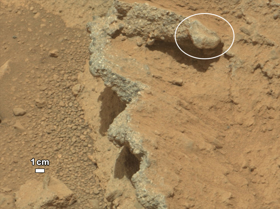
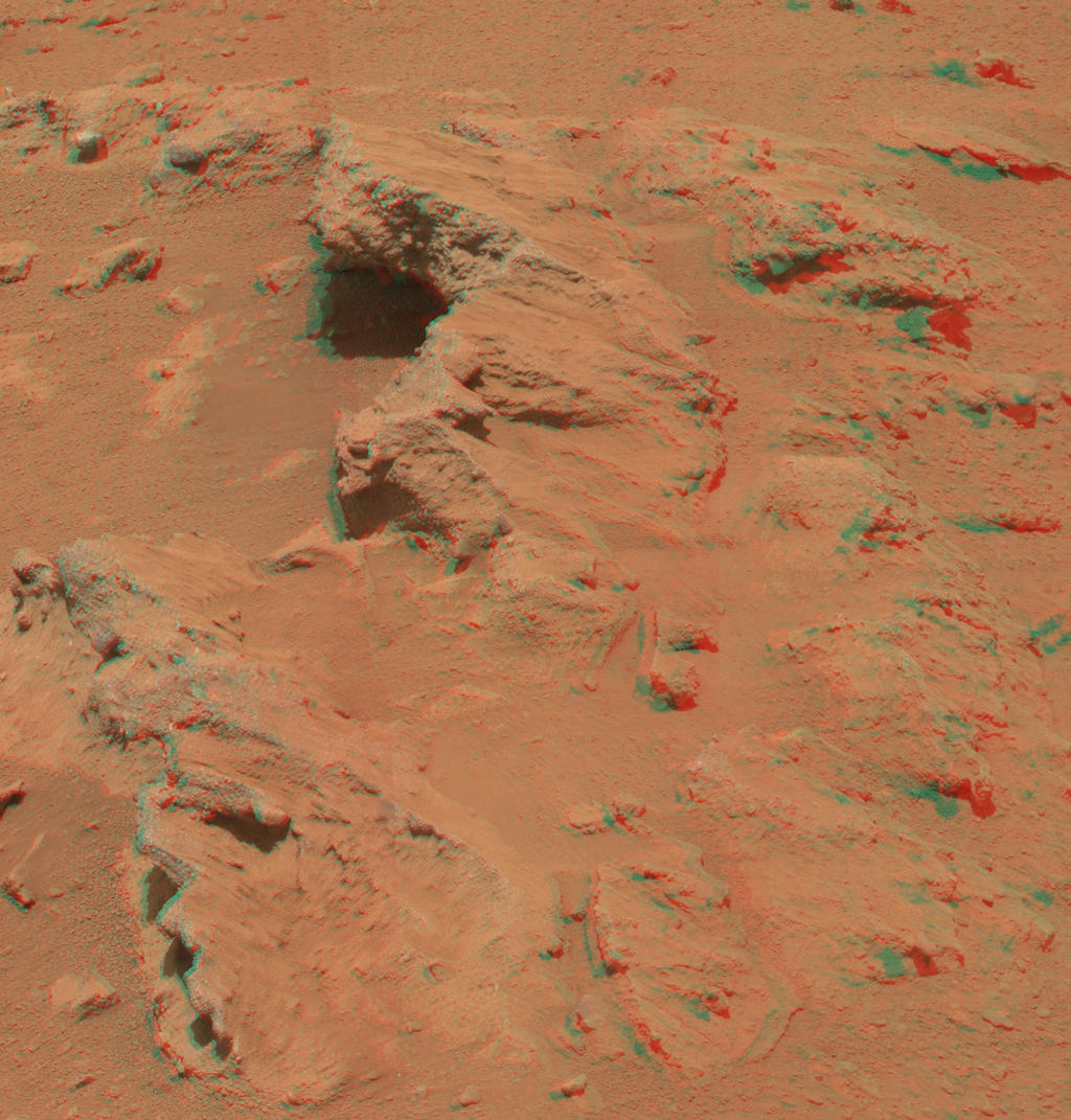