Zambales
<templatestyles src="Module:Hatnote/styles.css"></templatestyles>
| Zambales | |||
|---|---|---|---|
| Province | |||

Provincial Capitol in Iba, decorated for the Mango Festival
|
|||
|
|||
| Nickname(s): Mango Capital of the Philippines, Chromite Capital of the Philippines, Wreck Diving Capital of the Philippines | |||
| Motto: Sulong Zambales! Arangkada Zambaleño | |||
| {{#property:P242}} Location within the Philippines |
|||
| Coordinates: Lua error in package.lua at line 80: module 'strict' not found. | |||
| Country | [[{{#property:P17}}]] | ||
| Region | [[{{#property:P131}}]] (Region III) | ||
| Founded | 1578 | ||
| Capital | Iba | ||
| Government | |||
| • Type | Province | ||
| • Governor | Hermogenes Ebdane (Sulong Zambales Party) | ||
| • Vice Governor | Ramon G. Lacbain II (Sulong Zambales Party) | ||
| Area[1] | |||
| • Total | 3,830.83 km2 (1,479.09 sq mi) | ||
| Area rank | 36th out of 80 | ||
| Population (2010)[2] | |||
| • Total | 534,443 | ||
| • Rank | 37th out of 80 | ||
| • Density | 140/km2 (360/sq mi) | ||
| • Density rank | 43rd out of 80 | ||
| Population (including Olongapo City): 755,621 | |||
| Divisions | |||
| • Independent cities | 1 | ||
| • Component cities | 0 | ||
| • Municipalities | 13 | ||
| • Barangays | 230 including independent cities: 247 |
||
| • Districts | 1st and 2nd districts of Zambales (shared with Olongapo City) | ||
| Demographics | |||
| • Ethnic groups | Tagalog (42%), Ilocano (28%), Sambal (27%), Others (3%) | ||
| • Languages | Tagalog, Ilocano, Sambal, Pangasinan, Kapampangan, English | ||
| Time zone | PHT (UTC+8) | ||
| ZIP code | 2200 to 2213 | ||
| Dialing code | {{#property:P473}} | ||
| ISO 3166 code | {{#property:P300}} | ||
| Website | {{ |
||
Zambales is a province of the Philippines located in the Central Luzon region in the island of Luzon. Its capital is Iba. Zambales borders Pangasinan to the north, Tarlac and Pampanga to the east, Bataan to the south and the South China Sea to the west. With a land area of 3,830.83 km2, Zambales is the second largest among the seven provinces of Central Luzon. The province is noted for its mangoes, which are abundant from January to April.
Zambales does not have a functional airport - the closest airport is Clark International airport. Subic Bay International Airport, which is located in Cubi Point in the Subic Bay Freeport Zone is no longer functional for international or domestic flights.[3]
The Freeport Zone (SBMA) is host to many tourist attractions which include casinos, beach resorts, parks, beachside huts and cottages and historical sites.
Contents
Etymology
The province's name came from the word zambal, which is a Hispanized term for Sambali. Zambal refers to the language spoken by the early Austronesian inhabitants of the place. A contending version states that the name was derived from the word samba, meaning worship, because the Spanish supposedly found the native inhabitants to be highly superstitious; worshiping the spirits of their ancestors.[4]
History
The area now occupied by Zambales was first explored by the Spanish in 1572, led by Juan de Salcedo.[4] Among the earliest towns founded were Subic (1572), Botolan (1572), Masinloc (1607), Iba (1611), and Santa Cruz (1612).[5] Masinloc became the province's first capital. However, the capital was moved among the last three towns above during its history before settling in Iba, due to its strategic location. Seven of the province's original northern towns, which included Bolinao, Infanta and Alaminos were later transferred under the jurisdiction of Pangasinan because of their distance from the capital.[4] The first civil governor of Zambales during the American era was Potenciano Lesaca from 1901-1903.
Geography
Physical
Zambales lies on the western shores of Luzon island along the South China Sea. Its shoreline is ragged and features many coves and inlets. The Zambales Mountains in the eastern part of the province occupies about 60% of the total land area of Zambales. Subic Bay, at the southern end of the province, provides a natural harbor, and was the location of the U.S. Naval Base Subic Bay until its closure in 1992.[4]


The summit and crater lake of Mount Pinatubo lies within Botolan municipality in Zambales, near the tripoint of Zambales, Pampanga, and Tarlac provinces.[6] This volcano, once considered dormant, erupted violently in 1991. The former summit of the volcano was obliterated by the eruption and replaced by a 2.5 km (1.6 mi) wide caldera, within which Lake Pinatubo is situated. With an average depth of 800 m (2,600 ft), Lake Pinatubo is the deepest lake in the Philippines. The highest point of the caldera rim is 1,485 m (4,872 ft) above sea level, some 260 m (850 ft) lower than the pre-eruption summit. A vast portion of the Zambales province acquired desert-like features in 1991,[4] after being buried by more than 20 feet (6.1 m) of lahar.
Climate
Zambales has two pronounced seasons: dry from October to June, and wet from July to September.
Administrative
Zambales is subdivided into 13 municipalities and 1 highly urbanized city, which are divided into two legislative districts.[7] Olongapo City is a highly urbanized city and administers itself autonomously from the province. Panatag Shoal (Scarborough Shoal) a Philippine-claimed territory, is a designated part of the province.
|
|
||||||||||||||||||||||||||||||||||||||||||||||||||||||||||||||||||||||||||||||||||||||||||||||||||||||||||||||||||||||||||||||||||||||||||||||||||||||||||||||||||||||||||||||||||||||
.svg)
Barangays
<templatestyles src="Module:Hatnote/styles.css"></templatestyles>
The 13 municipalities and 1 city of the province comprise a total of 247 barangays, with Santa Rita in Olongapo City as the most populous in 2010, and Owaog-Nibloc in Botolan as the least. If cities are excluded, Calapacuan in Subic has the highest population as of 2010.[7][9]
Demographics
| Population census of Zambales | ||
|---|---|---|
| Year | Pop. | ±% p.a. |
| 1990 | 369,665 | — |
| 1995 | 389,512 | +0.98% |
| 2000 | 433,542 | +2.32% |
| 2007 | 493,085 | +1.79% |
| 2010 | 534,443 | +2.97% |
| Excluding Olongapo City Source: National Statistics Office[2] |
||
<templatestyles src="Module:Hatnote/styles.css"></templatestyles>
The Aetas of Mount Pinatubo were the earliest inhabitants of what is now the province of Zambales.[4] They were later displaced[4] by the Sambal, an Austronesian people after whom the province is named. Many Sambal still believe in superstitions and mysteries that have been handed down through the generations.
The Tagalogs, the Ilocanos, the Sambal, and the Kapampangans today constitute the four largest ethnic groups in Zambales; these identities may and do, however, overlap with one another due to intermarriage[10] and other factors. Most of the people of southern Zambales are migrants from different parts of the country owing the influx of job opportunities brought on by the U.S Subic Naval Base (San Antonio and Subic) during the American regime of the country. Many people found jobs and permanently settled there. The presence of the Americans greatly influenced the culture and way of life of the inhabitants.
Religion
The people of Zambales are predominantly Roman Catholic with 80% composition in religious adherence while Aglipayan is a significant minority religious group like in most province in Northern and Central Luzon. The remaining proportions are divided with other Christian groups such as Born Again Christians, Iglesia Ni Cristo, United Methodist Church, Church of Jesus Christ of Latter Day Saints, Jehovah's Witnesses, Seventh-day Adventist as well as Non Christians which is usually represented by Muslims.
Town fiestas honoring patron saints are practiced in each parish.
Languages
<templatestyles src="Module:Hatnote/styles.css"></templatestyles>
Sambal, Tagalog, and Ilokano are the three main languages of Zambales.[4] Ilokano has 115,337 native speakers, Sambal has 114,637, and Tagalog has 250,637 (plus 24,995 non-native speakers).[12] 119,126 spoke other languages as their mother tongue, such as Kapampangan, including non-Philippine languages such as English.[12] About 75 percent of the population speaks and understands English to varying degrees of fluency, and road signs are written in that language.
Education
There are a number of higher educational institutions in the province. The Ramon Magsaysay Technological University, the first state university in the province can be found in Iba. It has also satellite campuses in the municipalities of Sta. Cruz, Candelaria, Masinloc, Botolan, San Marcelino, Castillejos, and in the city of Olongapo. St. Joseph College-Olongapo, a college run by the Roman Catholic Church can be found in Olongapo City. The Columban College, run by the Catholic Church can be found also in Olongapo. The Magsaysay Memorial College is also run by the Roman Catholic Church and can be found in San Narciso.
Economy
Tourism plays a large role in the economy of Zambales. Local and foreign tourist flock its many beaches creating many job opportunities and contributing to the economy. Most of the province is still agricultural but there are considerable industrial zones that provide jobs not just for residents of Zambales but also for neighboring provinces. Mining has recently been booming in Zambales where there is an abundant deposit of Nickel and other minerals.[4]
References
- ↑ 1.0 1.1 1.2 1.3 Lua error in package.lua at line 80: module 'strict' not found.
- ↑ 2.0 2.1 Lua error in package.lua at line 80: module 'strict' not found.
- ↑ Lua error in package.lua at line 80: module 'strict' not found.
- ↑ 4.0 4.1 4.2 4.3 4.4 4.5 4.6 4.7 4.8 Lua error in package.lua at line 80: module 'strict' not found.
- ↑ "Municipalities". Zambales Now, Official Website of Zambales. Retrieved on 2012-05.24.
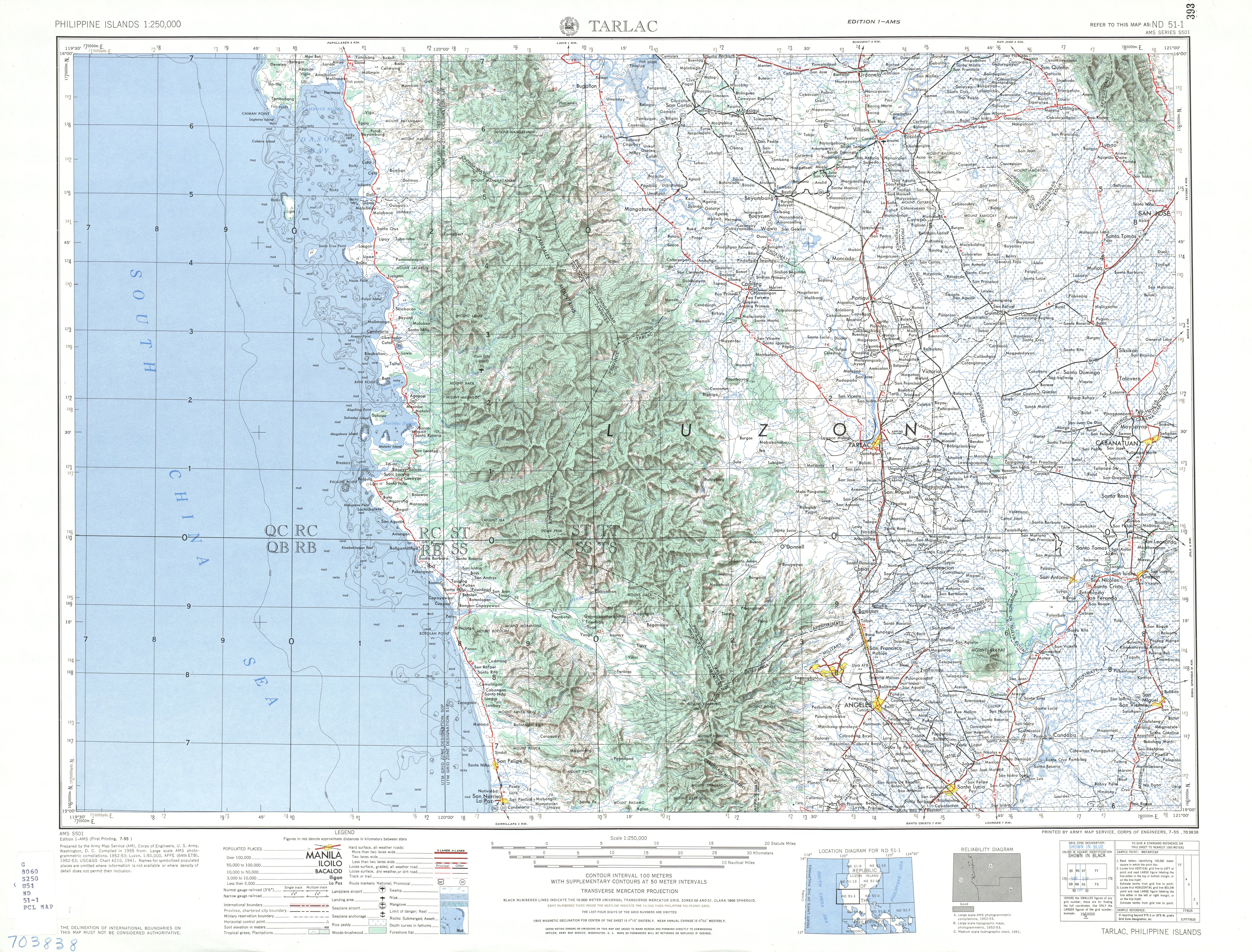
** The year of 1542 in the founding of Subic is a misprint and should be the year 1572 like in Botolan as Salcedo was born in 1549. - ↑ U.S. Army Corps of Engineers (1955). "Tarlac map". University of Texas in Austin Library. Retrieved on 2012-05-24.
- ↑ 7.0 7.1 7.2 7.3 7.4 Lua error in package.lua at line 80: module 'strict' not found.
- ↑ Lua error in package.lua at line 80: module 'strict' not found.
- ↑ Lua error in package.lua at line 80: module 'strict' not found.
- ↑ Iba travel guide
- ↑ Zambales: Dependency Ratio Down by Five Persons
- ↑ 12.0 12.1 Zambales
External links
| Wikimedia Commons has media related to [[commons:Lua error in Module:WikidataIB at line 506: attempt to index field 'wikibase' (a nil value).|Lua error in Module:WikidataIB at line 506: attempt to index field 'wikibase' (a nil value).]]. |
- Zambales mango remains to be sweetest, says DA official
- Baluate Ng Sambal
- Olongapo city news archive
 |
Pangasinan | |
||
| South China Sea | Tarlac Pampanga |
|||
|
||||
| Bataan |
|
|
|
|---|---|
|
Iba (capital)
|
|
| Municipalities | |
| Highly urbanized city |
|
| Barangays | |

Lua error in package.lua at line 80: module 'strict' not found.
